I had been eyeballing this route ever since my brother and I went from Badwater Basin to Telescope. Although that is the longest part of the route, ~22 miles one way with rougly 12k of vertical gain that is the easiest part of the route. What most don't realize is getting up Dantes from Badwater Basin is challenging and requires a lot of route finding. The GPX that is provided is highly inaccurate and will get a runner/hiker in a lot of trouble. I have scouted both ways of going up Dantes, each way has its pros and cons, but please scout this route out before you blindly follow a gpx route and definetly do not try to do the gpx route that is attached to this route, unless you have ropes.
My brother and I tried on the winter solistice, and we went after Telescope first hitting it by midday, and getting back to the car just as the sun had set. WIth darkness set in we attempted to climb up dantes but made it only a quarter of mile or so, in the dark it was dangerous and the amount of rockfall is considerable. We called it quites and decided it was a one person route, it wasn't the lack of fitness from either party, but rather the safety concerns.
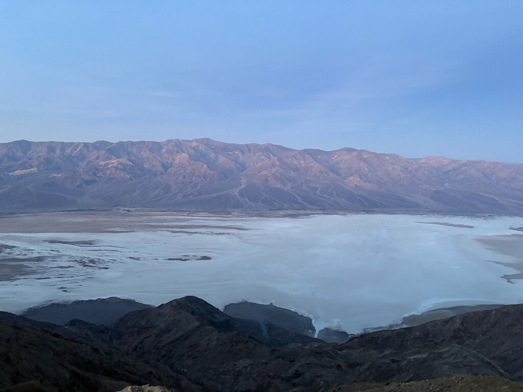
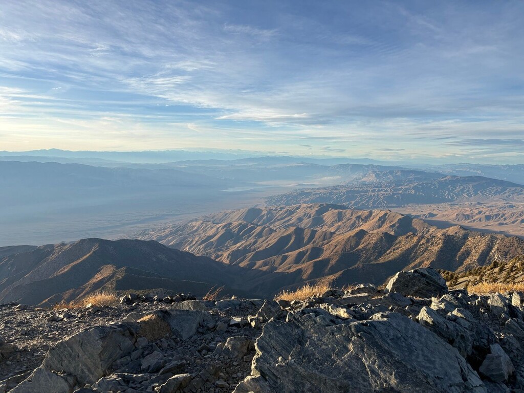
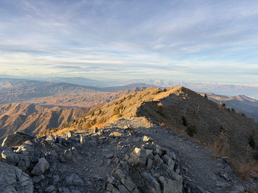
This attempt on the New Year started off bright and early around 0340 in the morning from the Badwate Basin Sign. I went after Dantes right away. Up climbing is usually way easier than down climbing technical stuff so I figured a head lamp would suffice. This was an ardous climb and I did get off route a tad and ended up in some class 4 and class 5 sections were consequences were high. Thankfully the sections were short and I just kept plugging away. I made it back to Dantes around first light as planned, and then started my down climb from Dantes in the light. Although it took me nearly 3 hours to get up, it still took 2 hours to get down, and I was extremely satisfied with my down route. I got back to the car, switched out running vests and headed across the basin.
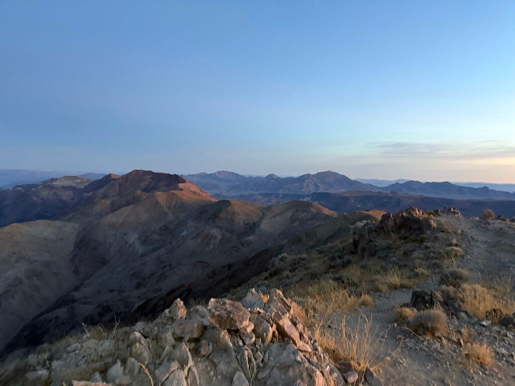
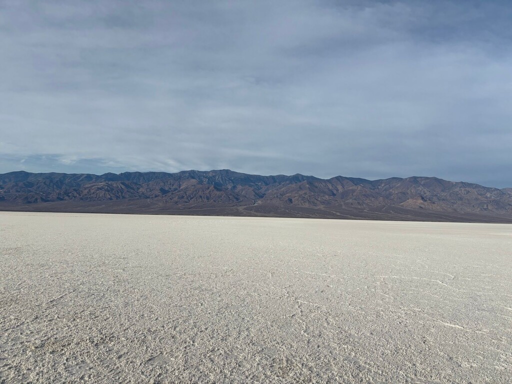
Honestly the day was 99% uneventful from there even though I still had 44 miles left in the route. The basin was a mucky mess so I detoured south and still found myself postholing into wet salt slime. I made it to the road, powerhiked my way to the springs. Got up the ridgeline and to Telescope. Enjoyed a beautiful Panamint sunset and then started my descent hoping to get most of the descent before last light. As i entered a scree field, I decided I needed my headlamp and i couldn't get it to turn on, sat around for 10ish minutes licking battery connections, warming the battery, etc and finally i got to work. That instilled some panic in me and got me to get moving down the ridge. Once I got down to the springs, I refueled and made my way down the road and across the basin. I was pretty pumped to possibly be the the first ever finisher of this route. As I was nearing the end, i just hit hte board walk, my watch shut off for unknwon reasons. If you look at the strava file it says, 52.67 miles, 17:36:39, but that is just shy of starting and stopping at the "Badwater Basin" sign. Garmin was able to retrieve the full file, with no map that read 52.72 miles, 17:37:08, so that is my time. Pretty devistating for that to occur, but I wasn't going to let that damper my day.
Comments
Congrats on a successful trip Shuan. I know purism is dead at FKT these days, but the route directions specifically say to climb "up to Dante's View Trailhead at 5,475' above sea level." It also says, "photos with the Dante's View sign on the one rim, the Badwater Basin Sign at the bottom, and with the summit sign/box on Telescope Peak should be included in conjunction with your gps tracking." It looks like you turned around at Dante's View Peak rather than continuing to the trailhead & the monument sign that's located there as instructed. This kind of thing doesn't just set a new precedent for a route, it alters it in a way that puts anyone who completes it correctly moving forward at a disadvantage - in this case a 0.8-mile disadvantage. To regain the advantage, future FKT athletes who start from Dante's View Trailhead could, based on your effort, wait until reaching the peak area before starting/ending their time. They could also avoid the trailhead area altogether and turn around once they hit the summit trail, especially since everyone is likely to take the same trailless ridgeline up or down that emanates from it. This may seem like a minor detail, but as someone who was thinking about doing this route again, it could not only change the strategy of my attempt, it could eliminate a key feature of the route that I was looking forward to, specifically, the monument sign at Dante's View Trailhead which is a metal relief map of the route and one of the coolest tag points I've encountered while doing an FKT. It would be sad to see that sign no longer a part of this route, but that's how precedent works at FKT. Every second counts.