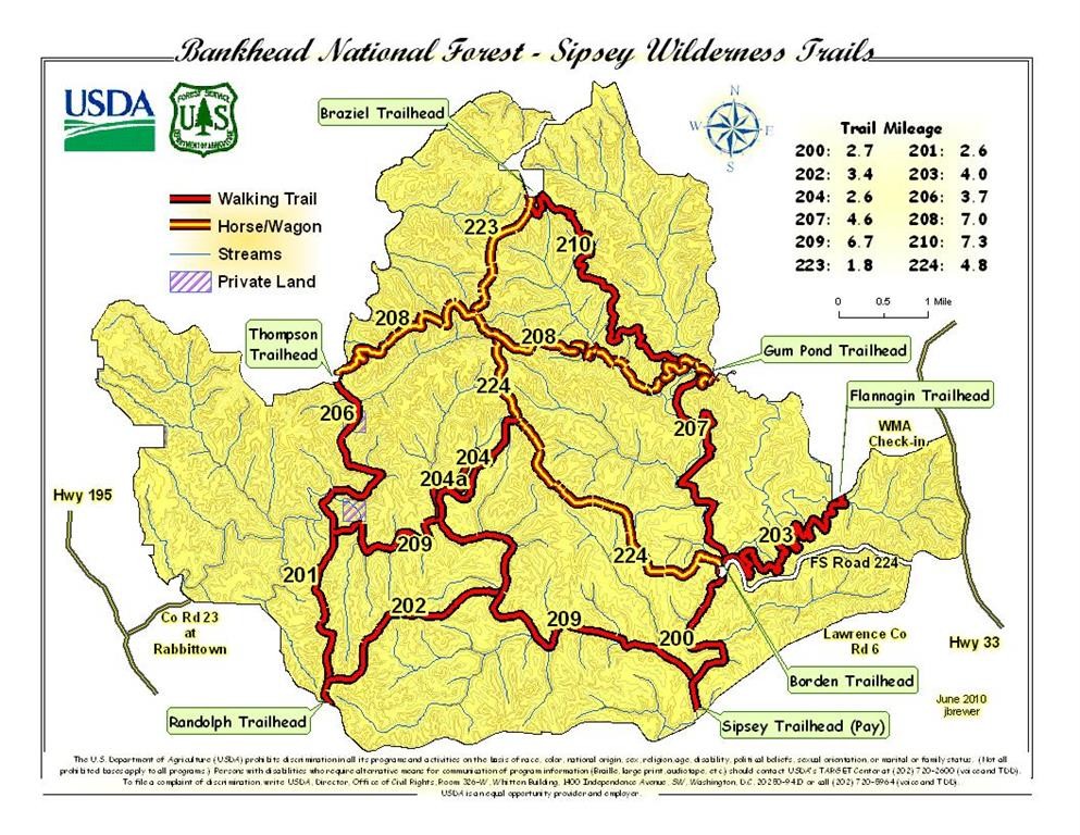
Location
Alabama,
US
Distance
56 mi
Vertical Gain
5,500 ft
Description
GPS Track
Sipsey.gpx4.72 MB
FKTs
Male
Female
| James Ebert | 9h 59m 53s | ||||
| Chase Frost | 14h 13m 7s |
| Chip Trimmier | 1d 0h 21m 17s |
| Abigail Stehno | 21h 26m 49s |
Images
Comments
I will be attempting an unsupported hike tomorrow 5/21/21
I will be attempting the route unsupported tomorrow. This is gping to be a good time, right?!?
FKT achievement unlocked!
Yes, you can beat my time, and I will do my best to arm you with the lessons I learned while doing this route unassisted.
These trails are unmarked. There are no blazes to help you understand whether you are on the trail or randomly wandering through the wilderness. Many of the trails are lightly traveled and not obvious, especially when the sun is down. If you want to save yourself many, many hours of searching for the trail you need to be on, go to travel each section of trail before you attempt the full FKT. Learn where the intersections and river crossings are. Know them without needing to search for them. Learn the landmarks that will guide you and keep you on course.
The first half of the course has plenty of access to water. The second half does not. As you are leaving the river and canyon area, you will come to a bridge leading to trailhead parking. There you will take a horse trail up into the hills. This is your last good opportunity to get water for quite some time. You might want to load up with water there. Crossing the bridge will give you easy access to the shore. Staying on the side of the bridge with the horse trail you need to travel will not. Travel the extra distance and save yourself a struggle with thorny bramble.
The final loop begins so very temptingly close to where you parked to begin this journey. Be mentally prepared for this temptation. Carry on in your task and do not give up. You've got this!