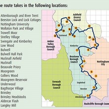
The trail uses existing routes to produce a long distance trail which roughly follows the boundary between Broxtowe Borough and Nottingham City.
The trail:
- Provides a 27 mile walking and cycling route taking in some of the most attractive countryside in Nottinghamshire.
- Connects communities and encourages those living on the urban fringe to explore the local countryside using short local routes.
- Provides a shared identity and encourages local pride. It helps to define the difference between Broxtowe Borough Council and the area of Broxtowe which is within the city. The two are often confused.
- The trail highlights local honey pot features such as Attenborough Nature Centre, DH Lawrence Museum and Wollaton Hall as well as connections to more distant features such as Papplewick , Ashfields Hidden Valleys, and Shipley Park.
- Helps to promote the wildlife sites and the general wildlife features in the area. Mapping shows Local Nature Reserves as well as the larger features such as the Moorgreen Reservoir and Attenborough Nature Reserve.
- Connects with the Erewash Valley Trail creating the opportunity to cycle the whole boundary of the Borough of Broxtowe a distance of about 40 miles.
https://www.broxtowe.gov.uk/for-you/parks-and-nature-conservation/walking-and-cycling/broxtowe-country-trail/


Comments
Aiming to attempt this 27/03/21 supported......fingers crossed its dry!! At the moment it looks like I go North, but subject to change.
Completed solo and unsupported on 27/03/21 Went from Langley Mill to Attenborough. Weather was windy but at least it stayed dry. Submitted and awaiting confirmation!!
Well this looks like fun!
Will certainly be trying to attempt this at some point :)
Completed on the 20th of June 2022. Perfect clear morning for it and an overall pretty route despite a couple of boring suburb sections.
The GPX file for this FKT is incorrect it is missing approx 1km at the northern start\finish.
The correct start/finish is at the Asda roundabout.