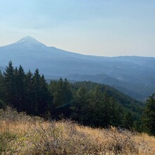
Route: Surveyor's Ridge Trail (OR)

Submitted by MartaFisher on Mon, 10/11/2021 - 10:34pm
Location
Oregon, US
Distance
11.5 mi
Vertical Gain
1,600 ft
Description

This is a gorgeous trail that dips in and out between incredible views of Mt Hood from across the Hood River Valley. On a clear day, you can also catch views of the Washington state volcanoes (Rainier, St Helens and Adams). Depending on the season, there are likely to be fabulous wildflowers or golden larches. You'll marvel at how few other people you're sharing those views with, though the few folks you will see are probably mountain bikers.

The one way route is staying on the Surveyor's Ridge Trail between the Clinger Spring and Bald Butte trailheads (note it is a net downhill if running from south to north). Out and back is also an option. Forest Service trail description is here: https://www.fs.usda.gov/recarea/mthood/recarea/?recid=53298 The section of trail north of Bald Butte TH is less used and may be overgrown.

Trail work may have rerouted the trail slightly since the GPS track was recorded. (Props to the 44 Trails Association for that.)

GPS Track
Images

Comments

User Picture
Profile picture for user MartaFisher

This route is such a classic that I can't believe there isn't already an established FKT for this route. I plan to kick things off tomorrow (10/23/21.) Supposed to be a pretty rainy day, so I won't get the Mt Hood views that make it so stunning, but it's a pretty rewarding trail regardless. 

Â