The “Ruta Veredas Noreste” is a multi-surface route that traverses 4 municipalities in Puerto Rico and goes from the northeastern coastline, within the territory of Las Cabezas de San Juan, to the western end of El Yunque National Forest.
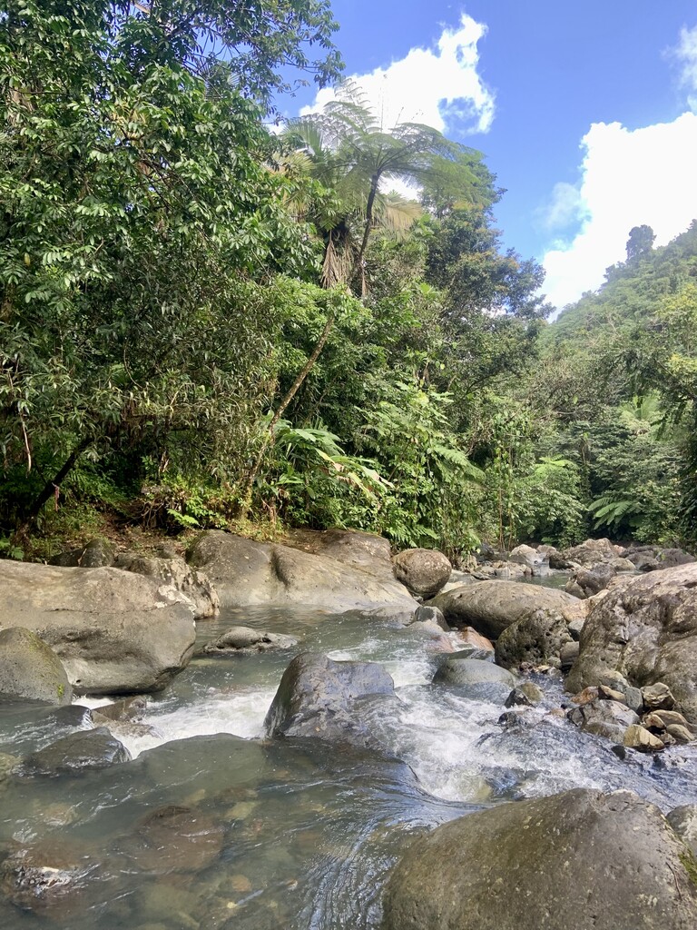
For the first half of the total mileage, the route goes in to the protected area of Las Cabezas de San Juan through the main road and out through the coast, passes through the Corredor Ecológico del Noreste, between Fajardo and Luquillo, along the beach, and then crosses through to El Yunque via a few roads/sidewalks to the entrance of the Bisley Trail (carr. 988). This section is dominated by flat, sandy terrain with the potential for strong swells to make portions of the route dangerous or even impassable. Within the Corredor, there are a few coastal jungle trails that connect “hidden” beaches in the area; the Veredas Noreste route includes side trails to Playa Colorá and Playa Escondida. From there, the route consists of following the coastline all the way to Playa La Pared in Luquillo. From Playa La Pared, the route continues through the Luquillo town square through some roads connecting various suburbs and the Sector Sabana. The route connects roads 991, 993, and 988, at which point it becomes territory of El Yunque.
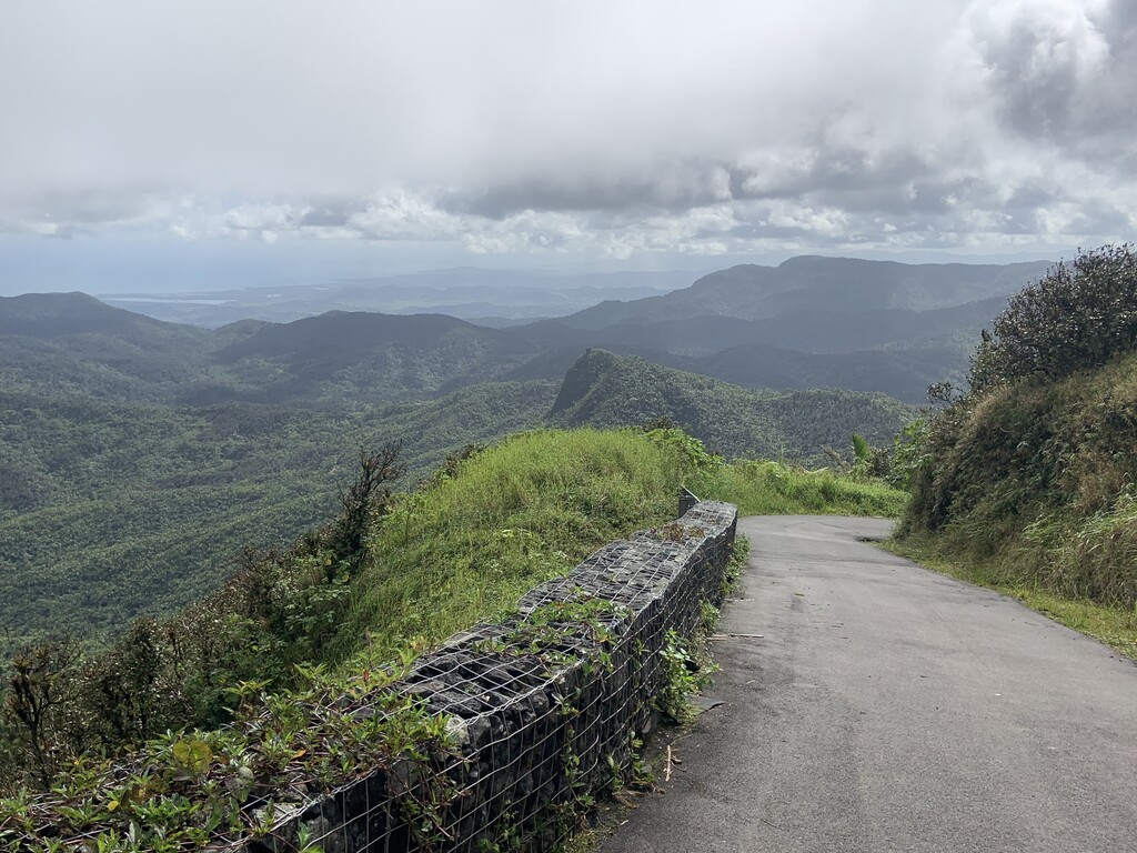
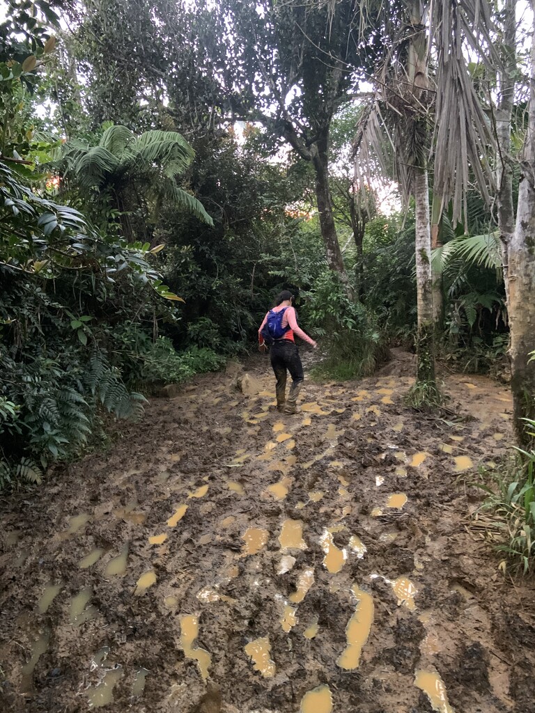
The remainder of the route is a collection of technical singletrack and well-kept asphalt roads within the boundaries of the national rainforest. Over 80% of the elevation gain is achieved in this portion of the route. The route follows Bisley Trail, crosses two rivers (Río Mameyes and Río de la Mina), La Coca Trail, road 191, Caimitillo Trail to El Yunque Trail, summit points at Los Picachos, Pico El Yunque, Roca El Yunque, Torre Britton, a descent of the Britton Trail, and using the road 191 to connect to the Trade Winds Trail. The Trade Winds Trail connects to El Toro Trail and summits Pico El Toro, the highest point in El Yunque and the Sierra de Luquillo. The descent to carr. 186 is done by completing El Toro Trail to its starting point in Canóvanas.
This route is one of the most beautiful and comprehensive trails in the island, giving runners/athletes/nature enthusiasts a good sampling of the ecodiversity of Puerto Rico. Depending on the time of year or recent weather, this trail can present serious health and/or safety challenges.
Full details of the route and specifications on preparation/logistics for a run like this are found in the website www.trailrunningpuertorico.com (Spanish)
Comments
I'm going to be attempting this one unsupported on May 5th, 2023
Tomas -- let me know how it goes! I am planning to attempt it unsupported the following weekend, May 13th. Have you figured out if there are any permits/approvals needed to do the route?
According to the website: https://www.trailrunningpuertorico.com the female FKT and submitter of this FKT says that you need to get a permit for the first few mile so that they open the gates for you at 5am or so. It's for the first loop. I wish she didn't put that in her route as it will be a hassle to bother the park employees for someone to open gates for you at 5am when you could easily start this route without that portion at the beach and without any permits or gates....
But that's the route. Other than that, everything is open.
Nevertheless, I still need to check with El Yunque if night trekking requires a permit. There is nothing physically stopping anyone from going through any of the rest of the trails on this route but I want to check anyway. If starting at 5am to 6am you wouldn't be night trekking in El Yunque, but there is a possibility of doing the last 5 to 8 miles in the dark. I want to finish before sunset, but will carry a headlamp just in case. That's the plan so far. I sent her a message and I'm waiting for her reply. My target is 12 hours unsupported. I'm pretty sure there will be freaks out there who will break my record later and do this in 9hrs or less. But I want to at least set a starting record that other ones will later break.
It looks like I might not be able to attempt this at all as the small section from Los Picachos to El Yunque is closed for a landslide!
Since this route was unavailable the dates that I was going to be there because of the section of trail from Los Picachos to El Yunque being closed to a landslide, I decided instead to create my own FKT route for El Yunque rainforest by going from the Beach to El Toro summit and set the time for it: https://fastestknowntime.com/route/beach-el-toro-summit
Once the missing section opens again, I will attempt this full FKT when I come back to the island. Most likely in October or Novemnber.
Hi Tomas, were you ever able to complete the full trail? I'm looking to do it this spring and am having a hard time finding information about whether the section is reopened or not