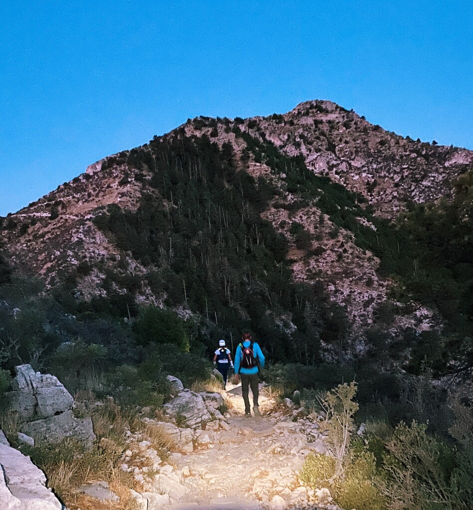
Trailhead 0.0 miles, 00:00:00. The three of us left the trailhead around 5:20am hoping to catch sunrise at the peak of Guadalupe. All of us had long pants and long sleeves for sun/brush protection. We each started with 2.5-3.5 liters of water. The previous standing mixed gender unsupported FKT time to beat was 10:29:37. We hoped that choosing smart lines would help us shave time off this standing record.
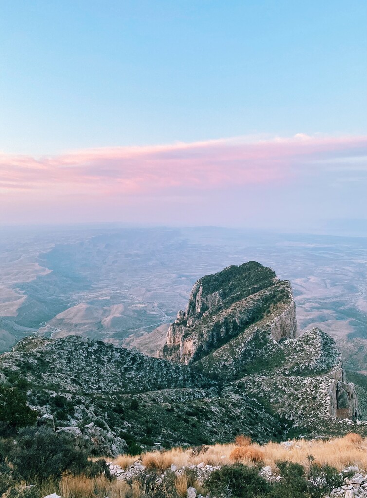
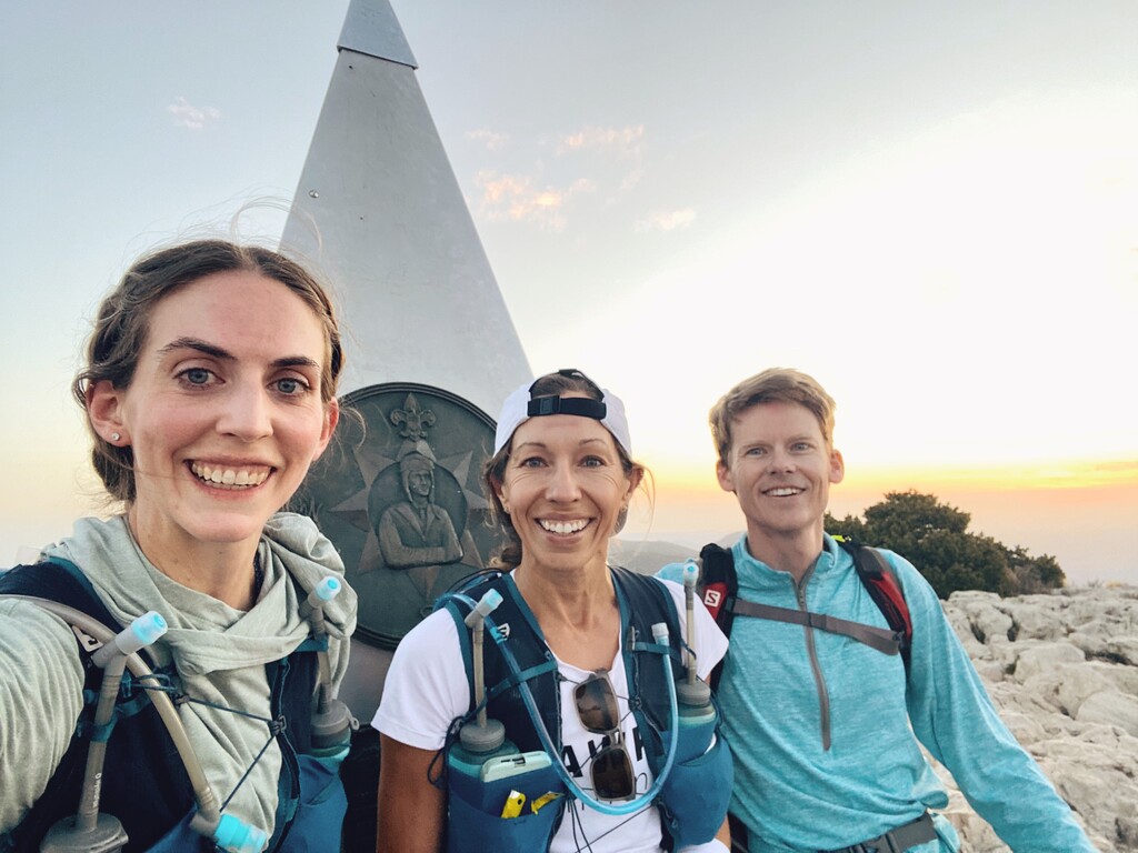
Guadalupe Peak- 4.11 miles, 1:30:08. Tried to keep a good effort climbing to take advantage of the well used trail. Reached the peak just in time for sunrise - spent a few min taking pictures before beginning our descent.
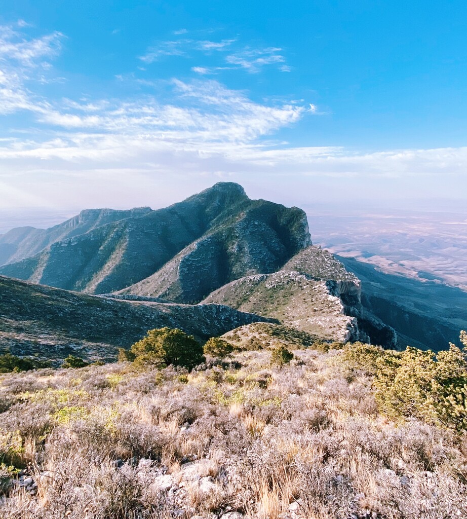
Shumard Peak- 5.77 miles, 3:20:22. We made quick work of the descent off of Guadalupe, putting on our gloves before heading down. The ground was semi- loose with many rocks. We attempted to stay close the the edges of the ridge line to avoid losing elevation. It was helpful to pick out landmarks to work towards in order to maintain our line.
Bartlett Peak- 7 miles, 4:44:35. Again, tried to stick to the ridge line to avoid losing elevation. The effort felt slow going as we moved through the brush, rocks and a few trees. Shoe laces would catch on the brush and come untied - would consider wearing gaiters next time.
Bush Peak- 8 miles, 5:36:56. Picked a fairly direct line to a game trail that could be seen on the ascent. It felt like there was a lot of steep climbing that involved using our hands to assist. Once at Bush peak, more defined trails would lead us to Hunter Peak, though it looked very far away from where we were standing.
Hunter Peak- 11.94 miles, 7:04:28. The trails from Bush to Hunter seemed to go from runnable to very technical at a moments notice. We found ourselves run-hiking or bouncing along the route. Our legs were clearly tired. The fallen pine needles added a little cushion and nice aroma to the air. Great views from the peak, especially of the 4 highest peaks all in a row.
Back to trailhead- 15.77, 8:30:16. We took the Bear Creek Trail down the mountain, which was a slew of tortuous rocky switchbacks. There was a series of short cave tunnels towards the bottom which provided some shade. Met up with the Frijole trail where we spotted some bighorn sheep! Last mile seemed to drag on, but once we crossed the creek bed, the trailhead suddenly appeared.
To sum it up, this was a very challenging course. Navigating the rocky and brush heavy terrain made the going very slow at times. Compared to the other attempts, we seemed to have navigated an efficient route, sticking to the ridge lines to avoid elevation loss. Our overall mileage was less than 16 miles. Wear long pants, have sun protection and bring gloves! Only one of us ran out of water with 1-2 miles left. Due to the early start time, we didn’t feel the force of the full sun until we reached the summit of the 3rd peak. The scenery was stunning; lots of interesting plants and fossils everywhere. We are glad we did this FKT, but I don’t think any of us feel the need to do it again.