
Full report with more pics: https://www.christofteuscher.com/aagaa/report-self-supported-210mi-anza-borrego-loop-fkt
Section 1: Santa Rosa Traverse (43mi)
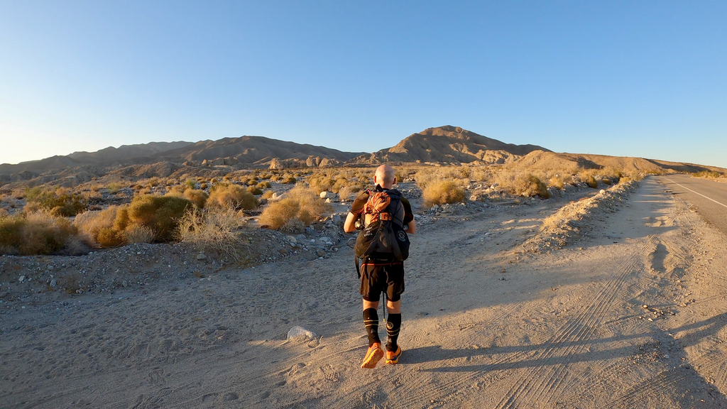
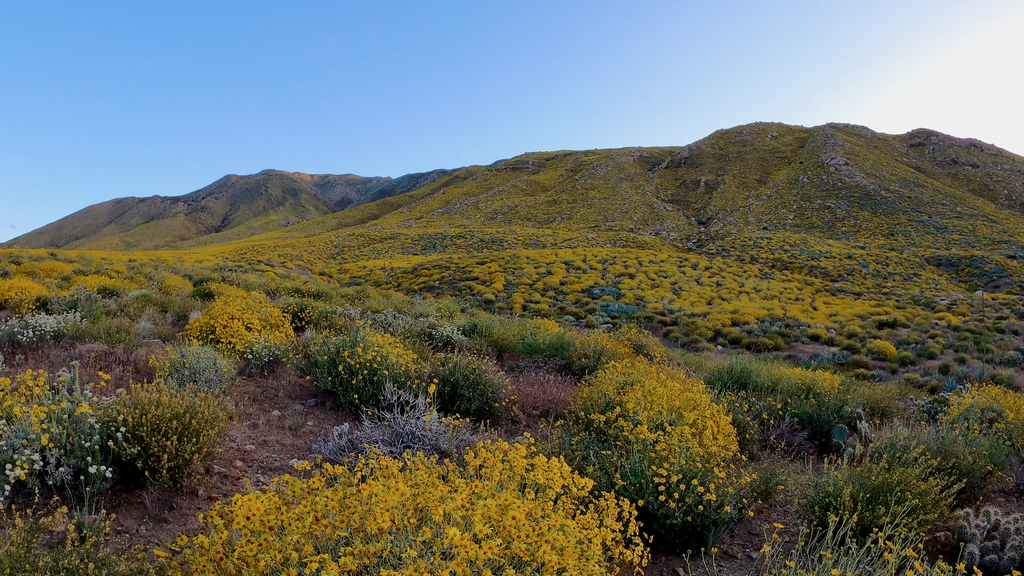
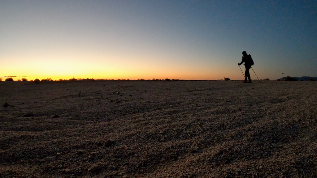
I started at 7pm on Fri, Apr 28, 2023 at the CA County Road S22 with the goal to tackle the difficult Santa Rosa Traverse first. It was 100F at the start. I was hoping it would cool down quickly as night fell, but it didn’t. I had loaded extra water because of the hot weather, knowing that the traverse would take me 30h+ at least. From the start, the route climbs soon rather steeply, and it keeps climbing (with a few descents) until reaching Villager Peak (peak #4 on the traverse). I quickly realized that I would be slower than anticipated because of the additional weight of the water and the heat. And sure enough I was. I reached Villager Peak almost 2h behind schedule and had to declare a first crisis because I had already consumed more water than I was supposed to. At that point, I should probably have bailed because Villager Peak that is the only “easy” point where one can return to County Road S22. Yet, I continued.
Things went downhill rapidly. I was suddenly unable to keep down any food nor liquids and gradually slithered into increasingly severe dehydration. For more than 24h, I was unable to keep anything down. Multiple times I tried to sleep to calm my stomach, which usually works, but each time I stopped, I started to shiver and couldn’t sleep. Moving was slow and painful and my body starting to shake. I started to have serious doubts that I would be able to make it up to Toro after another hot day and into another night.
Day arrived and with it a relentless sun, heat, and wind. The bushwhacking was as terrible as always. After the sun set the 2nd time, I tried one last time to sleep. I woke up after 5min, shivering, and had to throw up again immediately. I figured there was nothing I could do except to continue as best as I could, no matter how slow.
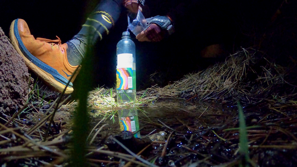
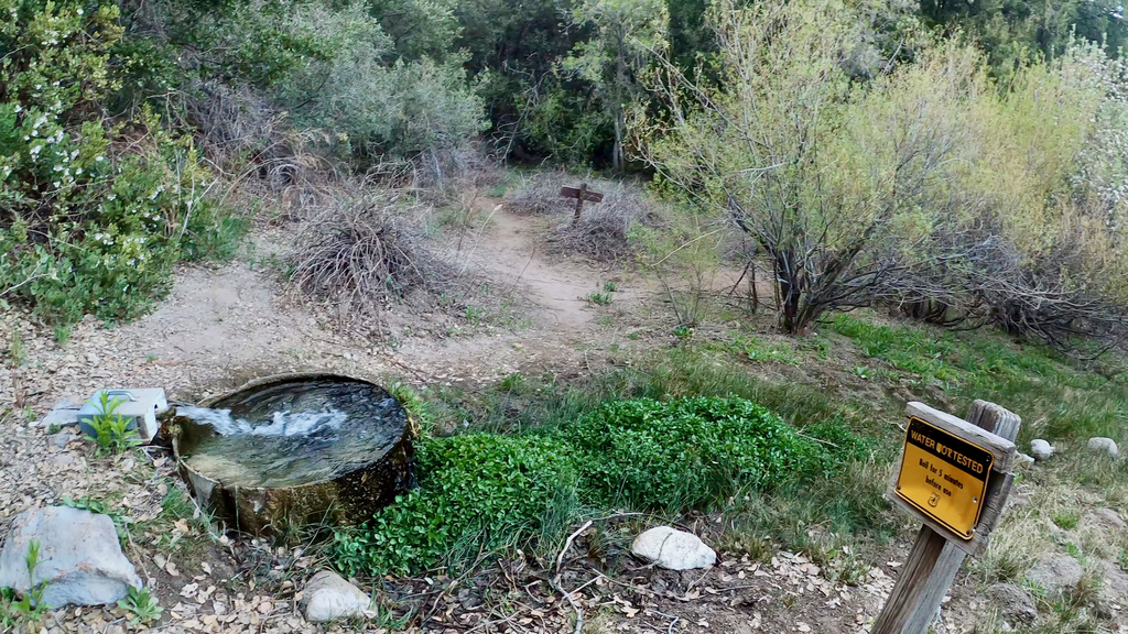
Out of the blue, I suddenly felt hungry and knew that this was the point my stomach was going to be back to normal. Thankfully I hadn’t tossed all the calories earlier, which I had considered in order to lighten my pack. I ate as much as a could and gradually started to feel better and stronger as I moved into the 2nd night and climbed up to Toro. But alas, I still urgently needed water. My only hope were small streams from snow-melt, which I’ve seen plenty of during my 1st attempt, or the Santa Rosa spring, which would be a detour. Needless to say that I felt very excited and relieved when I found a tiny stream and some puddles from the snow melt. I used a Ziploc to scoop water out of the puddles. Unfortunately, I had no water treatment tablets with me since I didn’t think I would need and find water from any source on the traverse.
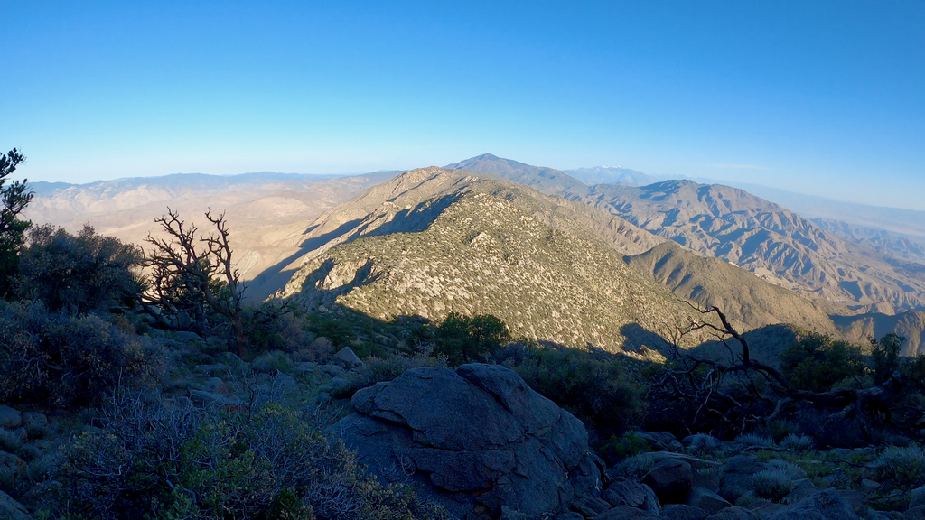
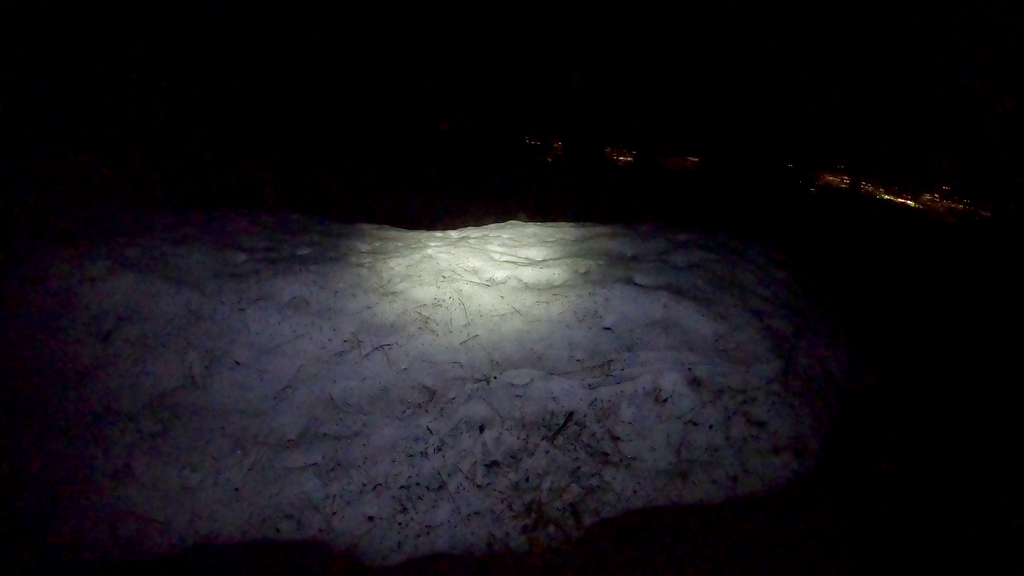
After filling up my bottles and finally being able to drink to thirst, I first bagged Wind Chill Peak (the peak right next to Toro, which is off-limits to public access), then Santa Rosa Mountain. There were still piles of snow everywhere.
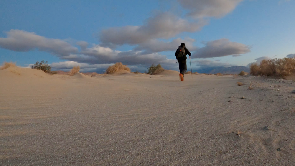
The descent into Pinyon Pines was rather smooth this time. I had corrected GPS tracks, the trails was not covered in snow anymore, and it was daylight. I wasn’t able to run, but I moved rather quickly compared to the last 30 hours. Nevertheless, I reached Pinyon Pines several hours behind schedule. Oh well, at least I made it. I slept for an hour under a bush before continuing.
Section 2: Pinyon Pines to PCT (13mi)
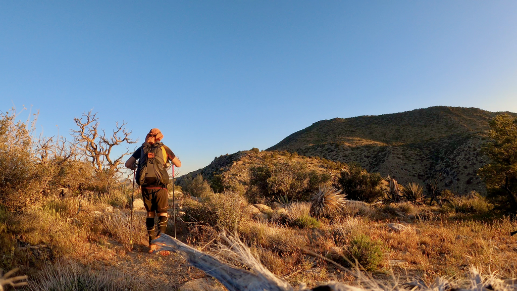
The first 7ish miles on that section are easy and lead on bike trails into canyons. It was hot and winy again. Omstott Creek still had some flowing water. The last time it was hard to get across it dry. I took a quick lunch break with another nap before reaching the turn-off to the Live Oak Spring Trail. After my 1st attempt and some impossible bushwhacking past Oak Canyon Spring (despite being on some maps, that trail is basically impassable), I’ve re-routed the loop to Live Oak Spring on the Live Oak Spring trail 4E03. It’s the same distance, but at least it used to be an official trail. I wasn’t sure what to expect. I knew the first few miles would be hard to follow. There are intermittent cairns, but it’s often difficult to see where the “trail” really goes.
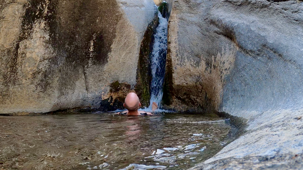
But before heading up into the mountains, I first took a 400ft detour to the Hidden Falls. Since it was raining during my 1st attempt, I didn’t go then. What I found was a bit of a paradise in the middle of the desert: 3 cascading waterfalls with several deep pools. I jumped in immediately and even ended up brushing my teeth (the one and only time…sorry, Dr. Kaip). Rejuvenated, I continued.
The Live Oak Spring trail turned out to be quite acceptable. I used my saw a couple of times to cut passages through brush or to clear downfall, but I did not encounter any major difficulties. I was hoping I would reach the PCT before dark, and would then still be able to reach highway 78. I had no intention to go to Paradise Valley Cafe (PVC), a PCT hot spot, so it didn’t matter when I reached highway 78.
I made it to highway 78 where I decide to sleep for a few hours. It was a bitter cold night near freezing temperatures. I was glad I had packed my warmer, non-summer sleeping bag.
Section 3: Pacific Crest Trail (93mi)
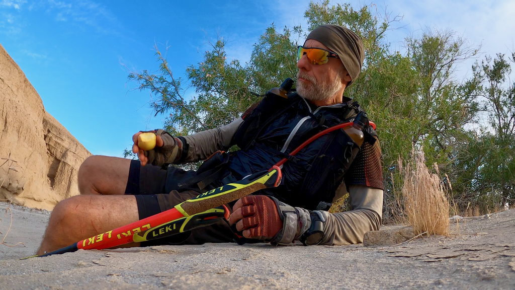
There isn’t too much to say about the PCT section except that (1) it felt easier than all the rest and (2) it felt rather packed and busy with PCT hikers. That was, however, not an unwelcome distraction. While some hikers looked energized and already dialed in into the long-distance hiking joys and sorrows, many seemed to struggle, carrying huge packs, huffing and puffing. Paradise Valley Cafe is at about mile 160 of the PCT for NOBOs, so I guess it’s normal that not everything has been figured out yet by then. Over the next 2 days, I would hand out lots of mini apples as treats to hikers who seemed to need a little surprise. There were tears.
I left highway 78 in the dark and continued my journey toward Warner Springs. Soon I hit fog and wind. It looked like some marine layer snuck into the valley. The flowers were blooming everywhere. I had to put on layers and wear gloves as I climbed higher into the mountains. The creeks before Warner Springs were easily passable this time. During my 1st attempt, the crossings were challenging due to the torrential rain. As I got closer to Warner Springs, it started to drizzle and did so all night. I slept a few hours and had to set up the tarp as a shelter. When I left in the middle of the night, everything was soaking wet.
The trail leads through grasslands for a couple of miles. It was dark and wet.
I made it to the Scissors Crossing in the late afternoon. The long, winding, and dry section through San Felipe Hills never wanted to end. It was hot and windy. I decide to continue was far into the night as a I could. It took me a while to find a sleeping spot that was somewhat sheltered.
Section 4: Anza-Borrego Traverse (39mi)
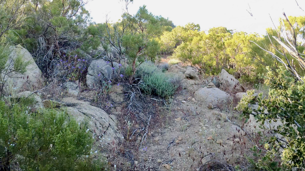
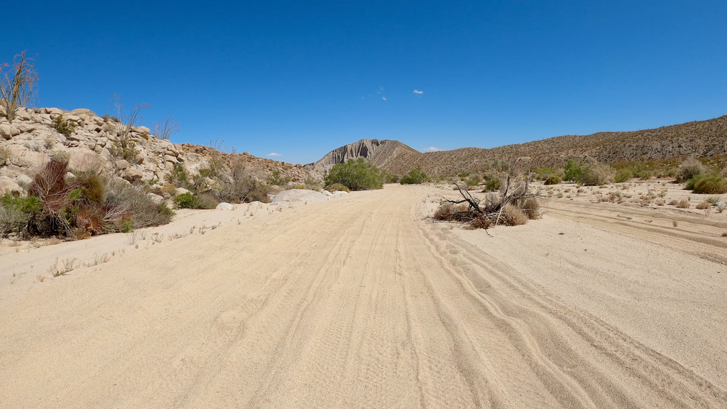
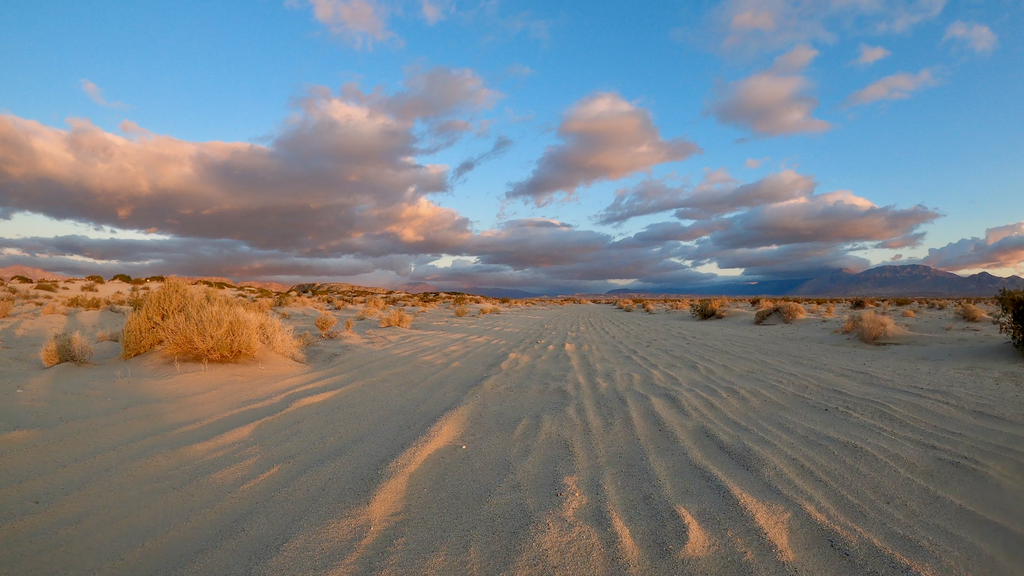
I was looking forward to leaving the PCT and not having to answer another 2,340 times whether I was going SOBO. It was still pitch dark when I turn off the PCT and onto the Anza-Borrego Traverse. A big descent led through the Oriflamme canyon into the Mason valley. The hillsides were exploding with flowers. I was now technically on the California Riding and Hiking Trail (CRHT) for several miles. I cleared Blair Valley and started climbing into the Pinyon mountains. Once again, the sun was relentless. Without a heavy pack, one could easily run most of these dirt roads. The later parts of the Anza-Borrego Traverse tend to be soft sand, however.
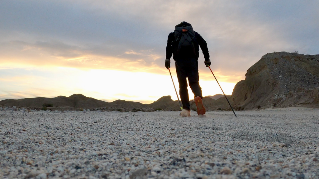
It was dark when I finally made it to the Split Mountain road, the end of the Anza-Borrego Traverse. By then I had acquired a number of painful blisters due to the heat and sand. I took care of what I could take care of before sleeping for 1.5h. I wanted to get the last 22mi through the Badlands done mostly at night so that I would not have to deal with the sun and heat anymore.
Section 5: Badlands (22mi)
I had never done this section before, so I was prepared for some surprises. I figured I could do that section in 7h, but I was wrong. The wind continued to blow hard. Most of the “trails” were deep and soft sand that made moving hard and slow. Large parts of the “trails” were covered with blown in sand. As you can guess, it took me quite longer to get to the finish line. As the sun rose, the Santa Rosa mountains came into view and I admired all the peaks I had summited and traverse a few days ago.
The wind kept blowing hard until the very end and I was worried the thunderstorms that seemed to rage in the mountains would reach me too, but they didn’t. After going through countless washes, I finally reached CA County Road S22. I had less than a mile to go to where I started. This really is the only paved section of this loop.
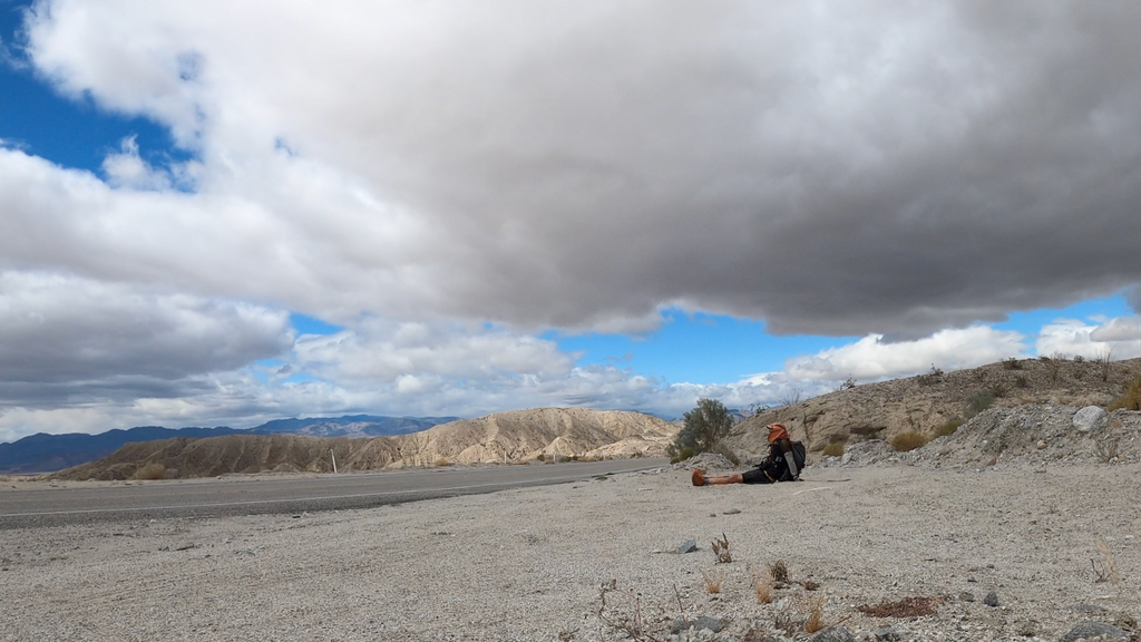
I stopped my watch at 134:58:16 and sat down to wait for my ride.
Full report with more pics: https://www.christofteuscher.com/aagaa/report-self-supported-210mi-anza-borrego-loop-fkt
Comments
Amazing. Great work! Being from Michigan, and never having experienced areas such as this, do you have to deal with wildlife? Will anything (animals or critters) approach you while you are sleeping at night? Sounds like you had no tent, but I could be mistaken.
The movie is out...enjoy: https://www.youtube.com/watch?v=WFux99bz03s