Full report at https://www.christofteuscher.com/aagaa/report-unsupported-one-way-and-out-back-arctic-circle-trail-fkts
Note that this report covers both the one-way and the out & back FKT.
In a nutshell
In August 2022, I was able to set two new unsupported FKTs on the Arctic Circle Trail (ACT) in Greenland. One-way (90mi): 1d 23h 30m. Out & back (180mi): 4d 10h 15m. The one-way time came out to be 4h 47m faster than Torsten Niecke’s 2019 self-supported FKT (2d 4h 17m). To the best of my knowledge, nobody had completed an out & back of the ACT previously. In hindsight, it’s clear why nobody has done this.
Torsten Niecke’s self-supported FKT
At the time of my attempt (Aug 2022), Torsten Niecke held the self-supported one-way FKT in 2d 4h 17m on the ~90mi ACT trail section. According to his FKT report, he started by the old heliport in Sisimiut at the Mittarfimmut road, which I assumed was at 66.938955, -53.633268. He finished at the Sonderstrom Upper Atmospheric Research Facility, which, according to Google Maps and Wikipedia, would be at 66.987235, -50.941402. I attempted to contact Torsten to get clarification on the exact locations where he started/stopped his watch, but had not heard back from him. I therefore decided to go with the coordinates above so that our times could be compared. He submitted the route and set a first FKT, so his start/finish choice should be respected.
Suggested termini for future FKTs
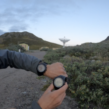
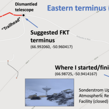
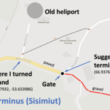
After seeing the start/finish locations myself, I’m suggesting the following termini for the eastern and western ends of the trail for future FKTs (see images for two illustrations):
- Western terminus (Sisimiut): 66.937655, -53.631912
- Eastern terminus (Kellyville): 66.992060, -50.960417
The Western terminus is a gate in the “outskirts” of Sisimiut, where the paved turns into a gravel road. The Eastern terminus is a parking lot where hikers typically get dropped off (e.g., by Albatros) and where the first ACT trail sign is located. The suggested termini would make the route 0.68mi shorter than my and Torsten’s route, yet, it would make the start/finish locations more natural and less ambiguous.
Day 1 (Tue, Aug 16, 2022)
At 2:35am I was on the road. Literally. It was going to be an ~8mi road walk from the Old Camp hostel to the start of the trail. The pack was heavy as hell, stuffed with food for 4+ days. My FKT attempt was going to be unsupported, which means I had to carry all my food and supplies (except water) from the beginning to the end, without receiving any form of external support.
It was cool and the night was lovely. The moving felt relatively easy after sitting in airports and on planes for 3 days. It took me about 2h30min to get to the “FKT start” in Kelleyville. Now things were getting serious.
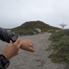
At 5:07am, I was at the Sonderstrom Upper Atmospheric Research Facility (66.987235, -50.941402), where I believed Torsten finished his FKT attempt (he started in Sisimiut). I started my watch and picked up my pace. Well, not for long. I almost missed a first crucial turn and swore to pay attention to my GPS. That mostly worked for the rest of the trip.
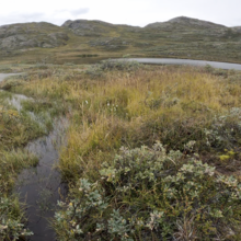
It took less than half-a-mile on the trail until I hit some first terrible bog. Wow, that can’t last, right?! I decided to change into waterproof socks (I had packed 4 pairs, one for each day). That turned out to be a rather fruitless exercise. The bog never really ended and my feet were soon moist, then wet, then cold. They essentially remained wet and cold for the next 5 days.
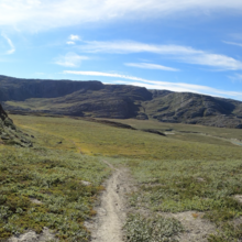
The moving wasn’t easy because the trail meandered, the pack was heavy, and the bogs never failed to reappear. Sometimes you can find a way around, but that always costs time and effort. After a while I just gave up and slogged right through whatever bog I encountered. I didn’t really matter, I was wet and cold anyway.
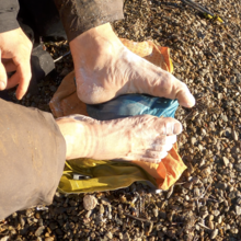
Every 5 or so hours I stopped, removed my shoes and socks, let my feet dry, reapplied either baby power or HikeGoo, and then continued on through the next bog. I knew I needed to take care of my feet (which were still not fully back in shape after the 530mi BMT FKT), or I would not be able to finish this adventure. My strategy paid off.
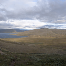
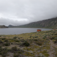
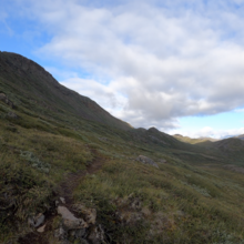
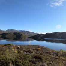
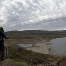
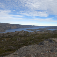
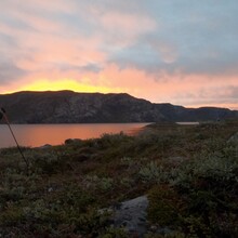
I blew past the Hundesø and the Katiffik huts without stopping. The scenery was rather spectacular and fit my taste: minimal, barren, wild. There are no trees whatsoever. The tundra kept giving wetness, but the weather was decent otherwise. The wind was blowing pretty hard and right into my face all day, but that kept the bugs grounded, and was thus most welcome.
Around 9pm I reached the Ikkattooq hut. I had completed a bit more than 50mi so far on this first day (including the initial road section). There were 5 people in the hut, most already in “bed.” They had used their stoves to heat the hut up nicely. For a short moment I considered sleeping a few hours in the remaining bunk bed. The hikers asked me what day this was for me and had a hard time believing that this was my first day. After a few minutes I decided that I could crank out a few more miles and that it would be easier and more efficient to sleep under the stars. Before I left into the night (to the hiker’s surprise), I was warned of heavy fog in the next section. I replied that I would be fine.
It got dark soon and I was indeed surrounded by very thick fog even sooner. I kept an eye out for potential sleeping spots that were protected from the wind. It was almost dark when I decided to call it a day after finding a flat spot near a big rock wall. I set up camp quickly under the stars in the fog and fell asleep for a while. But alas, a thick fog and drizzle woke me up. The sleeping bag was already wet, so I decided that staying in these conditions for a few more hours would lead to a soaked gear disaster. I quickly packed up and continued into the dark and foggy night.
As I started to drop into a valley, the fog disappeared and I found another great sleeping spot quite literally under a big boulder, where I decided to sleep for a few more hours.
Day 2 (Wed, Aug 17, 2022)
I was moving again sometime around 3am. The trail dropped steeply into a valley, where things got really boggy (no surprise there). Before I was even really warmed up, I reached the Itinneq river, supposedly the widest and deepest river on the entire trail. There is no bridge, but someone had set up a rope. The fording looked manageable, so in I went. The water was deeper than anticipated, but I made it across without falling in. The bogs continued.
Sometime before 6am I reached the Eqalugaarniarfik hut. I was still wet and cold. There were perhaps 8 people sleeping, some under the table on the floor. Nobody woke up when I spread myself out on the floor, dried my feet, and ate a delicious cold-soaked meal from a Ziploc bag (one of many). I left quietly and tackled the climb out of the valley up to the Iluliumanersuup Portonga crest. The views were exceptional.
At the Innajuattoq hut I took a quick lunch and foot care break and met a Danish woman who’s hiking partner had to be helicoptered out a few days earlier because she had broken an ankle. They had used their inReach to call for help, which apparently had arrived very quickly. That was somewhat comforting to know. She kindly offered me a cup of hot coffee, an offer I had to politely decline because my FKT attempt was unsupported, i.e., no external support of any form is allowed.
I didn’t dally and moved on to the Nerumaq hut, where two ladies were already making their beds while the sun was still up. One turned out to speak Swiss German. We chatted for a while. This was their 2nd go at the ACT. It was shortly after 4pm when I left the hut, which regular hikers typically reach on day 7. My tentative plan was to make it to the Kangerluarsuk Tulleq hill hut, and to then make a decision whether to sleep or to push through the night to Sisimiut.
I reached the hut shortly past 9pm. Two Danish hikers had also just arrived from Sisimiut. This was their 6th ACT hike. They told me that it had taken them 8h to reach the hut from Sisimiut, and that a fast person could perhaps do it in 6h. It was roughly a 12mi stretch, but with some solid climbing and some non-trivial terrain, as far as I could tell. I figured I could perhaps do it in 5h or so. After some flawed math, I decided that I would sleep ~1h30min and then head out so that I would hopefully reach Sisimiut before 5am.
By 11:30pm I was on the way, into the unknown of another rather dark and windy night. It didn’t take long until I found myself in very dense fog again.
Day 3 (Thu, Aug 18, 2022)
The night turned out to be very challenging, mainly due to the very dense fog. I could barely see 10 feet. Navigation became a real challenge and I had to be glued to my GPS. There were many river crossings and the trail often followed some riverbed, where it was very hard to figure out if and when to cross the river. The moving was slow, it was cold, windy, and wet. You get the idea. At some point I was sure I was moving backwards, and I needed all my senses to convince myself otherwise. To make things even better, it started to rain.
At 4:37am I finally reached my turnaround point at the Mittarfimmut road by the old heliport (in the “outskirts” of Sisimiut), where Torsten had (supposedly) started his self-supported FKT attempt. I had accomplished my goal of completing the one-way ACT in under two days (1d 23h 30m), 4h 47m faster than Torsten. Now I only had to go back. Easier said than done.
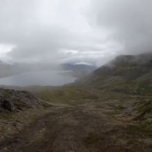
First, I needed to sleep. Yet, it was cold and windy and rainy. Not too far after turning around I spotted some building by a lake. It turned out to be a water pump station. More excitingly, it had a small “crawlspace” where I could barely fit in, but I would be out of the rain at least. I slept for perhaps 2 hours before heading back up into the mountains, the same way I came a few hours earlier in the dark. It was still raining lightly, but the fog had lifted a bit and I realized what amazing scenery I had missed in the dark.
Knowing the terrain and the trail made navigation easier. I did not constantly have to check my GPS. The rain eventually stopped and the fog disappeared. I made it back to the Kangerluarsuk Tulleq hill hut in about 4h, ate yet another delicious Ziploc meal, and napped for 15min.
On the way to the Nerumaq hut I met the Danish hiker woman that I had seen at the Innajuattoq hut. She was now hiking with another woman that she had met on the way. They were both surprised to see me again. They asked if they would see me again, and I said “hello no.” When I reached the Nerumaq hut before 5pm, the two Danish 6th-time ACT hikers were settling in for the night, as well as at least 6 other hikers. The hut was packed, but I had no intention to stay there. The day was still quite young.
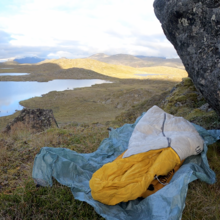
I had secretly hoped to be able to reach the Innajuattoq hut, but I became so tired and slow that I decided to get some sleep just past the highpoint on that section. That turned out to be a mistake. I set up my camp (= tarp + sleeping bag) by the side of a large boulder, somewhat protected from the wind. I was hoping for some quality sleep and dozed off. When I woke up after an hour or so, I was shivering, my throat felt very sore, I felt feverish, and there was thick fog around me. Great! I put on every layer I had and tried to fall asleep again. Everything was soaking wet, but that was not something I could fix now.
Day 4 (Fri, Aug 19, 2022)
I managed to sleep some more, but ended up getting up before 3am because it was so terribly cold. The temperature had dropped well below freezing and I felt quite sick. My sleeping bag was not made for these conditions and all my gear was completely soaked. It was clear that I needed to plan a drying break before another night, or I’d be in trouble.
The best I could do now was to move in order to somewhat stay warm, so I did. I made it to the Innajuattoq hut, but didn’t stop because I didn’t want to wake up hikers at 4am. As the temperature dropped further in the very early morning hours, I encountered ice on the trail and spotted peaks that were covered with a fresh coating of snow. It was too cold to stop and eat, so I just kept moving as fast as I could. At least the pack felt much lighter now.
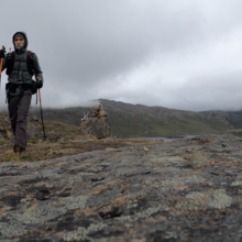
Eventually the sun came up and I was able to finally warm up, eat, and take care of my feet on the shore of a nice lake. Some clouds were already moving in, and I started to worry that I may not be able to dry my gear. After crossing the very scenic Iluliumanersuup Portonga crest again, I met perhaps 10 hikers as I dropped down to the Eqalugaarniarfik hut. Some had massive packs and were huffing and puffing heavily. The hut was empty when I got there, the sun was out, and there was a solid wind. That was my drying window! I hung all my gear on some bushes and set my alarm for a 20min nap.
Magically, everything (except my shoes) was dry when I got up. So far so good. But alas, my health was slowly deteriorating further. I felt feverish, my nose was running like a waterfall, and the sore throat was so bad that I had trouble eating.
At the Itinneq river I met two German hikers, a father and a son, who were planning to attempt the southern ACT route, a much less traveled alternate route. I wished them luck. Once I had crossed the river again and made my way through the very boggy valley, I met several hikers. Somehow the word had spread and they were all asking whether I was the guy trying to set records. I had some difficulty speaking and feared I would completely lose my voice. I later did.
I failed to grab water at some lake and ran dry on a long stretch. The guidebooks and websites will tell you that water does not need to be treated. However, I found some lakes to have rather questionable water quality, so I ended up using my iodine treatment tablets regularly.
My goal was to make it at least back to the beginning of the Amitsorsuaq lake, where hikers can grab a canoe for free (if there is one) to cross the very long lake. That was of course (sadly!) not an option for me. I reached the lake by 8pm or so, after a long and painful stretch through terrain with zero protection to set up a camp and also with zero water.
From the lake shore I could see the next hut, the Canoe Center hut, which is also the largest hut on the ACT. I figured I could still reach it with what I had left in my tank. When I got there, a group of Polish hikers had managed to light the stove and the hut felt magically cozy and warm. They told me that they had missed a crucial turn and did a 50km out & back on an ATV trail without realizing that they were not on the ACT. That had cost them 3 days! Why none of them became suspicious that there were no huts and no other hikers, remained unexplained to me.
I quickly crashed in an empty bunk bed and set my alarm for 2:30am. The night was terrible. I now also had a heavy dry cough besides all the other flu-like symptoms. Was it COVID? I had no way of knowing. I assumed it was just a terrible cold.
Day 5 (Sat, Aug 20, 2022)
It was still windy when I got up, packed my gear, and started moving along the seemingly never-ending Amitsorsuaq lake. I had some dehydrated meals left, but it was too cold to stop and eat. I had no bars left and started to worry about my supplies.
After a few hours I reached the Katiffik hut, which was cold and empty. I took a quick nap, ate the last (cold-soaked) oatmeal, and continued. Two guys, who camped in tents near the hut, were in the process to make a fire to warm up. Yet, in the absence of trees, there really isn’t much that can be burnt. It looked like a fruitless attempt. I didn’t wish them luck because my voice was mostly gone by then.
On the way to the Hundesø hut, I met several hikers who were at the beginning of their ACT adventure. They all asked whether the bogs were as bad on the rest of the trail they were so far. With a faint and cracking voice, I replied: “You have seen nothing yet, just get used to it.” I realize that was not very encouraging, but it was the simple truth.
Thankfully, everything eventually ends. So did this adventure. I reached the Sonderstrom Upper Atmospheric Research Facility at 3:22pm. It had taken me 4d 10h 15m to complete the out & back of the ACT (185.41mi) in an unsupported way. So this was it.
With a lot of luck, I was able to organize a ride back to the Hotel Kangerlussuaq, where I had managed to book a room for two nights months ago. I’m not sure I would have been able to complete the ~10mi road walk back into town in my state.
Afterword
I spent two days in bed at the hotel, shivering, suffering, trying to feel better. Unfortunately, Kangerlussuaq (~ 500 inhabitants) has no doctor and there were no meds available at the local store. Instead, one could grab and purchase a gun right at the store entrance. I bought Pringles and Fisherman’s Friend instead. My other medicine consisted of hot tea with a shot of whiskey from the hotel bar. Two days later, after flying back to the European mainland, I was able get a COVID test: it turned out to be negative. It took me another week to somewhat recover.
Stats and data:
- Start/finish location: 66.987235, -50.941402 (Kellyville)
- Turnaround location: 66.938955, -53.633268 (Sisimiut)
- Start date/time: Tue, Aug 16, 2022, 5:07am
- Finish date/time:
- One-way: Thu, Aug 19, 2022, 4:37am
- Out & back: Sat, Aug 20, 2022, 3:22pm
- Elapsed time:
- One-way: 1d 23h 30m (see splits tab in Strava)
- Out & back: 4d 10h 15m
- FKT style: unsupported, solo
- Total distance: 185.41mi
- GPS data:
- Strava: https://www.strava.com/activities/7672113957
- GPS recording interval: 1min, so not very accurate.
- The Strava data is public, yet, one needs an account to see it.
- SPOT track: https://maps.findmespot.com/s/V6QT
- Relive clip: https://www.relive.cc/view/v4OGRyZYd5v




Comments
great run - but shouldn't the start be at Kangerlussaq airport ? that is where I started