

Lost Coast Trail FKT, Mattole to Usal
Yeehaw!! I had such a blast out there. New FKT in 10:10:37, set going north to south. This definitely ranks among the most diverse and challenging routes I've ever done.
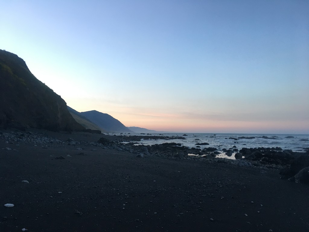
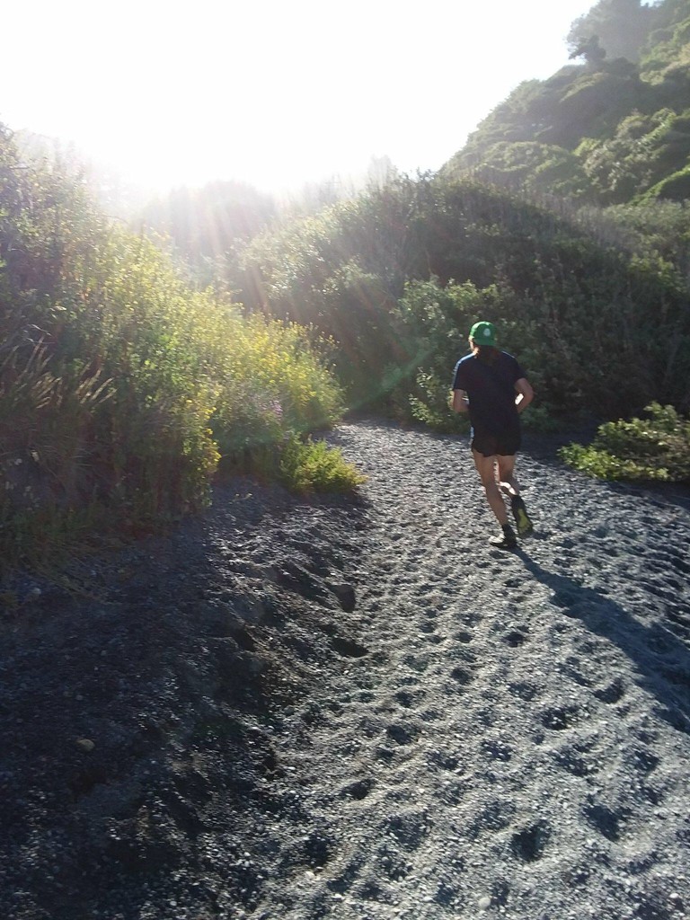
I started at 4:32am from the Mattole trailhead, and took off for an hour under headlight (and moonlight). After a fabulous moonset, the sun rose and the stunning coastline came into focus. Ran through globs of sleeping seals and sea lions. There was far more single track in this northern 25 miles than I was expecting. Rock hopping and the last 6 miles of sand running had my hips and feet very sore.
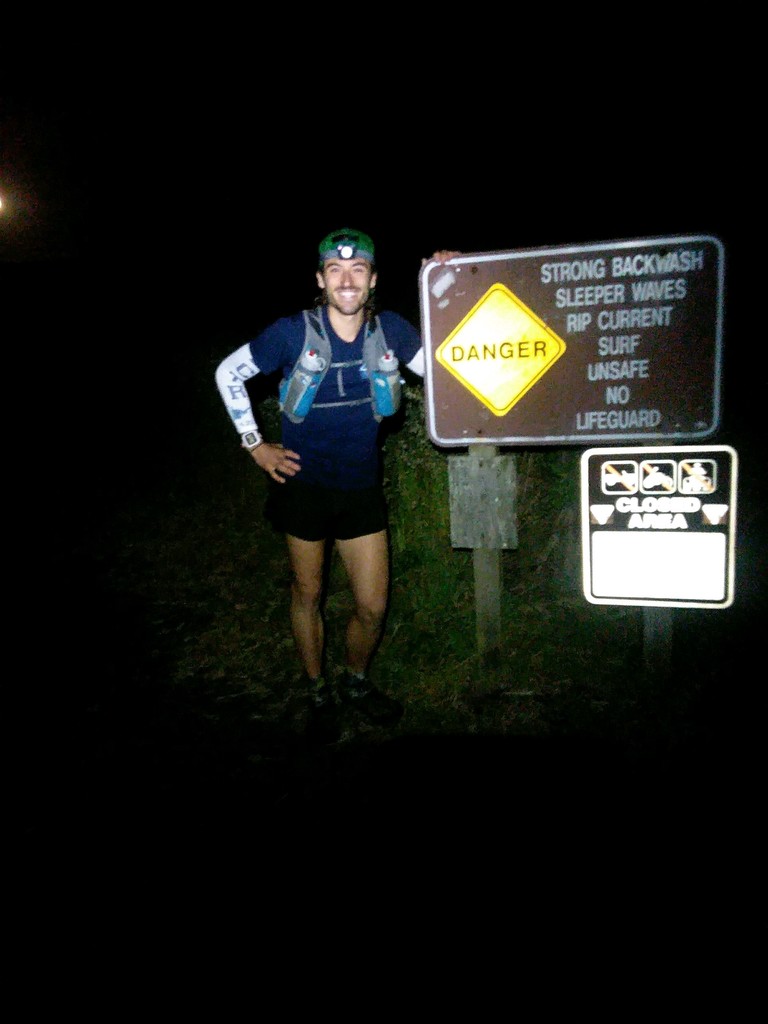
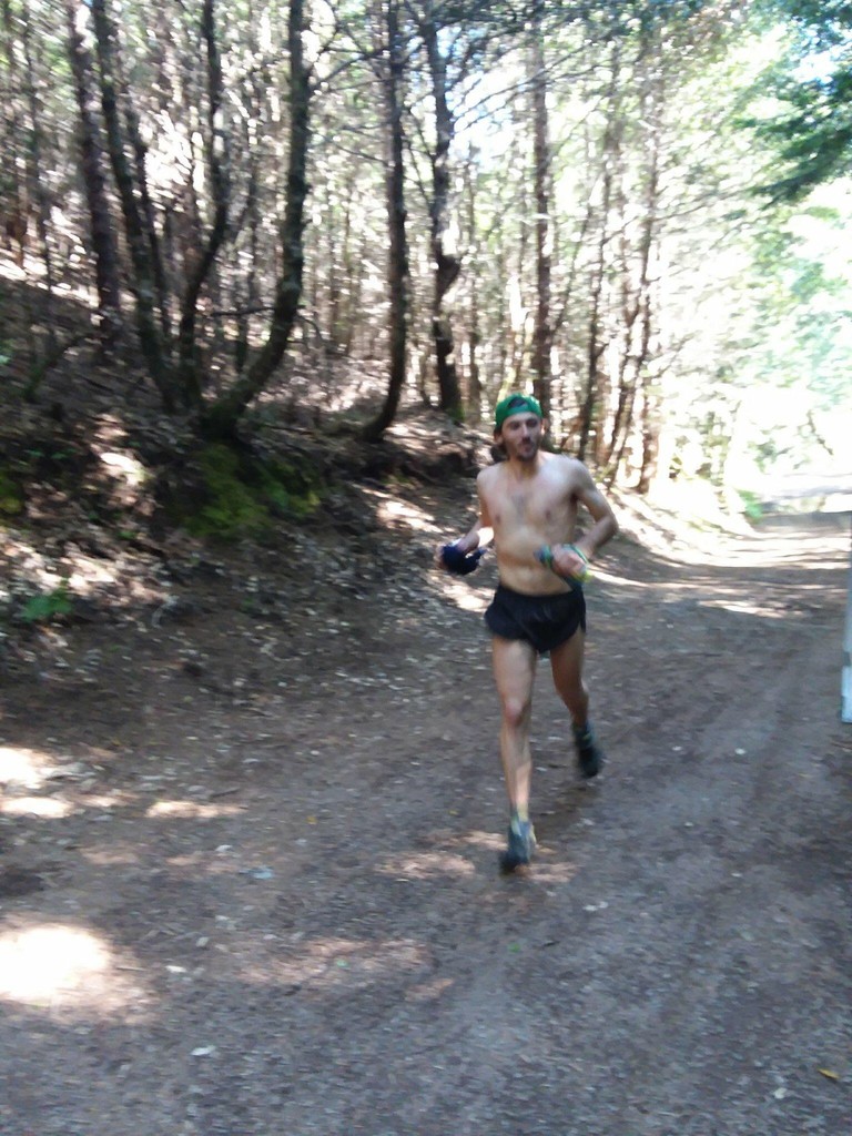
I hit the Black Sands Beach trailhead 3:51 after starting. I saw my crew and swapped my pack for a handheld. The 4 mile climb out of Shelter Cove was excellent foreshadowing for the rest of the day. The temperature spiked dramatically and my legs felt a bit heavy. I was quickly shedding my shirt and guzzling water in the heat. I met my crew again at the trailhead to Chemise Mountain. I spent a few minutes changing shoes, socks, and shirt. I also put 12 strips of KT tape on my thighs and shins to help me battle the overgrown craziness that was to come. I tried to eat, but the unexpected heat had me feeling pretty nauseous. With a restocked vest, I took off for the last hilly hilly marathon.
The final ~26 miles were rough. It got hot. I had two 20 oz bottles and was refilling in streams. But I let myself slip on hydration and missed a few creeks (I wasn't treating my water, so I was being a bit picky with water sources). Sitting in creeks wound up being my salvation. I bonked really hard towards the top of Chemise Mt, and on a number of the climbs to come. A massive part of this section was heinously overgrown. Head high stinging nettle, poison oak, thistle, blackberries, and shrubbery barred my path. On many sections the vegetation would only be a foot or two high, but it was enough to complete obscure the trail and make the going incredibly slow. To my dismay, it was even more overgrown than when I was scouting the southern section three weeks ago. Add in eroded/poor trail to begin with, and it was exceedingly slow-going. Despite trying to push harder, the trail had a definitive max speed limit.
I trucked onward, and finished the route in a bit over 10 hours. After the first 25 miles, I though 9:30 was super doable. Alas, I had not factored in the heat or challenging trail conditions. I chose to go north to south to avoid the gnarly northwest wind that often hammers the northern beach section. I think doing the trail south to north on a day of little wind, when things are warming up but before the springtime bloom, would provide the best opportunity for a smoking hot time on this route.
I am so so so incredibly happy I did this! Ran through seals, a herd of elk, and some damn beautiful terrain. Still digesting this one.