I've been looking at running this FKT for a couple years, hoping we could get it to line up with our travels, my training, and the weather/road conditions. Obviously it can be very hot down at the Colorado River or very cold on top of Humphrey's Peak. Another factor we discovered last year is that the forest roads can turn into a sloppy muddy mess from snowmelt, and who wants to run (much less drive) on that for miles and miles?
We found a narrow window when we were in Flagstaff, the overnight temps were perfect, the canyon was warm but not ridiculous, and -- oh -- there's a lot of wind in the forecast for the top of the mountain. If I make it that far, hopefully I will find a way! Other FKT runners (Meghan and Nick) had a wind challenge up top as well.
Husband John supported me throughout the attempt, including hiking down Hance trail to the river and back, driving the roads overnight to meet me every 3-4 miles, and accompanying me up Humphrey's to experience the gale force wind. Hugely helpful, could not have done it without him, big thank you to John!
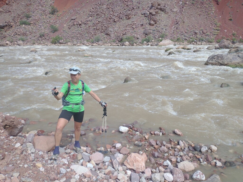
We hiked down into the Canyon and got started right at noon. The sun came out from behind the clouds as we climbed and it got a tad warm (forecast at the bottom was a high of 90). I didn't climb as fast as I wanted, trying to push without spending too much time maxed out on breathing and leg strength. John led the way across the middle traverse to help us stay on the trail amid the rocks. Hance is not runnable (at least for me), and it was helpful to have seen it before to know what we were getting into.
As I led the way up the upper drainage, John mentioned I should be "snake aware", and a few minutes later a baby rattler freaked out just ahead of me. I jumped back and we waited for it to leave, but it just stayed there waiting for us to leave. We found a way around and could still hear it rattling as we continued upward. Well that was exciting!
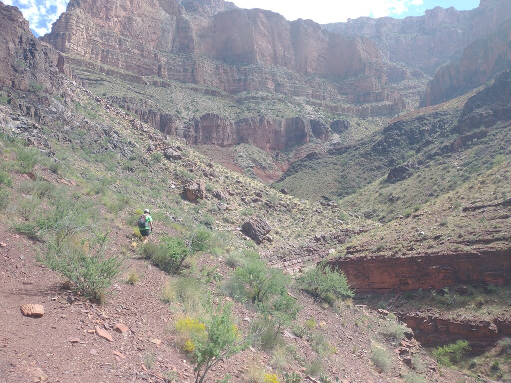
We popped out at the trailhead right on my target time of 3:20, only concerning because I had done it rather faster in a previous scouting mission. I tried not to imagine how that would bode for the climb up Humphreys the next day. Still, when my first few forest road splits were also slightly slow, I started wondering whether this whole thing was even possible.
I committed to going until I ran out of time vs. Carol's 21-hour run last year. My first goal was to see the whole road section and learn what I could in case I didn't make it this time but still got another opportunity (never a given in the FKT world!).
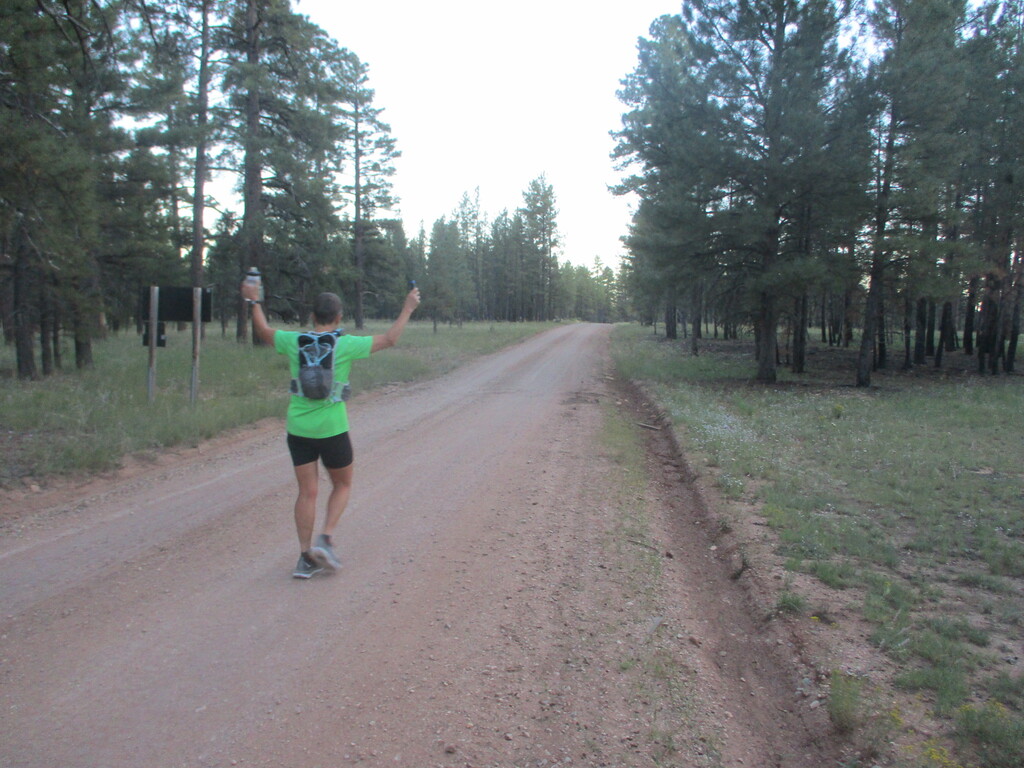
I also committed to running as much as I physically could - and it turned out this was absolutely necessary (at least at my speed). Not a lot of walking going on across the prairie that night. It felt like I was running relatively fast, but my times said otherwise. Even though the roads are mostly very nice and runnable. Well, at least I started gaining on my target splits eventually. I reached a 30 minute cushion and maintained that the rest of the night.
It was good motivation to make every stop as short as possible - swap the water bottle, drink some Spiz, get up and get going. I came to love the Rivian gear tube seat, perfect place to sit for a few seconds. As it got dark I gradually added clothing, settling on a medium-weight wool top, a buff and gloves, and just running shorts on my legs. Perfect running weather overnight, I believe in the 40's.
John found a "road closed to motorized vehicles" sign at the right turn off of 301, although the road looks heavily traveled. Weird. We decided he should try driving around (which worked fine), while I ran the road and pondered about the sign. We met up again at the next intersection and continued onward.
Sometimes I could see our truck taillight from a long way away, and sometimes it popped up right as I was about to reach our meeting spot. I learned what our tire tread looks like, spending so much time following it. Occasionally John assisted with route-finding, waiting at an intersection to ensure I knew which way to go before driving off (and trying to stay far enough ahead that I wasn't breathing much dust).
We heard elks bugling off and on all night, super cool. John and I both saw small birds (or bats?) with red eyes that sat on the road staring at us until we were almost there and then they would silently fly off. I heard another weird call that I guess was a bird, no idea what that was. The only real "wildlife" encounter was a cow that John made sure was off the road by the time I arrived (thanks John!).
Looks like there's a wind farm installation going on, although we couldn't see any of it in the darkness. Just a sign here and there, plus a brand new, very large/sturdy road that we traveled on briefly. That's not on our maps. I missed the turnoff by a short way, then figured out that I had seen our truck going straight and pulled out the Gaia app on my phone to figure out that I needed to cut over to the old road instead.
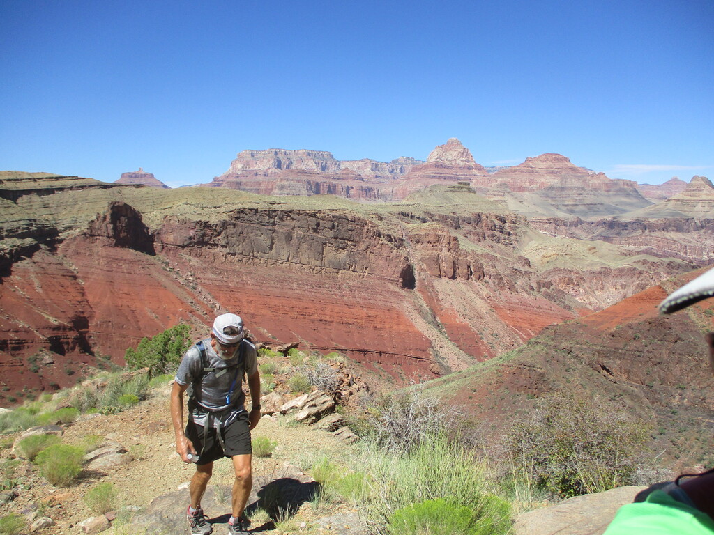
Most of the roads were easily drivable (at least in dry conditions), until we reached 9222A. I had heard from Carol that there was a rough section right before reaching highway 180, but didn't realize this is probably what she was referring to. John drove our truck up the road, which only worked because we have an "All Terrain" setting and the ability to increase the clearance for rock crawling. In hindsight we would have had him drive around that section to meet me either at 517B (which isn't perfect either) or even a couple miles further to the start of my run on 180.
One long section on pavement and zero cars passed me - good timing to hit that from 1 to 3 in the morning. The wind was picking up, and a head wind at that, must be getting close to the mountain.
John and I started talking about the transition to the climb up Humphreys, as I was starting to lose time on my splits (down to about a 20 minute cushion) and I was concerned about spending too much time at the truck in the Snowbowl parking lot. He took down a list of clothes that I wanted and we figured out when he should leave to drive around to be there in plenty of time to prepare.
After a fast hike up the dirt road, I found the turnoff onto Pine Mountain. I'm not fond of the idea of using this private road for an FKT route (my Flagstaff Fearsome Four run avoided it), but there is a lot of precedent for taking the road and I didn't have time to spare to hike up through the forest instead. At least it doesn't cross any actual personal property and the top of the road immediately hits National Forest land.
I was very glad to have seen the next section a couple times before, following reflectors up to the AZT and then an old road through a field. I avoided the "trail closed" trail by following the drainage, crossed the new parking lot and found a use trail up to the regular parking lot where John was waiting. Time gained = phew, more leeway.
After a quick shoe/sock swap plus the addition of tights and light rain pants, we were as ready as we could be for the cold winds up top. John led the way up the ski slope, and WOW that was tough going. I leaned heavily on the poles and just tried to keep up. Come on legs and lungs, you can do it! It felt so slow but apparently I gained a few more minutes in this section. I guess dawn was starting (we began the climb with lights on) but I don't remember much about that.
We went a bit too far left when trying to find the trail switchback, ending up climbing over a few logs, but finally we were on the trail. Even though it was still uphill, the gentle trail was a nice break in the mid section of the climb. OK, back to work on the haul up to the saddle...
...where we immediately sought shelter behind some rocks to fuel up and put on all the rest of our clothes. Yep, the wind was real. We started up the ridge trail, finding it not so bad for the most part. Here and there the wind picked up, and the good thing is that it was generally from the side or behind us. A north wind would have been a great deal worse.
It really helps to know the top part of this climb so you don't get disappointed over and over when you reach the false summits. Finally we could see the actual top and as we crossed the last little saddle the real fun began.
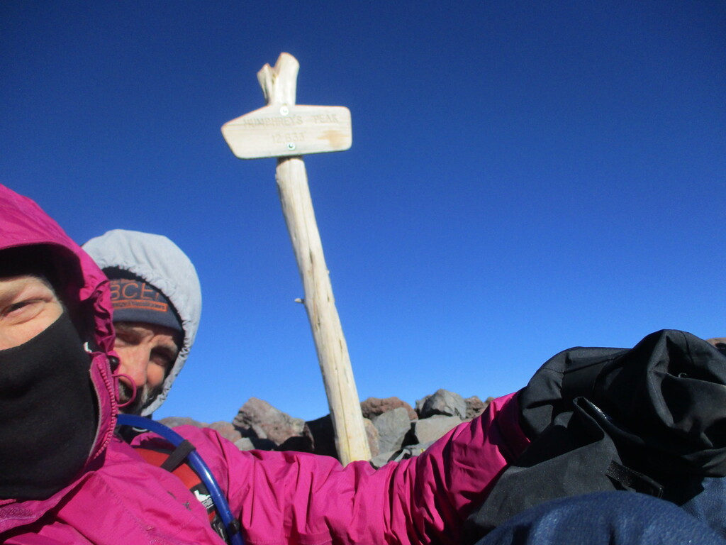
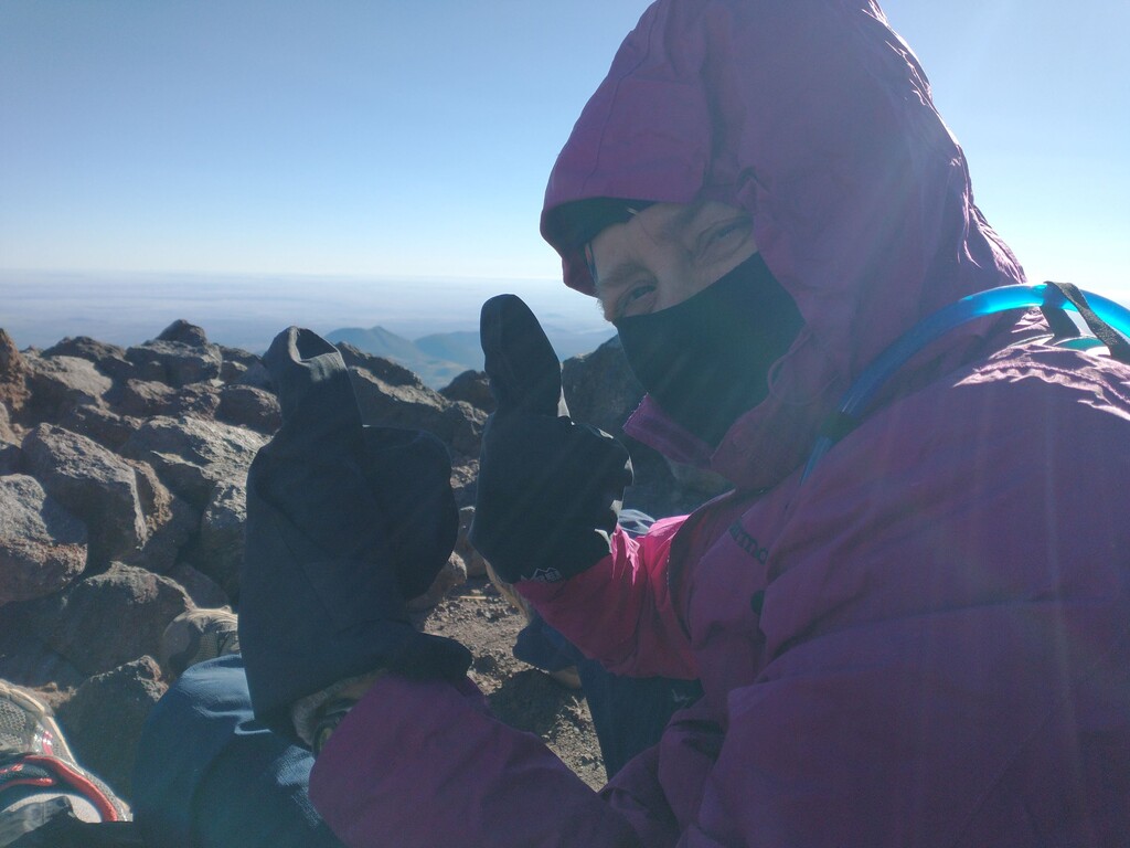
I don't know how, but the very summit of the mountain had (by far) the worst gusts and gales. It wasn't many vertical feet but it wasn't clear how we were going to get there. But it was also clear that we were going to try! John tried to find a leeway side by going around to the right, and that didn't appear to be helping so I made a more direct approach. It took some literal crawling but we made it! We dove behind the rock shelter at the top, finally able to catch our breath.
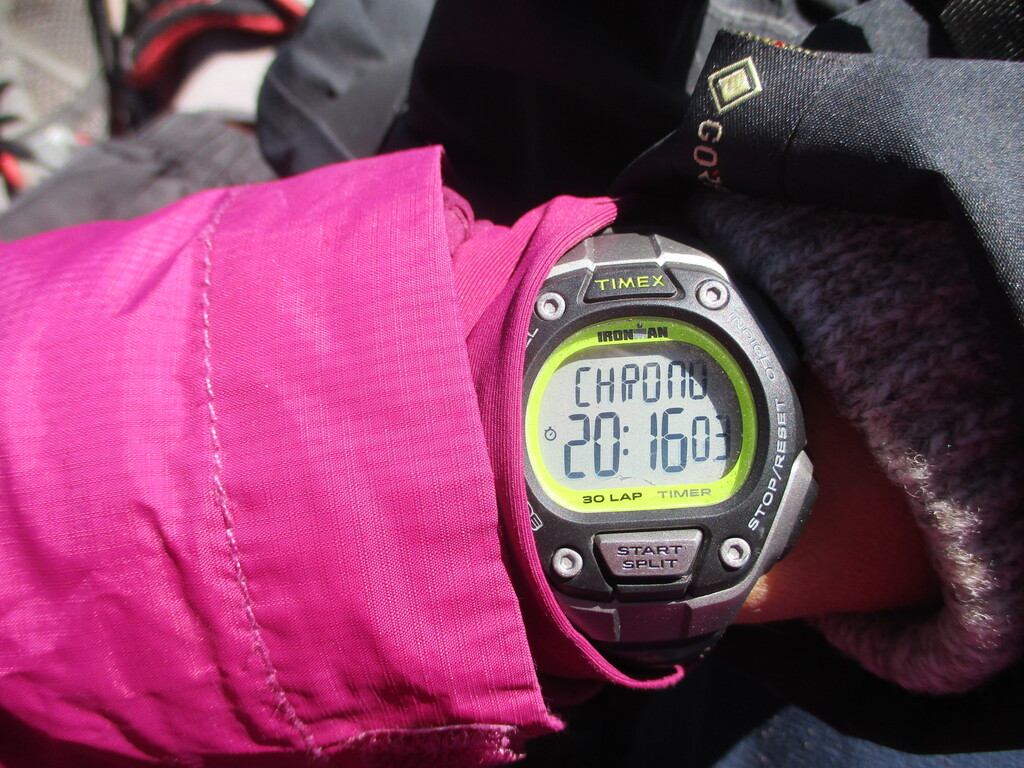
We stayed just long enough to hit the right buttons on the watch and the InReach Mini, take a couple pictures, and try not to get too much dirt in our eyes from the swirling particles around us. Crazy!!
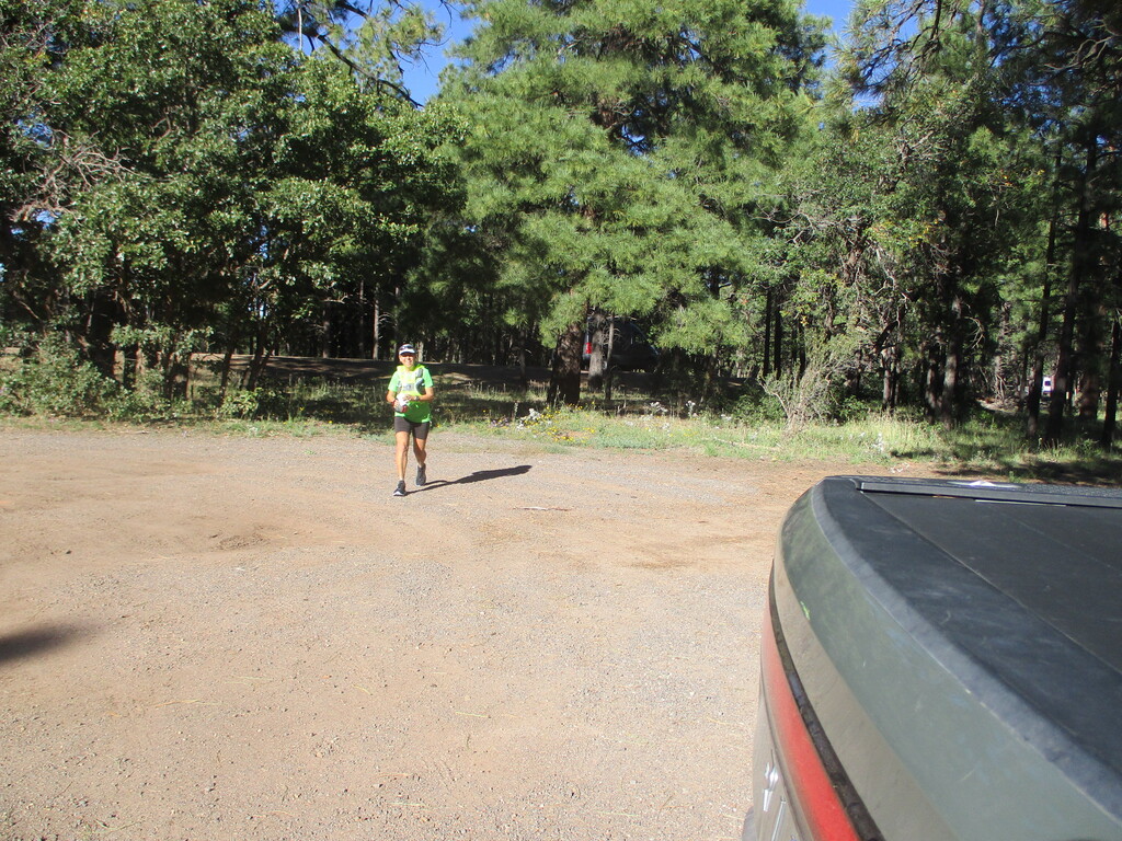
Happily the downhill went fine (especially once we were off the very tippy top), we were soon back out of the wind, and then we were at the truck and shedding all those extra clothes. What an experience - I still kind of can't believe we made it work!
Thank you to all the runners before us for the excellent ideas, info, and inspiration!
********
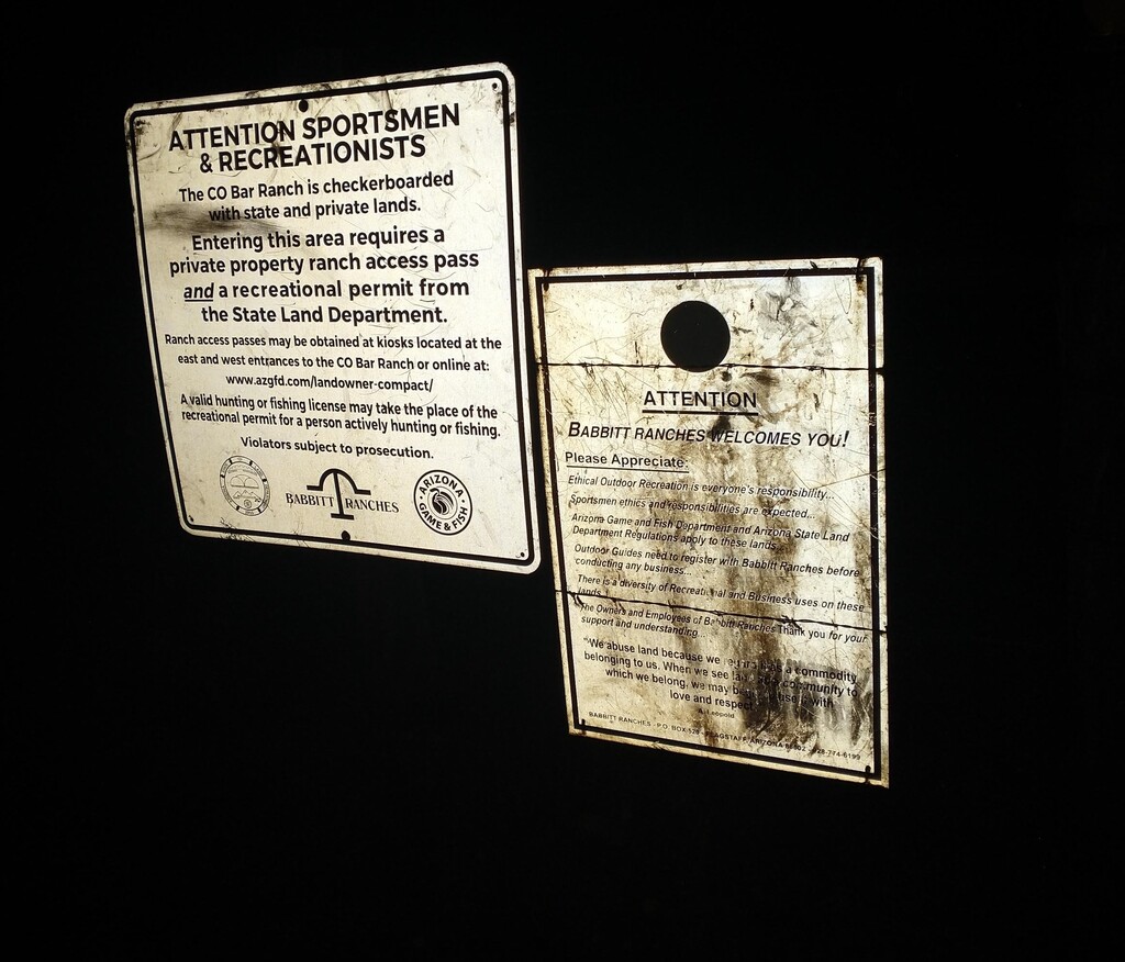
The links that appear to be the current procedure for crossing the ranch:
CO Bar Ranch access pass (I submitted our info but never got an email back):
https://www.azgfd.com/wildlife-conservation/on-the-ground-conservation/…
Arizona State Land Department permit:
https://azland.my.salesforce-sites.com/recreationalpermit/