(This is by far my longest trip report, sorry:) On May 15th-17th I ran a loop in the Grand Canyon connecting the standard Corridor Crossing (N Kaibab and Bright Angel in this case) with the Rim-2-Rim-2-Rim Alt route on the Bass Trail. I’m sure others have thought about doing this but I haven’t found a record of anyone else attempting it. I’m not entirely sure why I first thought about this but I should probably at least give partial credit (or blame, lol) to Jason Hardrath and Nate Bender. They set the Rim-2-Rim-2-Rim Alt FKT back in December 2020. This was during Covid and access to the S Bass TH across the Havasupai Reservation was closed so they biked out to it, epic!
I knew people go through the standard corridor trails quite often while bikepacking the AZT. They just have to take their bikes apart and carry them on their backs while in the canyon. What if Jason and Nate had taken their bikes across this way instead of stashing them on the south rim? Then maybe they could have biked over to the N Kaibab TH, taken their bikes apart and crossed a second time using the standard crossing. I quickly started playing around with different mapping programs and produced what looked like a “reasonable” possibility, close to a perfect 100 mile loop, mostly in Grand Canyon National Park!
Pretty soon I decided using bikes would be too complicated, at least for an initial attempt. The main issue was the river crossing. The bike would need some floatation. Maybe a packraft would work but I decided to give it a go on foot. My first failed attempt was on May 27, 2021. There was close to a full moon and I wanted the North Rim to be open. It typically opens May 15th. I knew the heat would probably be the main issue. I had thought about waiting until September or October but I didn’t know what my schedule would be like and I wanted to take advantage of the longer daylight hours. I started from the Bright Angel TH with 6 liters of water and took Rowe Well Road to meet up with some seldom used gravel roads. Within the first 10 miles I started developing an unusual hotspot on the bottom of my foot, then compounded the problem by putting some very rigid tape on the area. I soon had a huge blister but thought that I could keep going (I needed to refill with water anyway) so I made the descent down the South Bass. I had decided to go clockwise to keep this 30 mile waterless carry in the downhill direction but soon found myself filling up with water at the river and turning around, my blister having gotten extremely painful. I even filled up some spare ziplock bags with water but was very dry by the time I hit Santa Maria Spring, below Hermit’s Rest, a spring I had used a few times before. I limped up to the shuttle bus and rode back to my car, exhausted and dehydrated, feeling like I had gotten away with poor planning. Next time would be different.
After that experience I began looking for an opening in my schedule for the cooler months that fall. I made it to the canyon in early November, expecting to go for the loop, but I was still not prepared enough. There were too many unanswered variables, especially about the North Rim, and as I tried to sleep in my tent the night before I was going to start I decided it would be too sketchy without someone supporting me to bail me out if things went south.
A few months later my friend (who’d only been running a year) started planning to do his first traditional Rim-2-Rim-2-Rim. Excellent! As long as he was going to be there anyway, he could bail me out if necessary and maybe help with a couple resupplies. We decided that his first crossing would be with me as I finished the loop, then he could complete his second crossing solo. Highway 67 to the North Rim would open May 15 and there would be a full moon that night with a lunar eclipse. Perfect!
The heat would again be the main issue. I did 5 weeks of heat training this time. I had tried various combinations of shoes and socks throughout the year and was confident I wouldn’t have the same blister issue as the previous May.
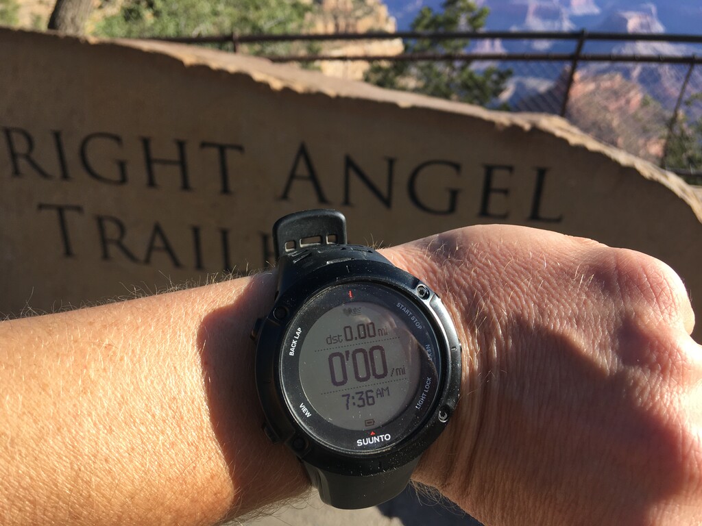
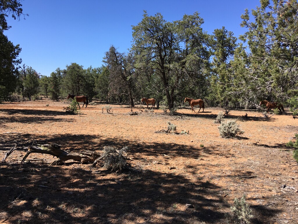
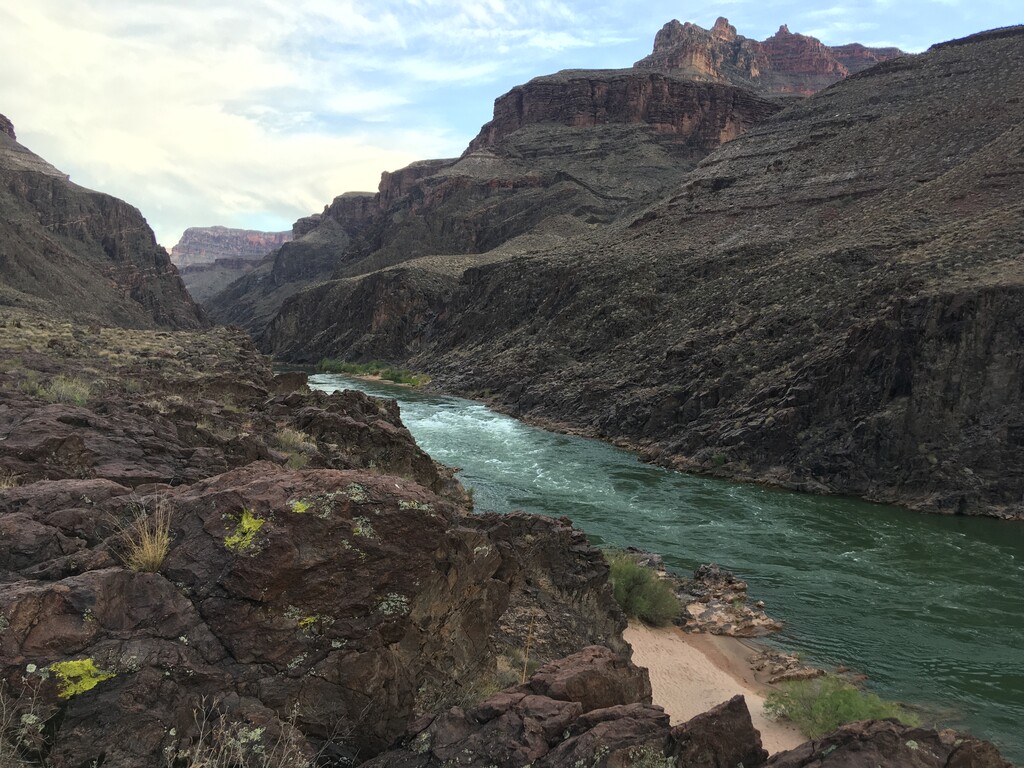
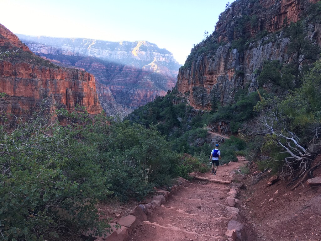
I started with 7 liters of water from the Bright Angel TH, again going clockwise. Actually it was 5 liters of water and 2 liters of ice, which I kept in my 36L pack against my back. It melted after a few hours but helped a lot staying cool as I walked out to South Bass. I actually saw 4 people (2 runners, 2 hikers) on the way out to South Bass, and several wild horses. I took it slow for obvious reasons, also trying to hit my goal of making to the river just a couple hours before sunset, so I could swim across in daylight yet not be at the bottom during the heat of the day.
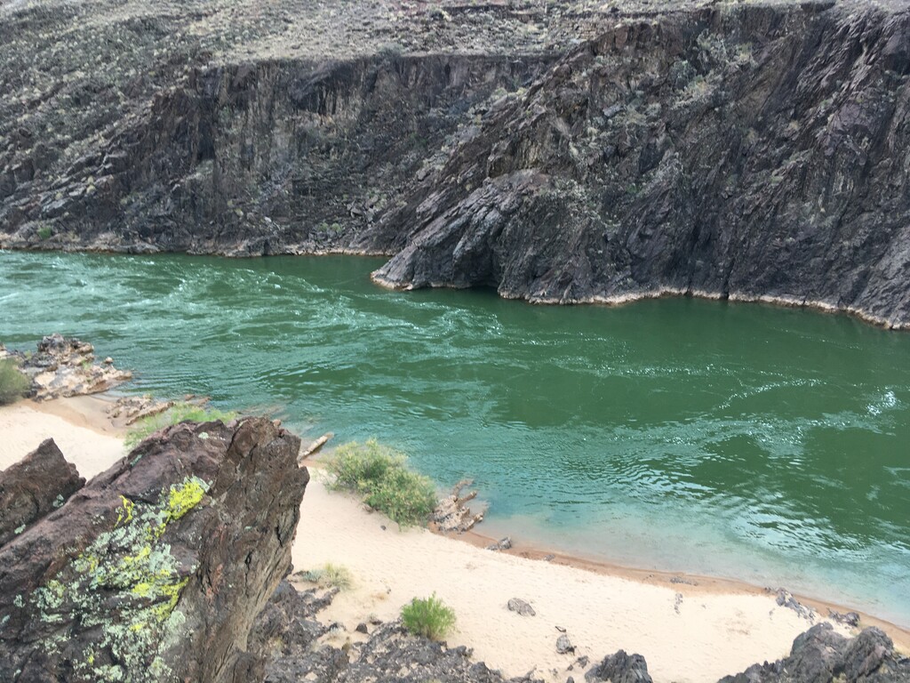
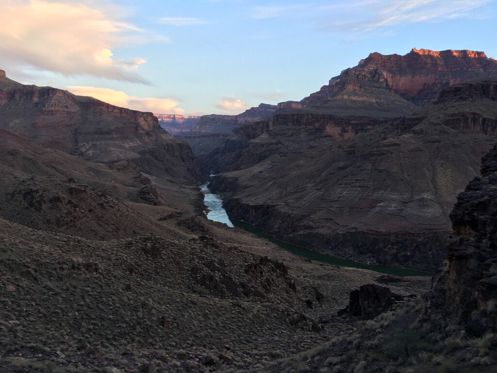
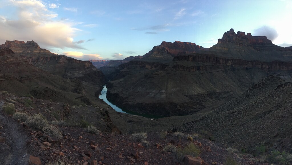
It worked, I made it down to the spot on the bank I had scouted out a year before. I decided that was still too close to Bass Rapids and spent a long time scrambling to find a better spot downstream, up against the near vertical cliff walls that dropped down into the river. I had decided against a wetsuit, but I’m not the best swimmer so I bought one of those cheap, lightweight inflatable life jackets that you can only get online from a country with let’s say, less rigorous safety standards. I’m not sure about it’s durability but it did the trick for the swim. I also wore Path Projects shorts with the three zippers and stuffed the important things in there in ziplocks should my pack somehow come untied from my waist and float away. Instead of a drybag I opted to save weight by wrapping my pack in two gigantic ziplocks and taping the openings shut.
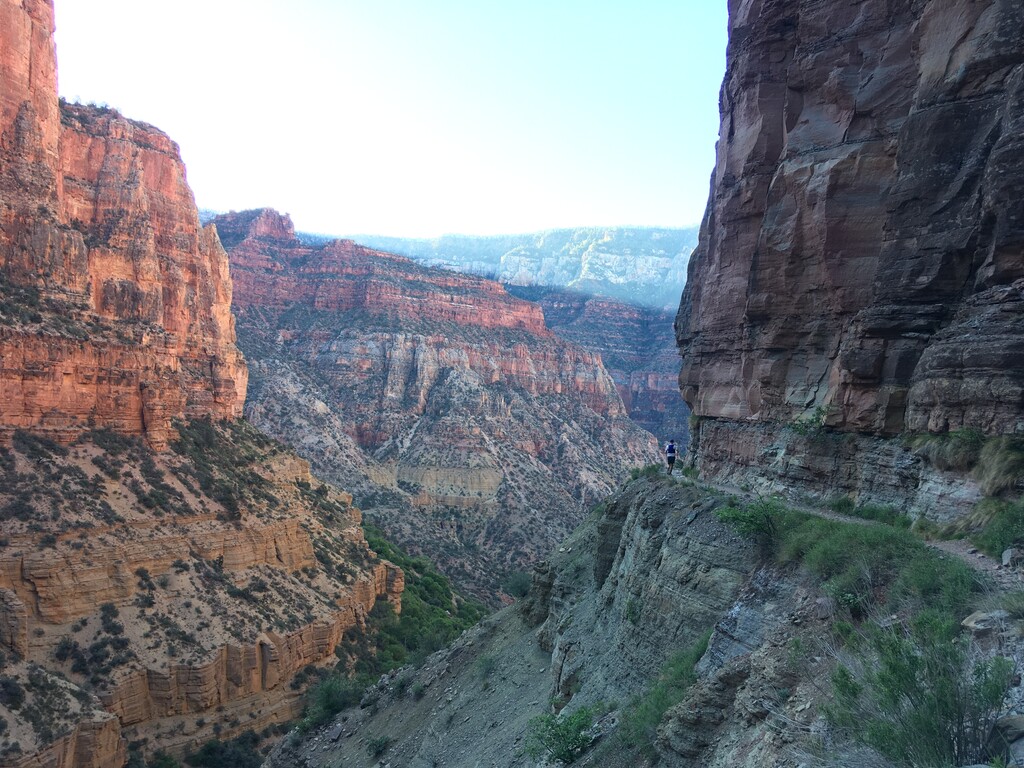
There was strong current and the water was pretty cold. I was shivering by the time I got across but warmed up quickly. I made it over to Shinumo Creek to filter water as it was getting dark and began my ascent up the North Bass Trail. This was where things started to fall apart. I felt great, but this was the one section of “trail” I hadn’t been on before. A lot of it is just following a drainage without any defined path. I wasted hours bushwhacking in the dark, trying to find the correct way out of some of the smaller canyons. At one point I thought I would have to wait until daylight to find the path. I saw my first person in 20 hours or so as I was climbing out onto the N Rim. I hiked out toward the National Forest boundary, fighting sleep, and met up with my friend who had a tent set up and supplies.
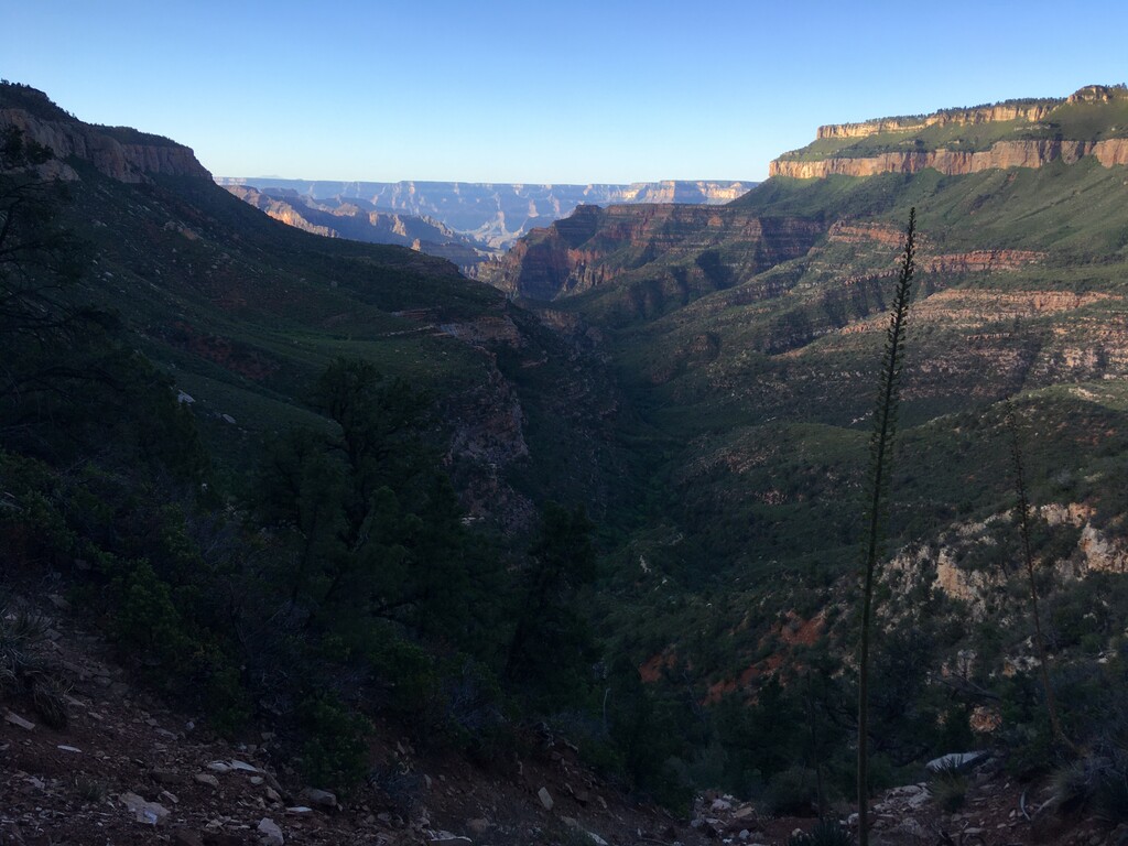
A few minutes of sleep and association did wonders. I switched to my running vest and started jogging down the forest roads toward the highway. This was when the stomach issues started and they did not get better. Norovirus was just starting to blow up in the canyon, so who knows. My friend resupplied me with water and food at the highway, then he went off to watch the sunset from the N Rim as I walk/jogged down the highway and the AZT. When I got to the rim I got a few hours of much needed sleep in the tent. I thought about continuing without sleep but wanted to be more alert on the North Kaibab.
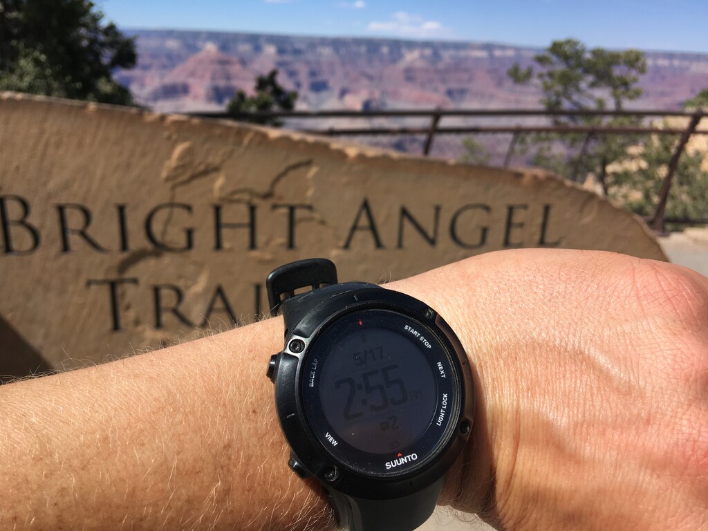
My final crossing went well. It was great getting to see someone run in the Canyon for the first time. I also planned this as the last part of the loop so I could see all the other hikers and runners. When we reached the top we went to get Mexican food in Tusayan, waiting for the temps to cool down. Then my friend ran across again while I got some much needed sleep.