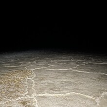
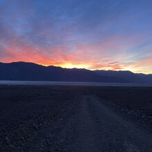
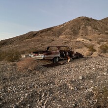
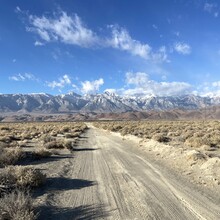
On October 31st, I started at the Badwater TH at 4:36 AM after saying a few words to crew and offering dried sage to the land. Being that this would be a fully supported effort, I already had my first pacer with me, Jon. I had been keeping an eye on L2H backpacker trip reports (from a Facebook group) regarding the Badwater crossing and many were tales of deep mud beneath sharp crust. But one party had taken a northerly alternate that largely avoided the mud, thus Jon and I took this trajectory. When we encountered muddy sections we only sank a few inches as opposed to the horror stories of calf or thigh deep mud (so, shout out to L2H hikers James and Katie for the beta). This alternate added two miles, but it was worth it. We reached the road on the other side at Tule Springs in about 1h 37m, met with my first crew resupply (who had biked West Side Road), then took the road south to Hanaupah Canyon. The sun rose as we made our way up Hanaupah road. Around 4h 52m in, we stopped at the creek that was flowing down from the spring to filter water from. I know there are signs up at the actual spring site warning against potability, but I also know that many L2H backpackers drink this water, so I felt okay doing it. After refilling, we began our off-trail ascent up to the ridge that would lead to the main Telescope ridge. There were faint trails from other hikers (including other animals) that we were able to follow here and there, but the terrain is just tedious, and this word will come up again and again on this route. Loose scree, steep terrain. Jon and I reached the Telescope ridge trail at around 9h 10m (1:46 PM).
After following the single track trail down a couple miles, Jon was done and I met with more crew and my second pacer, Anya. We began a very long and tedious descent into and through Tuber Canyon. More loose scree, more steep terrain. Lots of bushwhacking. This descent (which is over 7k ft of loss over 11-ish miles) took much longer than I thought it would. The sun set on us near the bottom of the canyon. We made our way to the paved (but closed) Trona-Wildrose Rd and met my friend Mike who was waiting at the junction of the open Minnietta-Wildrose Connector Rd (he rode his dirt bike). It was about 14h 35m in now (7:11 PM). Anya and I continued on the Minnietta-Wildrose Rd toward the Panamint playa. We saw wild burros wandering in the dark. Someone was setting off fireworks far off in the distance (probably because it was Halloween). Crossing the Panamint Playa was really neat and very dry, so no mud at all. We hit the paved Panamint Valley road at around 17h 50m (10:26 PM) where my husband met us in our van for a quick resupply, and we were off again. After some sandy road and wash wandering, we popped out on HWY 190 for the final stretch to Panamint Springs Resort. 18h 53m in (11:29 PM), I decided to sleep. I'd booked the Group Site at the campground there for my crew and pacers, so I crawled into the van. I maybe slept 2.5 hours, woke up around 3 AM, but was very nauseous. It took a while for me to get ready, but thankfully the nausea subsided, and I began again around 4:40 AM after another offering of dried sage. This time, my husband was with me to pace for the section across the Darwin Falls Wilderness. We followed the washed-out Old Toll road and then took burro trails up a ridge to the Darwin mesa. Sunrise was spectacular. We saw a drove of wild burros -- they're so freakin' cute! And an owl flew overhead.
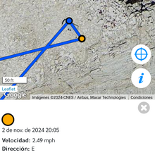
We made it to HWY 190 at Saline Valley Rd at 29h 11m (9:47 AM). Jon had driven our van to meet us at the junction. My husband was done pacing and my friend Johnny met me there with his mountain bike to follow me along Saline Valley Rd. He had a speaker and played upbeat music, which honestly helped so much mentally. After about 14-ish miles, Johnny turned around and my dirt bike friend Mike found me, then followed me up to Cerro Gordo. I took the Cerro Gordo alternate, which was quite the adventure for Mike on his dirt bike, since it turns from dirt road to single track. I was starting to slow down a lot and didn't crest into Cerro Gordo until just after sunset. More crew and Jon, who was about to pace me again, met me at the Cerro Gordo patio at 37h 44m (6:20 PM). I prepared for a long night, because I still had about 20 miles to go until I reached the van. Jon and I tried our best to run across the Inyo mountains, but really I was hiking a lot, reaching the top of Long John Canyon at 43h 26m (12:02 AM). I was bummed to miss all the open views of Payahuunadü. Long John Canyon was and is the very definition of TEDIOUS. Navigating this in the dark was just brutal and the steep, loose terrain was a pure slog. I was starting to ache quite a bit, especially in my feet. Not quite halfway down I noticed that my watch map had frozen and when I pushed buttons nothing would happen. Then the watch face went black. I thought it had died, but that didn't make sense, as I knew this watch (Suunto Vertical) had long battery life and I'd charged it had Panamint Springs while I slept. The watch face came back on but it was just showing me what time it was. I freaked out, thinking that the 105 miles of my journey thus far had just vanished (I had my Garmin InReach Mini, but still...). I checked the watch logbook and thankfully the track was there, but it was the only thing there, so I knew it was a memory problem. Jon and I sat there, 45h 19m (1:55 AM), in the middle of a dark and obscure desert canyon as I synced my watch with my phone; I knew that starting a new track would start erasing data (which happened to me on the Wind River High Route), so it had to be done. Finally, at 2:10 AM, I began the new track and we continued on, but this time I turned the wrist HR feature off, which I just should've done from the beginning to make sure there was ample room for data.
Near the bottom, I remember laying down for a few minutes and staring at the stars. My eyes wanted to close so badly, but Jon kept encouraging me that we were so close to the van now, just a little more. I got up and trudged on. We saw a fox, who followed us for a bit. I could hear owls. We made it to the crew spot near the bottom of the canyon at around 48h 17m (4:53 AM). Jon got a ride to Alabama Hills where crew basecamp was now set up, but I decided to nap in the van right then and there. I was so wrecked that I honestly began to doubt that I could actually pull this off. I was 5 hours behind schedule. I knew a storm was currently sitting atop Tumanguya (Mt. Whitney) dusting snow and I didn't know what weather window I would actually have. My husband set a timer for 3 hours and I slept. I'm always amazed at what any amount of sleep can do for endurance efforts. When I woke up, my body was actually okay. I offered dried sage and left the van at 52h 32m (9:08 AM) and jogged through Lone Pine. The sun was out, the clouds above Tumanguya parted. I knew then that my weather window was there, but only for about the next 15-20 hours or so, because very intense winds (50+ mph) were expected to hit the summit early Sunday. I made it my objective to make up for how long the previous night had taken, so I pushed the pace. When I made it to Alabama Hills (10:42 AM), crew and my next pacer, Liz, met me. My friend Bri had made some carne asada tacos (¡ay dios mío!) and I grabbed one to eat while Liz and I made our way up a portion of Whitney Portal road.
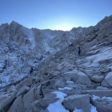
Liz and I made great time on the trail that leads from Lone Pine Campground to Whitney Portal. So much so that my crew was both surprised and frantic to catch me. After gearing up for the mountain, my husband and a few friends joined in. We offered tobacco and around 57h 29m in (2:05 PM) we began our ascent up the final section. It was strange to be going up when so many hikers were coming down from their own long journeys on the mountain. Some hikers looked like zombies and others looked put together but still tired and wind-burned. We kept the pace hot, averaging around 3 mph for a while. We hit snow fairly quickly. Two friends turned around partway up, as they were just joining for a day hike. It was now just my husband, Anya, and me. We reached the bottom of the infamous 99 switchbacks at 60h 43m (5:19 PM). The sun set on us right before we made it to Trail Crest. I was bummed to not be able to see the beautiful granite walls. The trail became very narrow and exposed, and the snow made for some mildly slippery conditions. I honestly don't know what the temps were, but they were definitely below freezing since our water froze. The wind was gusting up to 30 mph and I knew that it would only get worse as the night went on. I tried to push the pace once again those final two miles, leaving Anya and my husband (somewhat) behind. I would move for a bit and then sit down on a rock to make sure I wasn't getting dizzy, and I just repeated this until I could see the summit hut. I knew the true summit was just beyond the hut, so I passed the hut and looked for those metal geo markers. It was so dark (no moon), windy, cold. But I made it. I touched one of the geo markers and sat down next to it, stopped my watch. 8:05 PM. 63h 29m (2 days 15 hours 29 minutes).
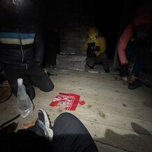
Anya and my husband joined me minutes later. I said a few words on behalf of Teyana and Norm, who'd asked me to carry a bundle to the summit for them to complete a MMIW (Missing Murdered Indigenous Women) prayer run they'd begun earlier in October. Because of the wind, we took the bundle into the summit hut to open it and give another offering of tobacco. Even though the descent isn't a part of this FKT, it's quite the additional feat. We layered up all the more in the summit hut before trying to book it down. The wind speeds were increasing, throwing the already fallen snow everywhere. Honestly, the descent was where I suffered the most, but I'll save that part of the story for elsewhere. In brief, we camped at Trail Camp and finished the descent the next morning. I think I'm still in disbelief as to what took place. So many rallied to help make this happen. And I'm honored to have helped Teyana and Norm complete their prayer run. This run was also to help fundraise for ReNew Earth Running and the Lone Pine Paiute-Shoshone Reservation Environmental Department for a winter community garden project, which can be viewed here: https://secure.givelively.org/donate/renew-earth-running/renew-earth-ru…
Special Thanks to all my crew and pacers.
Special Thanks to these brands for providing me very integral gear for this effort: HydraPak, Gu Energy, Suunto, LEKI, Fenix Lighting, Merrell
And stay tuned for a film.

