My L2H research and route were largely built off of Sean O and his experience. He probably has the best write-up of the route.
Before I started the route, I dropped water caches at the bottom of Tuber Canyon, Darwin Falls, Saline Valley, 15 miles back on Saline Valley, and the bottom of Long John Canyon. I wish I had a water cache up at Cerro Gordo- I somehow overlooked the fact that it's a long stretch from Cerro Gordo down to the mouth of Long John Canyon. After dropping the water caches, I drove up to Whitney Portal, parked there (forgot my Garmin inReach in the truck), then hitched down to Lone Pine and stayed the night in a hotel. The following morning I hitched a ride to Badwater Basin.
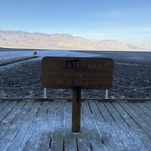
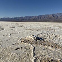
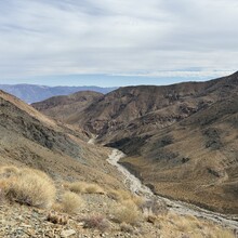
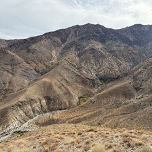
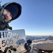
I didn’t start the route until 0830, which would later prove foolish. Cutting across the salt flats was mostly uneventful, there was some post-holing since it was still wet from Lake Manly. I deviated from the normal route and hit the actual “Lowest” point. Personally, it was important to me to trek over the true “lowest point” since the route is from lowest to highest. We often make a big stink about being on the actual peak/summit, and I wanted to carry that out on this route with the summit and the lowest point. It added about an extra 1.5 miles or so, lots more and deeper post-holing, and a slower experience, but I was glad for it. The west end of the salt flats was horribly jagged/sharp/slow. I was happy to hit Hanuapah Canyon road, made my way up, used the spring to restock on water, and continued up the ridgeline. I got to the ridgeline and was greeted with some snow and cold winds, and headed down into Tuber Canyon. I had never been in Tuber Canyon and I would have preferred to do this in light as I think I bushwhacked through some unnecessary paths at points. I slept for 20 minutes once I got to my water cache and moved on. I did not go to China Garden Springs since I did not know if the landscape had changed with Hurricane Hilary, so instead I took the standard route out of Darwin Falls. I was up on the plateau aimlessly wandering in the dark under a new moon, it made the stars beautiful, but it was dark dark. I got to Saline Valley, fell asleep for a little bit, woke up cold, and kept moving. I had to stop 14 miles later to sleep for another 30 minutes. The climb up to Cerro Gordo was during the heat of the day. I was down to one liter once at the top, thinking it would be a quick jaunt to Long John Canyon- I was wrong. Once again, starting earlier would have proved to be beneficial since I had never been down Long John Canyon, and I think I missed the “trail” at a lot of points and did some unnecessary Inyo County Bushwhacking. Dehydrated and tired, I got to the bottom of Long John Canyon, drank some water, and fell asleep for another 15-30 minutes. I woke up cold and started moving again. In the climb up to Whitney Portal I was moving super slow. My soul was crushed at this point, I was delirious, having trouble reading a map or walking straight, and I was doing a slow, slow death march. I made it to Whitney Portal and my plan was to sleep for 1 hour and then start my ascent. 1 hour quickly turned into 4.5 hours. When I awoke later than anticipated, I decided to go up the Mountaineers route. I believe it proved to be a lot slower time-wise for me versus the standard route despite being shorter. The couloir was filled with snow (waist-deep at some points), and I was moving oh so slowly. The Santa Ana winds were howling at 40-50 mph and made the ascent miserable. I finally made it to the top in 47 hours 14 minutes. I kept getting knocked off my feet by the winds that were gusting upwards of 60 mph. I took some photos, scampered to the shelter, and began my walk down to the truck.
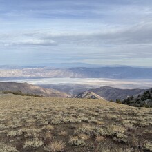
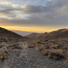
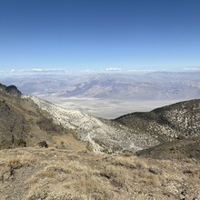
I do believe the route can be done by someone in 33-36 hours. I think I could shave another 4-6 hours off my time, and someone more fit than me with proper knowledge of the route could really make a dent in the time. I am more than happy to help anyone out who is looking to set FKT on this route. This route is truthfully remarkable- the landscape, the views, the stars, the desolation, etc.

Comments
Dude, savage effort.
Years back I went out with no sleep and no training with some friends and we set a modest record on this route before Dr. Dirtbag obliterated our time. I've always thought about going back for it, and now you've made it an even harder one to break haha!
If you'd be down to jump on a call to chat, I'd love to pick your brain on the FKT some more. Hit me up at: mcharlesmorrison [AT] berkeley [DOT] edu if you see this. I don't have socials or anything so I figured this is my best bet at getting ahold of you.
Best
Matt