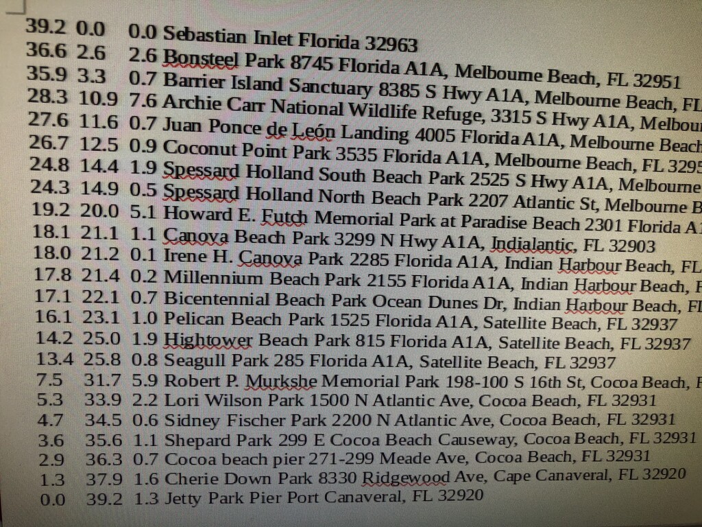
Ais Island is a name for the forty-five mile long barrier island from Cape Canaveral to Sebastian Inlet in Brevard County Florida. The Ais were Native Americans who survived contact with Europeans from the 16th to 18th century. Ais mean “the people” in the Chitimacha language. Ais island is separated by the Banana River to Merritt Island in the North and the Indian River to the Florida mainland in the South. The Northern Border of Ais Island is Port Canaveral and the Barge Canal between the Atlantic Ocean and the Banana River. North of the Barge Canal is the Cape Canaveral Air Force Station. South of Sebastian Inlet is Indian River County as the inlet is the southern border of Brevard County. Orchard Island is on the south side of Sebastian Inlet.
The route is completely beach and changes continuously due to the encroaching surf. The route is easiest at low tide, but as the tides change every six hours, it is a challenge to complete it before the tide changes.
Beach Replenishment is common on Ais Island and occurs November through April. May through October is Sea Turtle nesting season, which allows running the island without interfering with beach replenishment (which frequently closes sections of the beach).