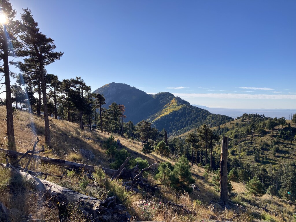
This route is based on the Arizona 20-20 Challenge. Arizona is a state with incredible diversity but peakbagging lists in Arizona have been problematic. Many of the highest peaks are private or closed for various reasons. So in the late 1990s the State of Arizona’s Office of Tourism funded a project to come up with a list of the 20 highest peaks in Arizona that a person could legally summit. (They also came up with a similar list of the 20 deepest canyons, hence “20-20,” which we will discuss later). The project was organized by professors Mike Kuby, Elizabeth Wentz, Brandon Vogt and Randy Virden, and much of the work was done by students in an Intermediate GIS class. A detailed explanation of their summit criteria can be found on this website, but included in these requirements were:
- It must be a public peak.
- It should be the highest point within at least 1200’.
- The trail to the top should be closed to vehicular traffic.
- You should be able to gain 1000’ of elevation when climbing it.
Even with these criteria there were a few edge case peaks that either made the list or didn’t. Despite the various issues involved in creating this list, it is still probably the best peakbagging list in Arizona. The most efficient route is likely around 135 miles with 37,000' of gain, though longer routes may make some peaks easier. This is a list of the 20 peaks, from highest to lowest:
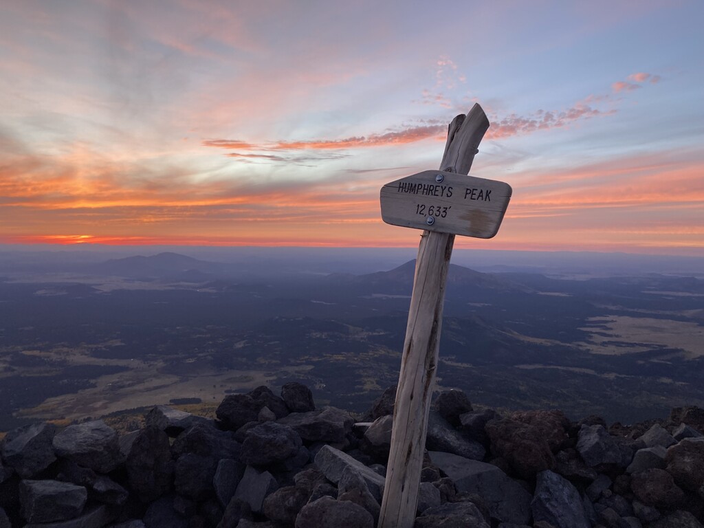
- Humphrey’s Peak
- Mt Baldy
- Escudilla Mountain
- Kendrick Mountain
- Webb Peak
- Heliograph Peak
- Chiricahua Peak
- Fly Peak
- Snowshed Peak
- Miller Peak
- Mt Wrightson
- Monte Vista Peak
- Blue Peak
- Mt Elden
- Bill Williams Mountain
- Carr Peak
- Mt Lemmon
- Clark Peak
- Sentinel Peak
- O’Leary Peak
The 20-20 website is old but still has a lot of good information. It says on the site that it hasn’t been updated since 1999, so some of the data on there is no longer correct. For the purposes of this FKT route we would suggest the following updates and clarifications:
- You must approach each peak or group of peaks (a “group” being connected on foot) from a point at least 1000’ of elevation below the summit. A few of the peaks have roads that will take you to a higher elevation. If you choose to use these roads you must run down to a point 1000’ below the summit before going to the top and then back to your car. This is based on the original design of the challenge and the “Colorado Rule” (a similar 3000’ guideline for Colorado 14er speed records.) We could perhaps call this the “Arizona Rule.”
- The original website indicates that you could catch a ride from the top of a couple of the peaks after having a car drop you off at a lower elevation. For the purpose of this FKT we think the entire distance should be covered on foot.
- This is an open-course route, as long as you tag each peak in any order and follow the 1000’ guideline. Be careful of going off trail in environmentally sensitive areas.
- Time starts when you leave your car before the first peak and ends when you get back to your car after the last peak. An unsupported effort would be entirely self-powered, no car.
Here are some important notes on a few of the peaks:
It is illegal to go off trail in the alpine tundra high up on Humphrey’s Peak.
Mt Baldy is probably the most controversial inclusion on this list. It is the only one of the 20 peaks where you aren’t allowed to go to the actual summit, as it is on Apache tribal land. The original compilers of this list included a ‘sub peak of Baldy at around 11,000’ elevation’ due to the importance of Mt Baldy to Arizona geography, being the highest mountain in Arizona outside the San Francisco Peaks, and the headwaters of the Little Colorado River. We thought they may have been referring to Mt Thomas just to the east, as some maps show this being on National Forest land, but we called and the ranger said Mt Thomas is on Apache land and is off limits. In fact, both the West Baldy and East Baldy Trails drift on to Apache land below the summit and then back on to National Forest Service land. It appears that the tribe is mainly concerned with the approach to the actual summit of Baldy. We’ve included in our gps file the sub peak we think the creators of this list were referring to off of the West Baldy trail, which is before any of the tribal land. It is around 10,900’, has a nice view, and is still the 2nd or 3rd highest peak on this list.
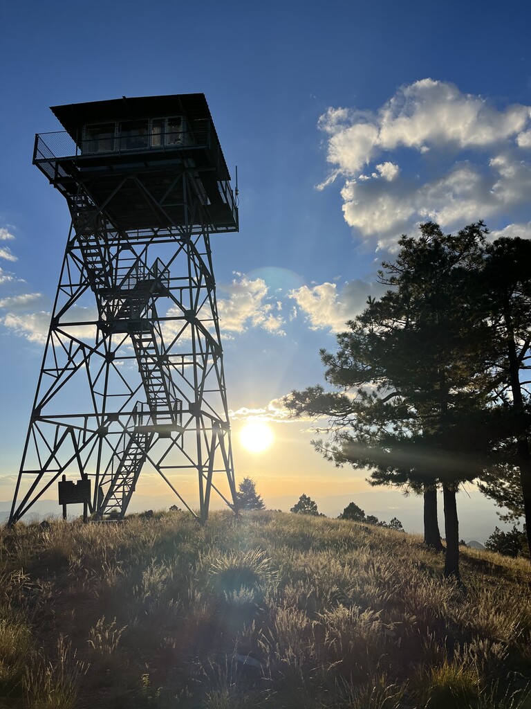
Escudilla and O’Leary have lookout towers that are NOT on the true summits. The true summits with benchmarks should be used, about .6miles north of the tower on Escudilla, and northwest of the col on O’Leary. O’Leary is incorrectly located on some maps.
The road on the Pinaleños ridge is pretty rough after Shannon Campground.
The southern summits of the Chiricahuas and Huachucas have signs warning about the possibility of smuggling and illegal immigration. Traveling alone at night isn’t recommended.
Rustler Park in the Chiricahuas requires a small fee, as does Madera Canyon (which is closed at night) for Wrightson, though there are other trailheads for both ranges that some may prefer to use.
Getting 1000’ of gain on Blue Peak is challenging. The trailhead at the end of Forest Road 84 is much less than 1000’ below the summit. There are a few options to get more than 1000’ below the peak, but many trails in this area are overgrown.
The Mt Lemmon summit and register are around the fence on the north side of the telescope. There is a herd path to the register.