Loop "The Loop"
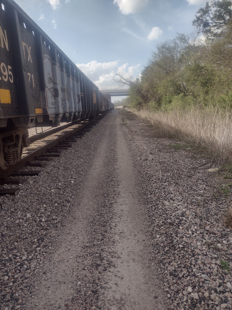
Houston's I-610 freeway forms a 42-mile ring around inner-city Houston, crossing bayous, intersecting 6 other freeways, and includes the 600-foot Sidney Sherman Bridge across the Houston Ship Channel. To navigate by foot around "The Loop" as its known locally requires several detours around freeway interchanges, on-ramps, and railroad yards which increase the total mileage to 48 miles. The terrain varies from sidewalks and grassy dirt paths to gravel and crossing the occasional irrigation ditch. The elevation is mostly flat with the exception of the Sidney Sherman Bridge which provides a 135 foot high view over ships transiting the busy Port of Houston, which handles the second largest amount of shipping by tonnage of all U.S. ports.
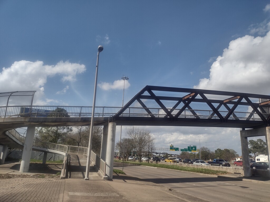
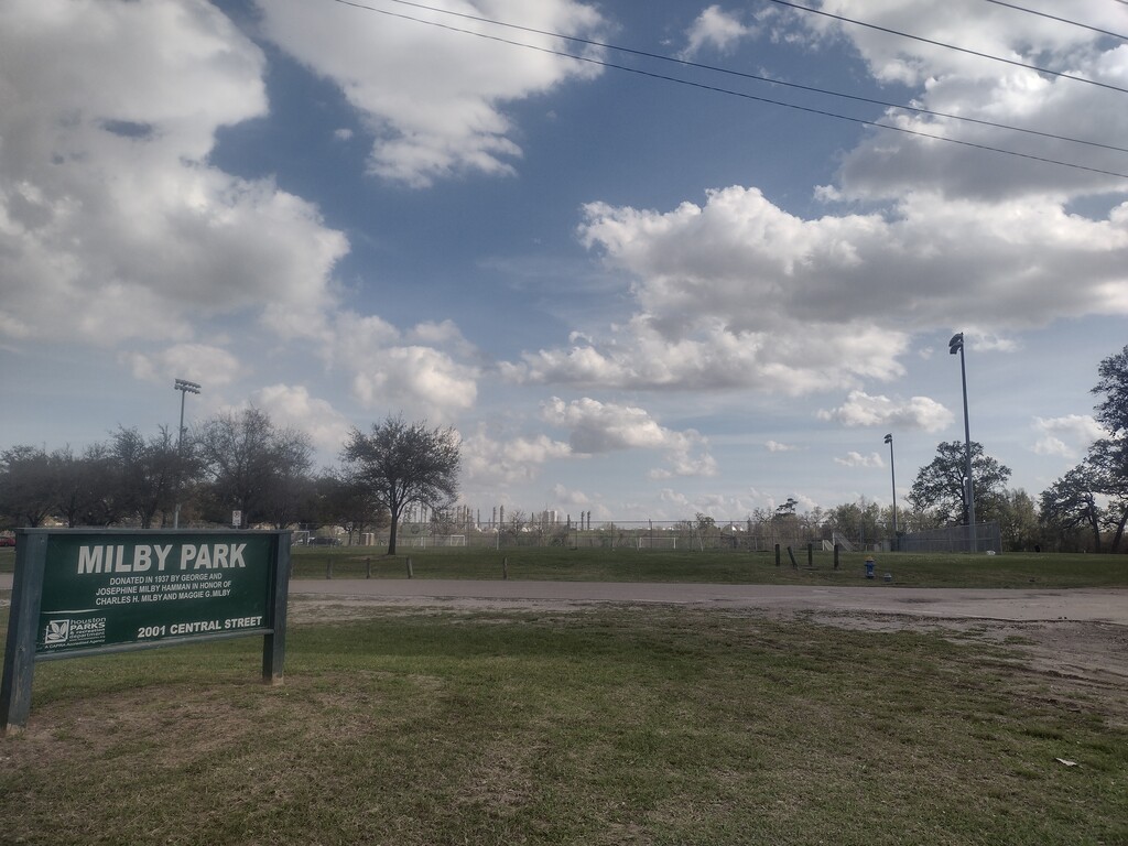
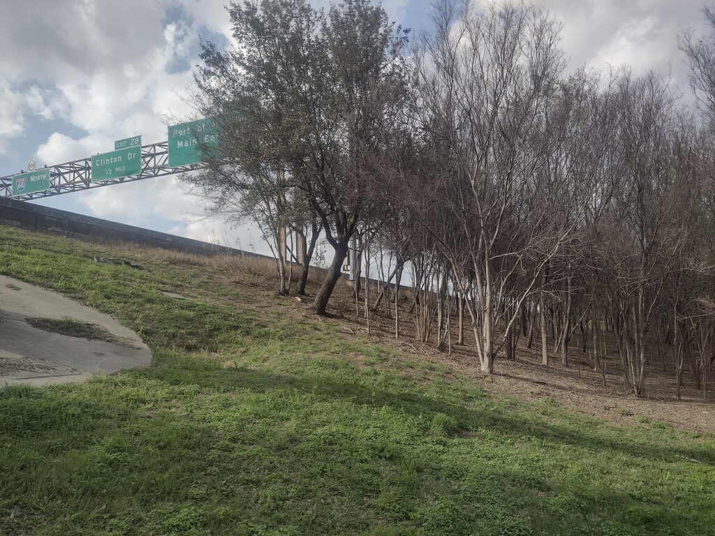
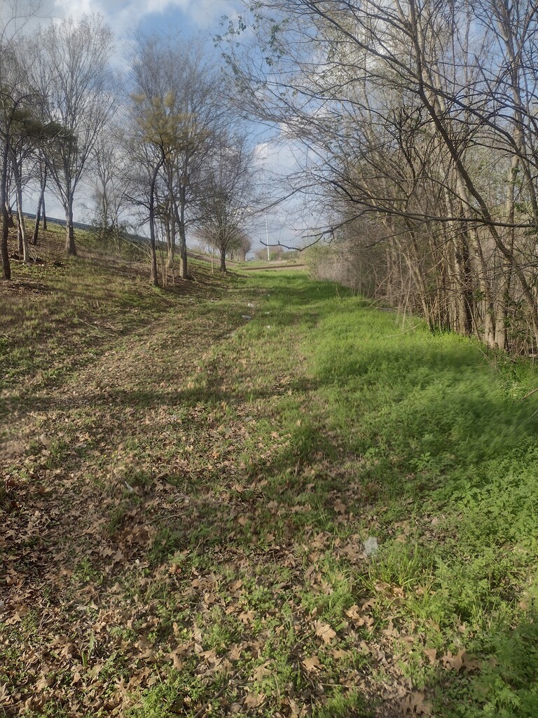
The route starts at the intersection of Martin Luther King Blvd and continues Eastward in a counter-clockwise loop traversing the Southpark and Golfcrest neighborhoods until reaching a pedestrian bridge over the Gulf Freeway (I-45S) at Southern St (mile 5). Continuing through Milby Park, crossing Sims Bayou twice, and through the Central St raily ard, the route re-converges with the East 610 Loop at mile 10 to cross the Ship Channel (AKA Buffalo Bayou) on the shoulder of the Sidney Hartman Bridge. To avoid having to cross traffic exiting the freeway, immediately after crossing the bridge and before Freeway exit #29 begins, cross over the 3-foot-tall retaining wall and into the tree-covered grassy slope to the East. Almost 1 mile later there is a convenience store at Clinton Dr, followed by Clinton Skatepark.
The route deviates from the 610 Loop again to cross the East Freeway (I-10East) at mile 14, and then returns alongside The Loop and Hunting Bayou on alternating grassy paths and sidewalks, crossing the Eastex Freeway (US-59N / I-69N) at mile 21. The majority of the remaining route has a sidewalk available past this point, as well as convenience stores fairly frequently. Upon reaching Durham St at mile 26, it's possible to pause for a snack from a handful of taco trucks to celebrate completing a marathon distance, before continuing into ultramarathon territory on the approach to the White Oak Bayou crossing at mile 28.
After passing under Northwest Freeway (US-290), and turning South along N Post Oak Rd, the route crosses the Katy Freeway (I-10 West) at mile 31 and then continues along the 1466-acre Memorial Park before crossing Buffalo Bayou again. The following few miles of the West Loop stand in stark contrast to the forests of Memorial as the route continues through the massive Houston Galleria shopping mall region, past the WaterWall Park, and around the Southwest Freeway (US-59S) intersection at mile 36. After some much quieter miles in the Bellaire neighborhood and crossing Braes Bayou at mile 39, the route turns again towards the East for the remaining 9 miles along the South Loop before concluding back at MLK Blvd.
Comments
Don't know if Thomas is monitoring comments, but if you are, the part I'm most nervous about is going over the Sidney Sherman bridge. I'm going to try on Sunday, starting around 5:30, so similar to what you did. How bad was the traffic? Was the shoulder pretty wide? It doesn't look too bad in your pictures, but people go pretty fast on that bridge. Did you feel relatively safe? Thanks! Jenny
Hi Jenny -- I guess you've probably made your run already, but in case you haven't yet:
I started around 6AM from MLK on a Sunday, and getting to that bridge around 7AM there was not a single car that passed me in the onramp lane immediately next to the shoulder coming out of that neighborhood. Next to that onramp lane is the slow truck lane, and 18wheelers are often crawling up the incline at 45MPH or so, and then of course there's the remaining normal highspeed freeway lanes further left.
The shoulder was about 10 feet wide on the south side and in the middle of the overpass, however it starts narrowing on the north downhill slope, and once the exit lane starts splitting off of 610 (which also had no cars on it at all at that time of morning/day) the shoulder gets pretty skinny. However no need to worry, as by the time the bridge has connected with land again (and the tall fence ends) it's easy to hop over the 3 foot tall concrete freeway barrier and run down the grassy slope into the small wooded section, and then continue the run along an access road.
I felt safe as far as cars are concerned the entire route, however there were a few neighborhoods (southeast and northside) that had some unleashed and very aggressive dogs, so it might be wise to carry pepper spray or a loud horn.
Good luck on your run! I'm actually thinking of attempting it again very soon!
I did! I ended up doing a few modifications for safety/legal reasons. (See report!) Thank you so much for putting this together--it was an experience. :)
Thanks for the write up guys! I’m going to attempt this route self supported this weekend if the current weather forecast holds.
I had a great weather day. I did have 2 dogs aggressively come up to me on Reveille about mile four in. It took three separate squirts from my handheld water bottle to get them to back off. Not the best way to start the day but that was the only dogs that came up to me.