The route from the Garita Centro Peatonal in Mexicali, Mexico BCN → through the Baja peninsula → to El Médano Beach in Cabo San Lucas using Highway 5 → Highway 1 → Highway 19 is one of North America’s most distinctive long-distance journeys. For someone unfamiliar with Baja, what makes it special is not just the destination — it’s the sense of traveling down a long, narrow, semi-wild peninsula where the road often feels like the only thread connecting isolated desert, mountains, and ocean.
Here’s how to picture it.
A road through a remote, almost island-like peninsula.
Baja California is a 1,200+ km (750+ mi) peninsula with only one continuous north-south trunk road system. The route from Mexicali to Cabo is roughly 1,500 km by road, passing towns like Guerrero Negro, Mulegé, Loreto, La Paz, and finally Los Cabos.
Because the peninsula is long and narrow, there’s often:
- Desert on one side
- Ocean on the other
- Very few alternate routes
This creates a feeling similar to crossing an entire country on one highway.
What each highway segment feels like:
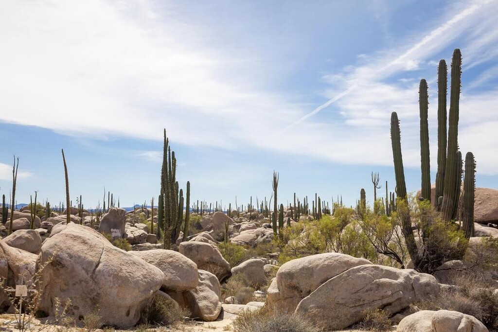
1) Highway 5 — the Sea of Cortez desert corridor
South of Mexicali, Highway 5 runs toward San Felipe and down the Gulf of California side.
This section is known for:
- Vast cactus forests
- Bleached desert plains
- Bright turquoise Gulf waters
- Huge empty stretches with almost no towns
It feels raw and frontier-like — Baja at its most isolated.
For many travelers, this is the moment the trip starts feeling like an expedition.
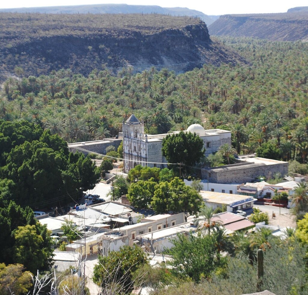
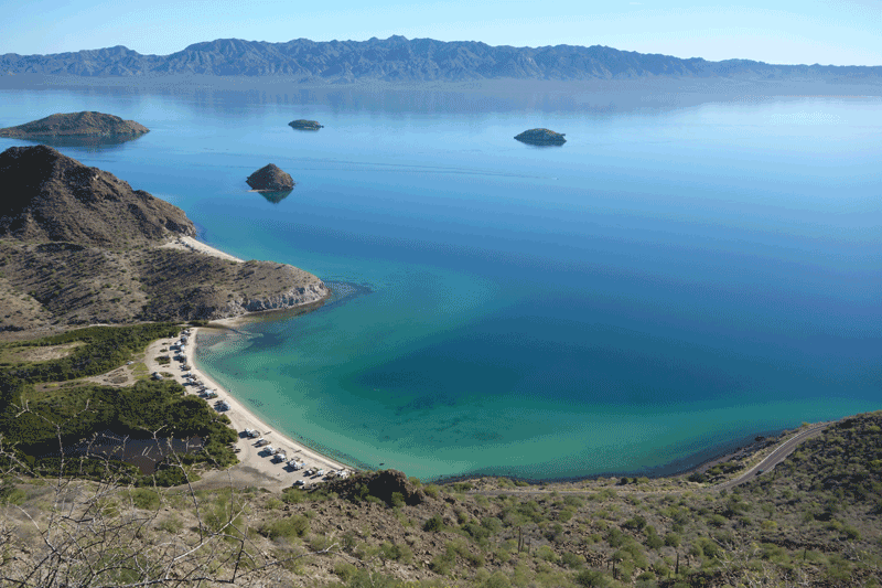
2) Highway 1 — the legendary Baja backbone
Highway 1 is the peninsula’s main north-south artery.
This stretch is famous because it:
- Traverses volcanic deserts
- Climbs through rugged mountain ranges
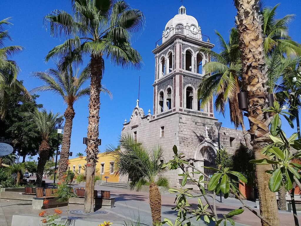
- Passes historic mission towns
- Runs beside spectacular bays like Bahía Concepción
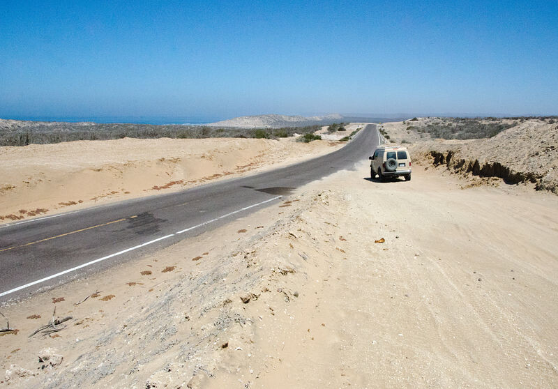
For long distances, it’s a narrow two-lane road threading through wilderness.
That “only road through everything” character is a defining Baja experience.
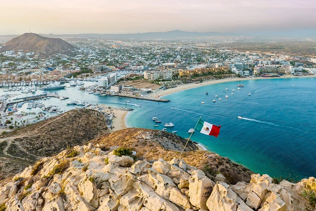
3) Highway 19 — the dramatic Pacific approach to Cabo
Near La Paz, turning onto Highway 19 brings you down the Pacific coast into Cabo.
This highway:
- Runs along the Pacific shoreline
- Passes surf towns like Todos Santos
- Ends in Cabo San Lucas
- Is about 130 km long and connects back to Highway 1
This last section feels like the scenic “victory lap” into Los Cabos — ocean cliffs, farms, desert palms, and finally resort coastline.
Why this route is special (globally)? It’s one of the longest continuous desert-coast routes in the world.
Few places let you travel:
- From border desert
- Through cactus wilderness
- Across historic colonial settlements
- Into tropical coastal resort zones
…all on essentially one peninsula road.
Extreme contrasts in landscape
Within one trip you experience:
- Colorado River delta flats
- Sonoran-style cactus deserts
- Volcanic mountains
- Calm turquoise gulf waters
- Wild Pacific surf coast
- Tropical southern Baja
The landscape changes constantly — but the isolation never fully disappears.
It still feels adventurous
Even today, Baja’s long-distance route retains a reputation for:
- Long fuel gaps
- wildlife crossing roads
- narrow shoulders
- vast unpopulated stretches
That combination gives the route an old-school road-expedition feel rare in modern North America.
A good website documenting the route:
Here’s a straightforward page showing the full Mexicali → Cabo route and highways used:
- https://ca.drivebestway.com/distance/mexicali/cabo-san-lucas/