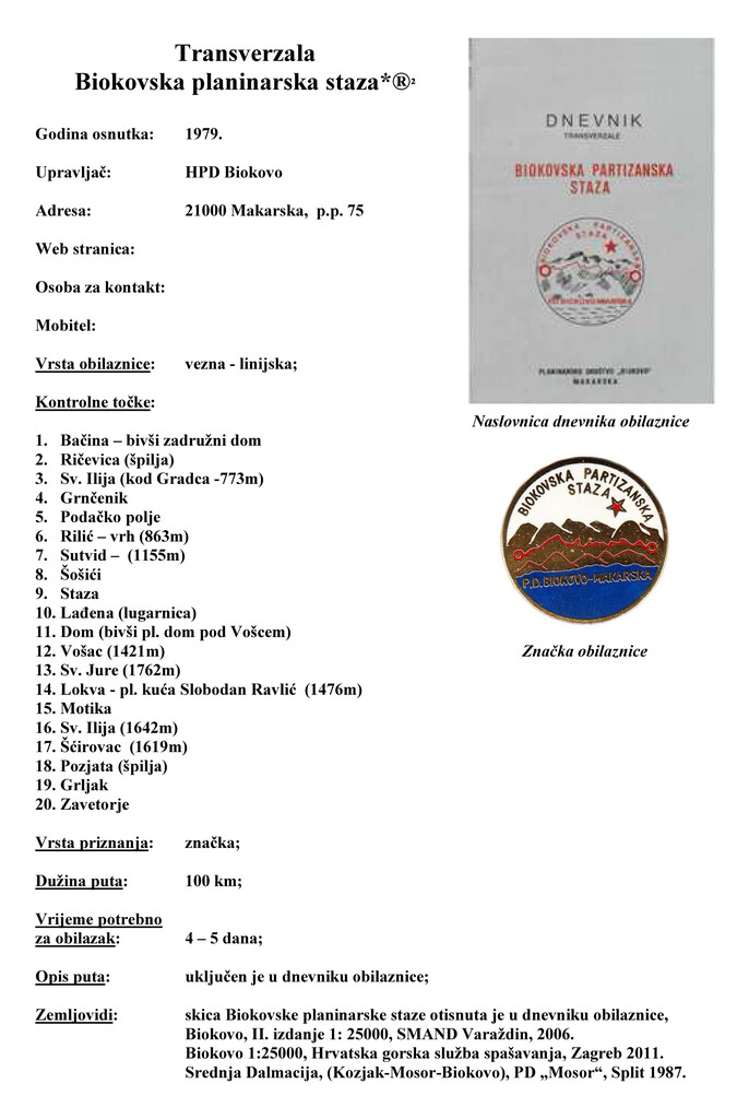
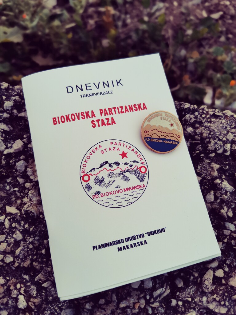
"Biokovska planinarska staza" (Biokovo Hiking Trail formerly Biokovo Partisan trail, acronym "BPS") is a hiking trail that goes from the town of Ploce (Bacina) to the village of Zadvarje (Bartulovici) traversing whole Biokovo mountain massif. It was envisioned and opened to the public in 1979 by Croatian mountain society Biokovo in honor of the anti-fascist Yugoslav Partisan fighters that use to gather, supply and live up in mountains to fight against the Axis powers for the liberation of the Italian occupied Dalmatia during the Wolrd War II. Since the Croatian independence from the Yugoslavia in the nineties the Partisan movement has been slowly put aside so the trail changed it's name from "Partisan" to "planinar" (meaning hiker) and focused only on the hiking part, less on the history lessons. It has 20 control points where you have to take a photo of yourself as proof that you've been there. The club use to issue a unique trail badge (once confirmed) as a "finishers medal" but the trail has been neglected for quite some time.
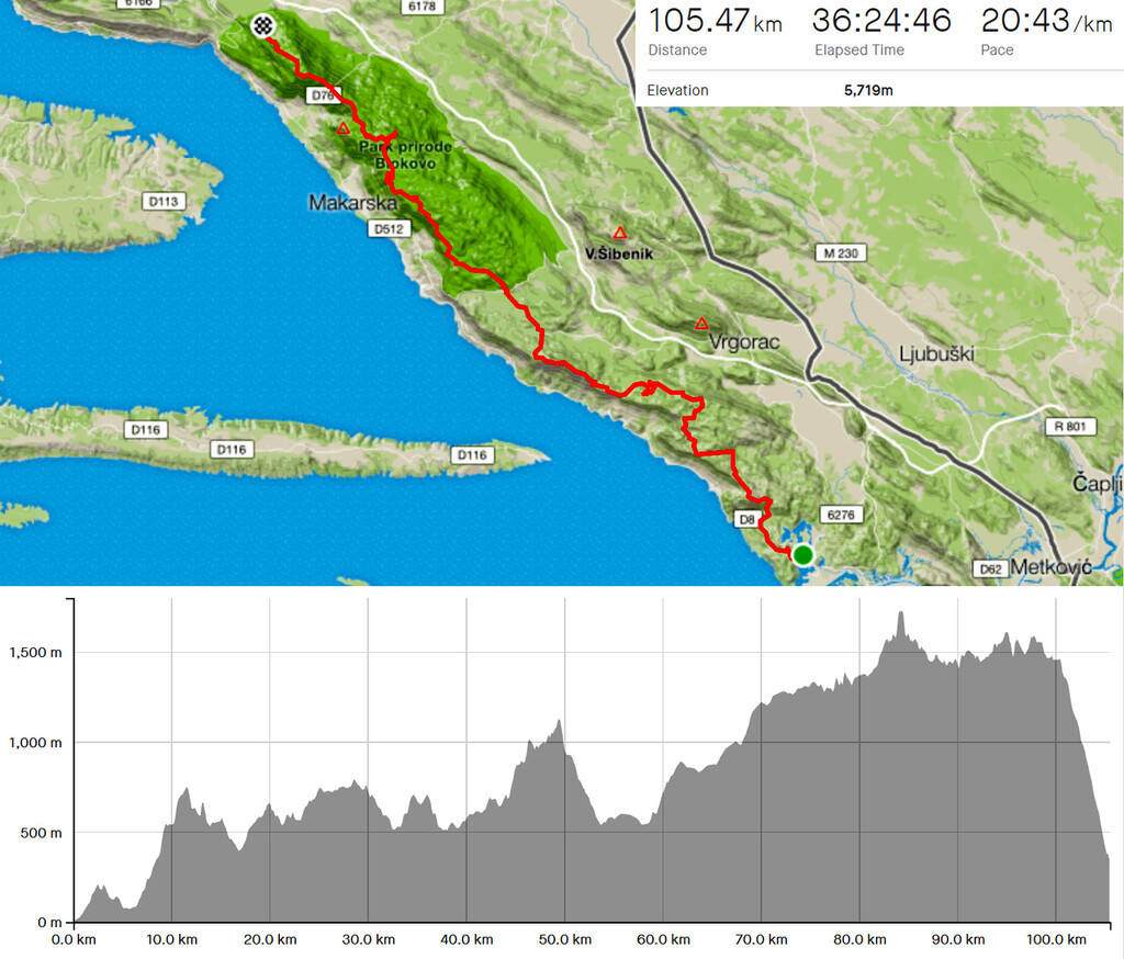
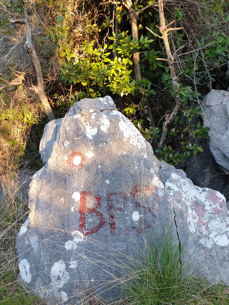
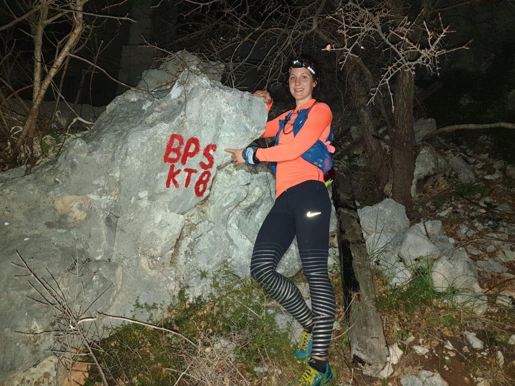
The trail is technically very difficult and at some parts unmarked or unmaintained so that it requires some orienteering skills. The trail includes the standard more popular Nature park Biokovo and less known southern Rilic part of the Biokovo massif. It has around 100 km (60 miles) and 6000 m (19000 ft) of vertical gain depending on the route you take between control points. The route is mostly marked with standard Croatian hiking blazes (red and white circle) at some parts unmaintained but mostly in good shape as the route goes through some of the more popular hiking destinations on Biokovo mountain, especially in the Nature park Biokovo part. Every once in a while there is a "BPS" blaze on the route and there are "KT" signs with accompanying number on the control points but it's usually old and somewhere completely faded out.
Submitter: Opara