The BTSS (Broken Top-South Sister) run allows adventurers to traverse some pretty, prominent peaks and gorgeous vistas within the Three Sisters Wilderness (Bend/Ft. Rock Ranger District)—if you have friends in town looking for an arduous pull that showcases perspectives within the Cascade Range of Central Oregon, bring them here. You will be on ancestral lands of the Molalla and Confederated Tribes of Siletz Indians, Grand Ronde, Grande Ronde of Klamath, and Warm Springs.
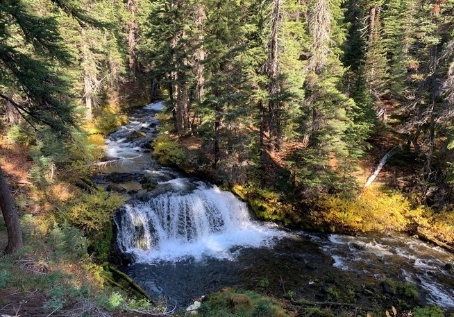
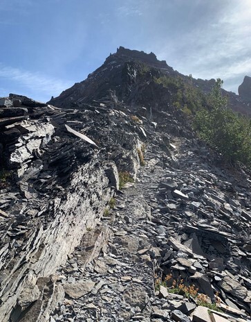
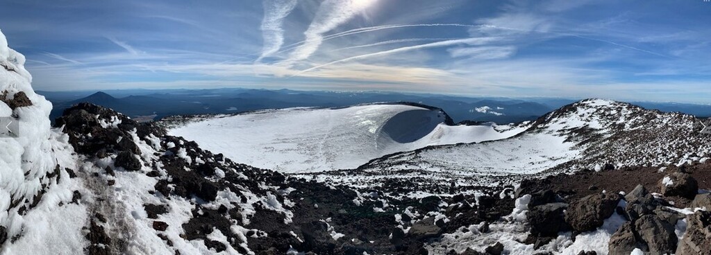
The run takes you from the start (Green Lakes Trailhead off Cascade Lakes Hwy) heading north to the southern side of the largest body of water at Green Lakes. There is an unnamed climber’s trail, shooting off to the east, that will bring you up to the northwest ridge of Broken Top (approx. 0.8-mi). Follow the ridgeline and just shy of the summit you will encounter some 4th class scrambling; you are heading correctly if you reach a 12-15’ ledge rock (the entire segment from the beginning of the NW ridge to summit is roughly 0.5-mi). Upon reach the summit, proceed back down the same path to reach Green Lakes; please avoid scree skiing.
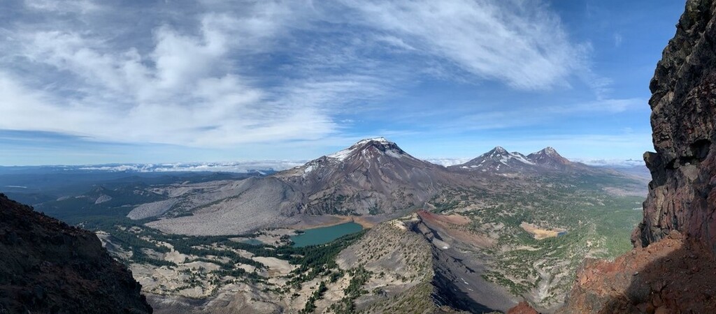
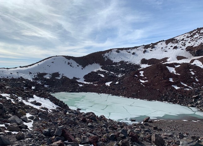
Upon reaching Green Lakes, proceed to the southwest edge of the largest body of water. You will see an unnamed trail (look for signs of foot-traffic wear and occasional cairns) heading W-NW towards Hodge Crest and South Sister. This segment takes off from Green Lakes and links up just shy of the South Sister summit at the glacial lake below Lewis Glacier (approx. 2-mi in length). Hikingproject.com has additional information on this segment. Once connected with the South Sister Climber Trail #36, proceed to the summit (roughly 1.25-mi).
Take the South Sister Climber Trail down from the summit to the intersection for the trail heading towards Moraine Lake (roughly 3.2-mi). Head east on the trail that passes the north side of Moraine Lake and proceed until you join back up with Green Lakes Trail (roughly 2-mi). Proceed south on Green Lakes Trail back to where the journey began (approx. 2.2-mi).
Enjoy the journey on two feet! Lastly, permits are mandatory even for day use. Provided are links to more information (valid at time of submission):
USDA Forest Service - Central Cascades Wilderness Permits
Recreation.gov: Central Cascades Wilderness Permit – Day Use
Comments
Heyo y'all! Nice work to Brittany and Xavier! I'm curious if the community cares about following this exact path of travel. There are faster ways through the Green Lakes section that stay on trail, and all non-official trails to moraine lake are considered closed. Plus, I'd love to try this route but I feel the opposite direction could be faster. Does it need to go counterclockwise, or would the community accept either way? Personally, I feel this FKT would be best if it only dictated the two summits and the trailhead, rather than anything else really. Even the scree ski should be fair game.