(Admin note: This is not the standard John Muir Trail, what we recognize as a "premier route." Please see this page for the John Muir Trail, which also has useful information pertaining to this route)
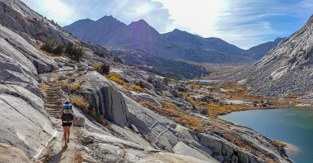
This route can be completed NOBO or SOBO. In most cases this FKT will be attempted, starting from the Cottonwood Pass Trailhead due to permit availability from Whitney Portal. Cottonwood Pass to Mount Whitney encompasses the beautiful scenery of the Eastern Sierra. From the Cottonwood Pass trailhead, hike 3.5 miles up to Cottonwood Pass. Turn right at the junction with the PCT in the direction of Rock Creek. At Crabtree Meadow, continue on the PCT until you reach the trail junction with the JMT, then turn right to summit Mount Whitney. Do not take the Crabtree Meadows Trail. To make this route straightforward, the hike should entirely take place on the PCT of JMT (except for the first 3.5 miles - from the Cottonwood Pass Trailhead to the PCT). Once Whitney is summited, complete the entirety of the John Muir Trail, ending in Happy Isles.
Admin note: There are several places where it is easy to lose the official route. These are some of the places where people have had navigation issues:
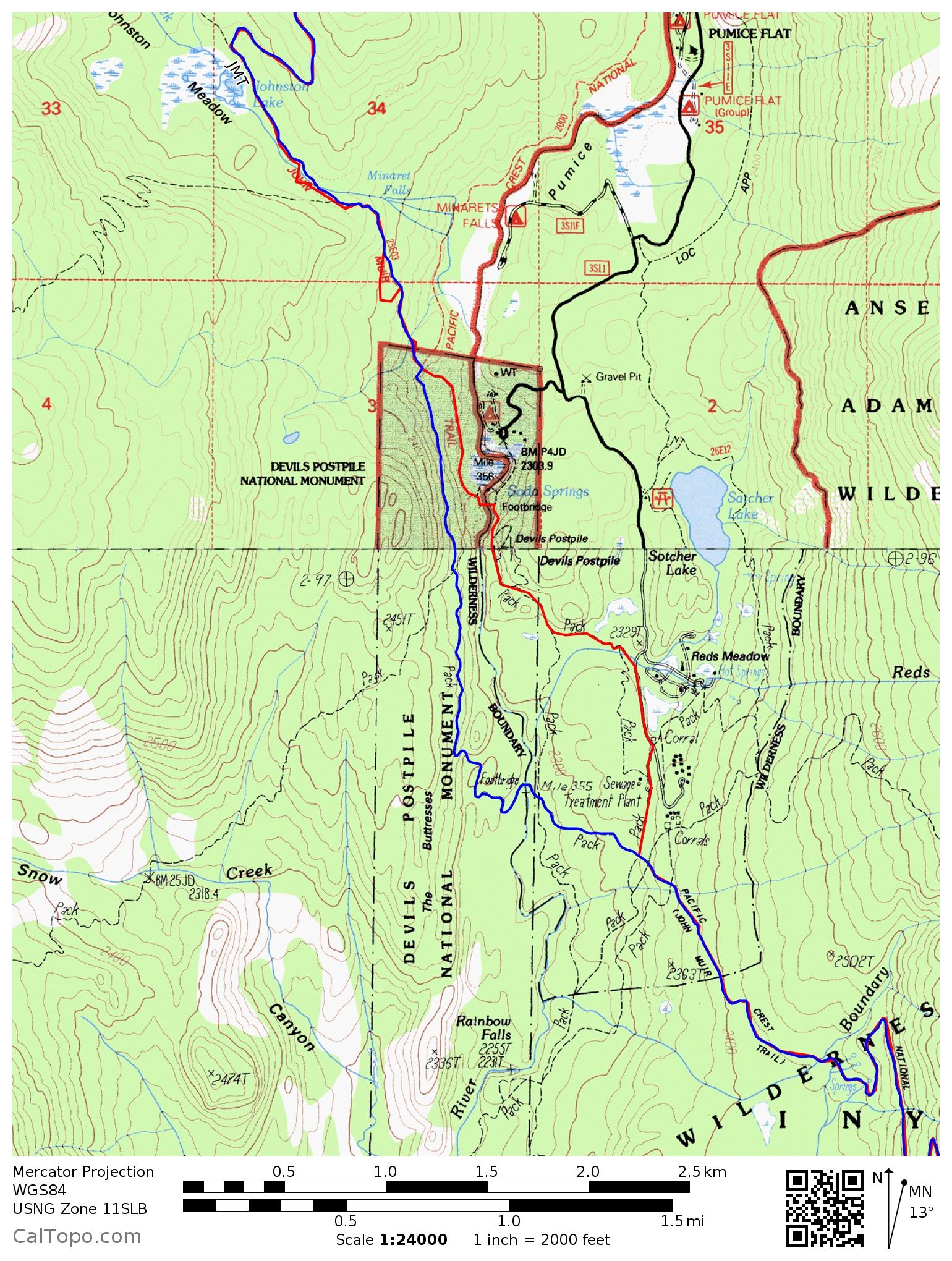
1) Red's Meadow. The JMT does NOT go to or through the campground or to the store, but stays mainly west of the Middle Fork San Joaquin River through Devil's Postpile National Monument. Follow the blue line on this map, NOT the red line.
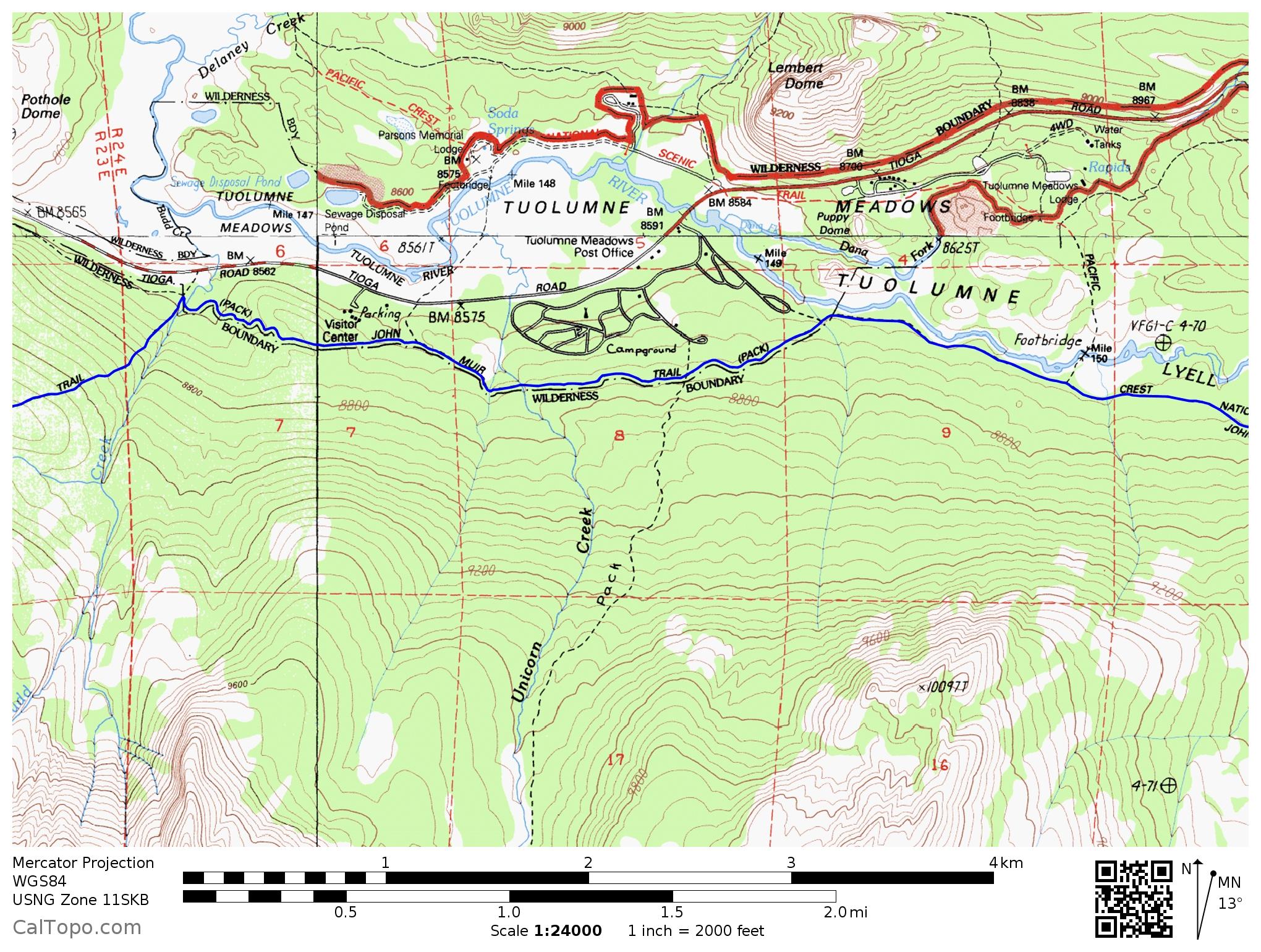
2) Tuolumne Meadows. The JMT stays south of the campground and road, as per the blue line on this map. If you leave the JMT to go to the campground (etc.) you must return to the JMT at the same point!
3) Yosemite Valley. The JMT is on the south side of Nevada Falls. On a northbound trip you must cross the Merced above Nevada Falls at an obvious sign. DO NOT take the Mist Trail! Follow the blue line on this map, NOT the red line.