"Cross Frog" is a well-established route in Hong Kong. If you look at Hong Kong Island on the map, its shape resembles a frog. If one hikes from its eastmost point to westmost point, the GPS track appears as a line that crosses the frog. The route has a variety of conditions, including:
- Steep climb, e.g. 250m ascent in 1KM distance in Old Peak Trail
- Long paved/ highly runnable segments, e.g. from Tai Tam Gap to Tai Tam Upper Reservoir which is around 3km in distance with 100m decline
- Stairs up/ down in some places
- Rough muddy trails, e.g. decline around the High West
Although hiked frequently by local communities, there are many slight variations covering 20km~25km with ascent 700m~900m. I tried different compositions and finally found this one that has the following important features:
1. Minimum exposure on vehicle roads.
2. Starts and ends at sea level on the almost eastmost (Former Cape Collinson Battery) and westmost point (around Jubilee Battery) of HK island
From east to west (you can go either direction), the route is as follows. While there are many options, you must follow this route if you wish to challenge the FKT.
- Former Cape Collinson Battery (climb up from sea level and head north)
- Cape Collinson Road Rest Garden (turn left and climb up mountain)
- Pottinger GreenRace
- Hong Kong Trail Sec 8
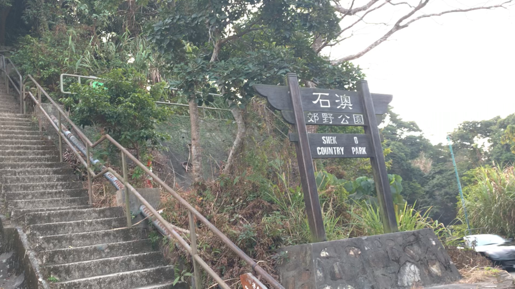
- Shek O Road (head northwest from intersection)
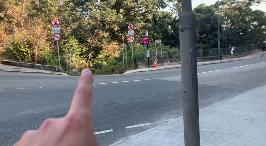
- Tai Tam Road X Shek O Road (head northwest from roundabout and find entrance after 300m) [CAUTION: PUBLIC ROAD EXPOSURE WITHOUT PEDESTRIAN PASS]
- Mount Parker Upper Catchwater intersection (head south towards Boa Vista Track)
- Boa Vista Track
- Hong Kong Forest Track
- Tai Tam Upper Reservoir
- Tai Tam Reservoir Road
- Wong Nai Chung Gap [NOTE: convenience shop at gas station]
- Black's Link
- Wan Chai Gap (head north descending along the gap) [NOTE: convenience shop at garden]
- Bowen Road (head west)
- Brewin Path (head south ascending)
- May Road (head west 100m to find Old Peak Road entrance)
- Old Peak Road
- The Peak [NOTE: convenience shop and many restaurants]
- Harlech Road
- Hatton Road
- Long Fu Shan Fitness Trail
- Long Fu Shan Fitness Trail X Pinewood Battery Heritage Trail (head west declining along the nonamed road) [NOTE: if you miss this intersection, the detour will be around 1KM longer]
- Pik Shan Path (head south 100m and find declining path)
- Pok Fu Lam Road (head west 50m to find traffic lights and cross the main street towards Mount Davis direction)
- Mount Davis Road
- Mount Davis Path (towards Davis Service Reservoir direction; and decline at reservoir)
- The University of Chicago Francis and Rose Yuen Campus (head south 30m; entrance at opposite side of bus stop; decline towards sea)
- Jubilee Battery


Comments
Note to anyone doing this route: I did this route on December 28th. I went East to West. I don’t think there’s a way to get to the Cape Collision Battery as the route intends due to a fence on the road. I think starting or ending where the road meets the trail would be OK for future attempts.