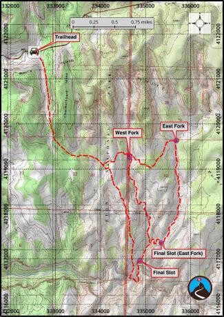
This is the FKT route for Fat Man’s Misery Slot Canyon, East Fork and West Fork Variations. These are technical canyons be sure to read full description, have proper skills and pack proper gear. It is recommended you rehearse either of these canyons first before your speed attempt. And please be courteous of other users, your FKT is not worth ruining someone else’s experience. Be a good representative of the sport. Plan your FKT attempt in shoulder (non-high-use) seasons, during weekdays (fewer people), and try to be either the first one in or last one through rather than clambering over other groups in your frenzy to race the clock. Following these guidelines will lead to increased success for you, and a better all around experience for everyone.
TL;DR: This is not a casual trail run, if you do not have proper canyon gear you cannot complete this loop and may end up needing to get yourself rescued or trapped without any communication.
This canyon seems to have quite varied times. Group trips can go between 5-8 hours with a small group of reasonably fit hikers (5 for west fork, about 8 for east fork), but some groups take 12 (or more) hours. The west fork variation is about 8.5 miles round trip, the east fork variation about 11. I recommend small, reasonably fit groups or plan for a long day. The hike out can be brutal on hot days.
Be sure to take photos of your trip as substantiation of your effort (especially at notable locations) since your GPS may not track well in the slot canyons.
West Fork Variation (8.5 mi) see map for reference
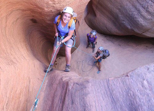
The West Fork provides skilled groups with a place to practice their downclimbs. A skilled team can likely get away with just one. Head down canyon about 15-20 minutes to the first rappel in a slot section, about 12 m ( 40 ft. ).
The canyon opens and is easy going before the next two rappels, about 5 m ( 17 ft. ) and 12 m ( 40 ft. ) in quick succession.
Another open section leads to a slot and rappel 4, about 3 m ( 10 ft. ). Bypass several potholes on the east side, then downclimb the last drop at the confluence, or follow the walk around to the east.
East Fork Variation (11mi) see map for reference
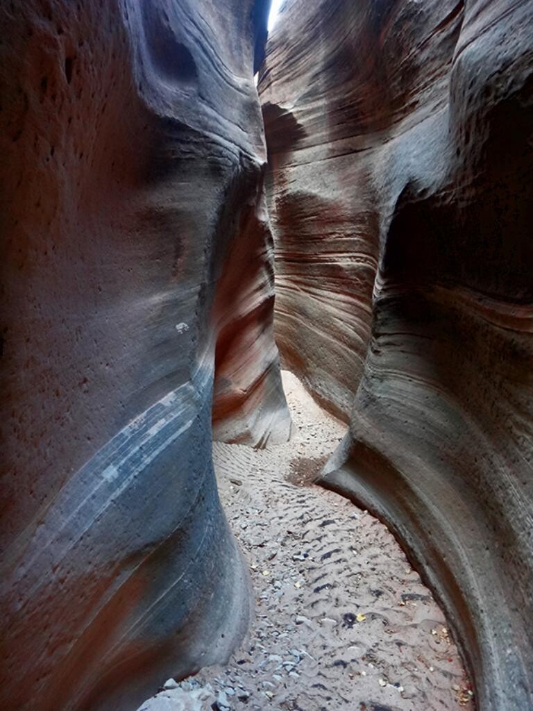
From the confluence of the two upper forks, head down canyon. The first slot sections comes in shortly (10 minutes). The rest of the East Fork is a cycle of amazing short slot sections interspersed with more open sections. Some pools may be encountered after recent rains, but many (most) can be avoided with some creativity.
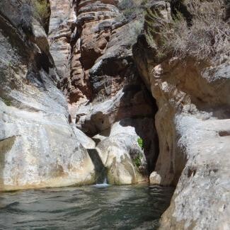
The canyon opens for awhile, then slots up as it makes a left hand turn, then deepens greatly as it makes a right hand turn. This is the last slot section. A 10 m ( 33 ft. ) rappel is encountered in this section and will likely put you into a pool, but opens shortly to the sun down canyon. This section is astounding; deep, dark, and scenic.
From the East/West Fork Confluence
Shortly down canyon (5 minutes), a rappel is reached. This is about 12 m ( 40 ft. ) into a fantastic slot section. A few downclimbs leads to the final magnificent slot and grotto. Again, a few downclimbs in this final section, but no rappels needed. As the canyon opens right after the bridge, a spring gushes from the east wall. Though I doubted my partner on our late fall trip, he was indeed right, the spring is not cold, but a "not-really-warm-but-not-freezing-spring". Bask in the sun here and enjoy the amazing pools, the confluence with Parunaweep is a minute down canyon.
Exit (2-2.5 hours / 4.4 miles)
Walk down Parunaweep about 10 minutes through an amazing Narrows like section of canyon, until it opens a bit and turns right then left. This is the first obvious place to climb out on the right with a large sandy beach. There is a heavily used trail here, follow it as it climbs up and out of Parunaweep.
Once up the first level, it (unfortunately) splits into a maze of use trails. The easiest way is to stay on the most used trail on the left that works up the ridgeline directly. There are quite a few side trails, but stay on the most used one as it works up the ridge. It is about 1.8 miles (45-60 minutes) from the river to the top of the West Fork and junction with the approach trail. Follow the approach trail back to the trailhead (2.6 miles).
Resources:
CalTopo Map - see east/west variations
https://www.roadtripryan.com/go/t/utah/zion/misery-canyon
https://www.canyoneeringusa.com/zion/technical/fat-mans-misery
Submitted by Jason Hardrath (IG)