The Trinity Alps Wilderness, located in northwestern California, is home to more than 600 miles of trails and encompasses more than 500 acres of land. It is the second largest wilderness area in California after having doubled in size when the 1984 California Wilderness Act was passed. That same year it was added to the Wilderness Preservation System.
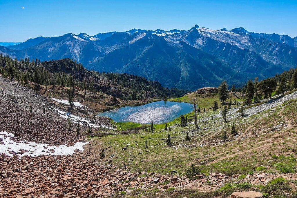
The landscape of the Trinity Alps is quite diverse. Creek drainages drop as low as 2,000 ft and surrounding summits top 9,000 ft. Dotted throughout are immaculate alpine lakes and rugged granite peaks. The trail network is intricate and well established.
The Trinity Alps have long been a well kept secret. Locals in surrounding towns, such as Weaverville and Trinity Center, have enjoyed the tranquility and remote feeling while out in their backyard terrain. More and more, visitation from population centers like the Bay Area, Sacramento and Portland has increased. It’s common to have a hard time finding parking at the many trailheads including those a little further in and off the main highways.
You can learn more about the Trinity Alps Wilderness on the Shasta-Trinity National Forest Website HERE.
This route, the Four Lakes Loop via Long Canyon, is considered by many to be one of the most stunning backpacking/hiking routes in the Trinity Alps (see AllTrails LINK for 80+ reviews). The trailhead is fairly simple to get to (see notes below) and the majority of trail is well established and simple to navigate. This route features a steady climb up the Long Canyon drainage for about 5.5 miles until you reach the first substantial pass. Runners/hikers can then take the 6 mile Four Lakes Loop clockwise or counterclockwise where they will pass by Deer Lake, Luella Lake, Diamond Lake, and Summit Lake before returning to the predominant trail back down Long Canyon.
To access the trailhead, travel east or west on California Highway 3 between Weaverville and Trinity Center. From Weaverville, drive north for 22.9 miles and look for the Long Canyon Road sign on the left (west) side of HWY 3. Turn onto Long Canyon Road and drive for approximately 3 miles, following signs for the Long Canyon trailhead parking. The road is narrow, winding and mostly paved, and a low clearance 2WD car can make it just fine. Once at the trailhead be mindful of parking, as this is a smaller lot that can often fill on the weekends during the high season.
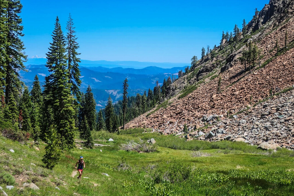
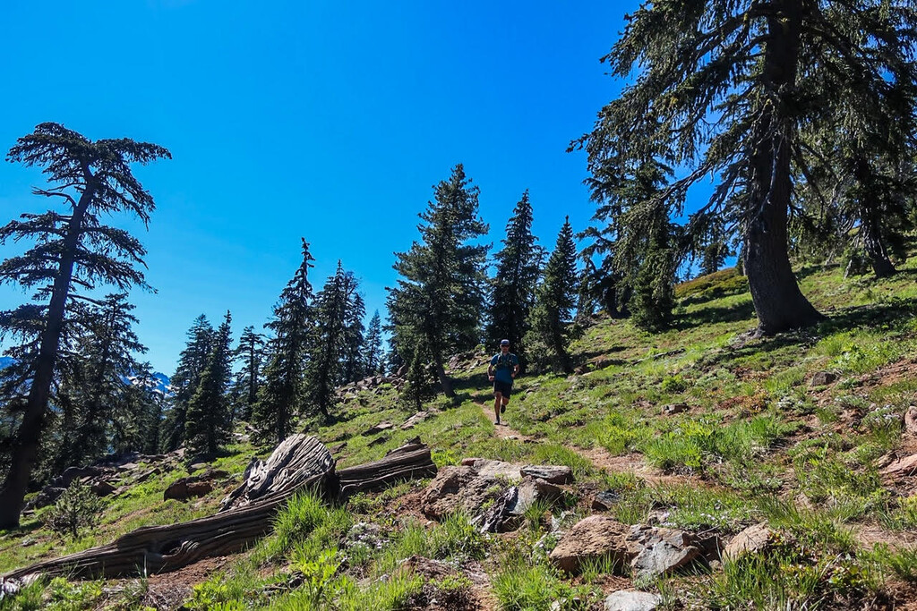
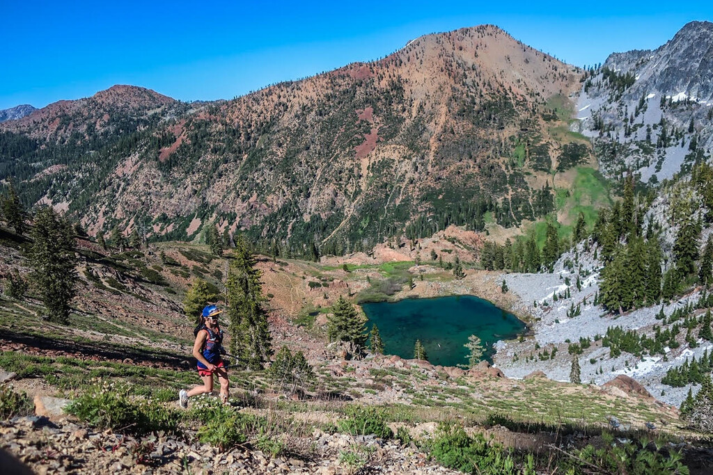
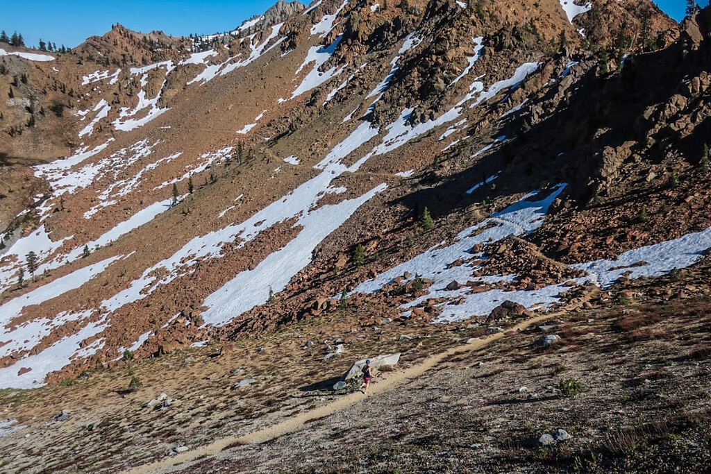
This route starts with a 5.5 mile gradual climb up the Long Canyon trail. Start at the obvious large kiosk in the parking lot. The first three miles of trail follows the canyon drainage and is primarily shaded by trees. After three miles the trail opens up to alpine meadows and a final climb to the predominant pass. From the pass, make a short traverse across until you reach an overlook of Deer Lake. From here, you have the option of either dropping down all the way to Deer Lake and following the loop counterclockwise, or staying high and traversing clockwise to Summit Lake. As the name suggests, the Four Lakes Loop features four prominent alpine lakes, as well as a couple more substantial climbs/descents. Follow the main loop trail until you return to Deer Lake, and make your final climb back to the pass before dropping back down Long Canyon.
IMPORTANT: The Four Lakes Loop trail will naturally take you next to Deer Lake, Luella Lake, and Diamond Lake. There is a substantial separate trail that drops downhill for about a half mile to Summit Lake and beyond. Runners/hikers have the option of visiting Summit Lake as well, but we have not included this detour into this FKT route, as we wanted to keep the route focused on the actual Four Lakes Loop trail.