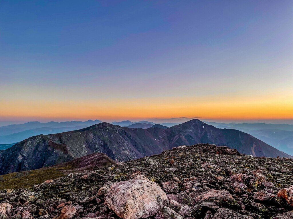
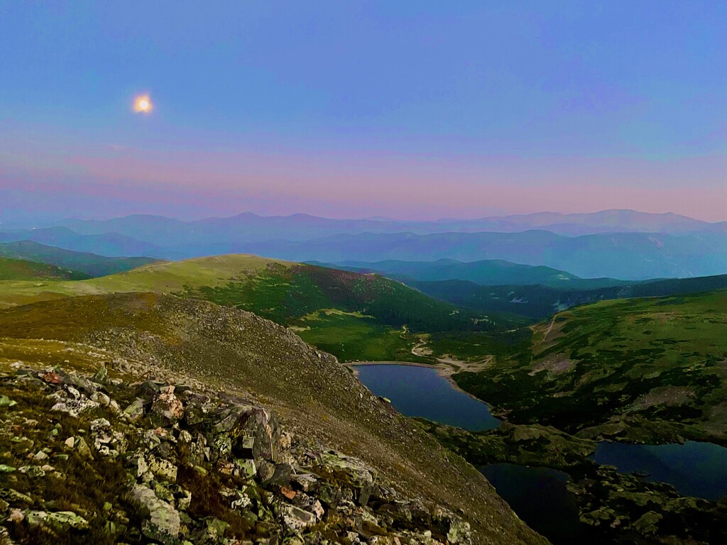
The trail begins at St Mary's Glacier Trailhead on a wide, rocky forest road heading northwest. Keep left of all offshoots, and within clearly drawn property lines on each side of the road. The road-trail rises quickly through a high subalpine forest that breaks suddenly across a bridge across the outlet of St Mary's Lake (.45 miles : 10,738'). The trail is somewhat ill-defined but intuitively followed along the NE shore toward the snow field. It narrows on a clearer path through dense willows and emerges on the north shore just below the snowfield. A few steps off-path leads to the base of St Mary's Glacier (.75 miles : 10,848'). The trail continues up the north side of the glacier over churned rocks and soil pushed to its margins by the annual growth and recession of the snow mass. A well-defined path soon appears on the glacier's south side, where you'll ultimately need to be - cross the glacier at a convenient point and resume travel beside it. The snowfield tapers up a narrow gulch to its top (1.1 miles : 11,236'), where the path levels on the edge an immense tundra flat. James Peak (right) and Mount Bancroft (left) emerge on the western horizon, while Grays Peak (14,270') and Torreys Peak (14,267') stand out to the south.
Travel eases considerably through the open flat on a westerly heading toward James Peak, crossing a Jeep-ATV road at 2.0 miles (11,641'). Though the trail disappears once over the road, a number of trail markers about 75 yards away - clearly visible in the open tundra - will connect you back to it. Improvise your way to the markers and continue west on a well-cut path toward James Peak. The trail moves quickly through an expanding landscape to the base of James Peak, where it bends south and steepens up its east face (2.5 miles : 11,818'). The trail soon merges at a cairn - but otherwise unmarked point - with the Continental Divide Trail (2.8 miles : 12,020'). This is an important point, as you'll need to recognize this split on the return.
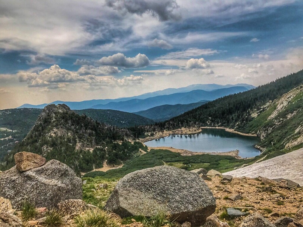
The trail grows intermittently rocky and steep on a winding course up the mountain's east face, but seldom too much of one or the other to slow travel. It briefly straightens on a westerly heading, edging close to the deep chasm between Mount Bancroft (13,250') and James Peak (3.0 miles : 12,195'). Views of Ice Lake emerge in a spectacular cirque between the adjacent peaks, and with a few steps off trail, down the entire Loch Lomond drainage. The trail then skirts a perennial snowfield (3.4 miles : 12,535') and gradually bends northwest up a broad slope with views of James Peak Lake, Little Echo Lake and the Mammoth Gulch drainage in the northern valley below (3.8 miles : 12,880'). A final push over two false summits levels on the large summit of James Peak (4.15 miles : 12,295'). The summit area is large, flat and easy to explore. Maneuver about for a revealing look down the Loch Lomond and Mammoth Gulch drainages, and over the vast tundra flat through which you traveled to reach the base of James Peak. There are several rock-wind shelters on the summit.