Introduction
Jersey is the largest of the Channel Islands and lies in the English Channel about 12 miles from the coast of France. The Island has a long and rich history and culture and was ruled by Normandy for nearly three centuries before swearing allegiance to the English Crown in 1204 AD.
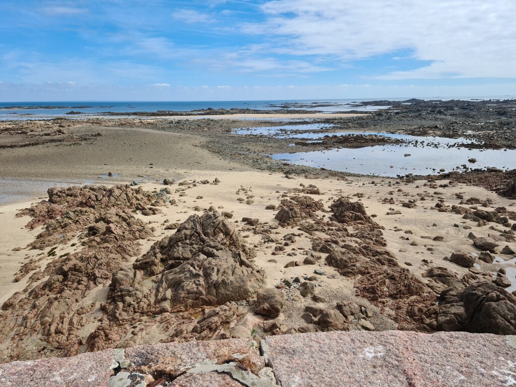
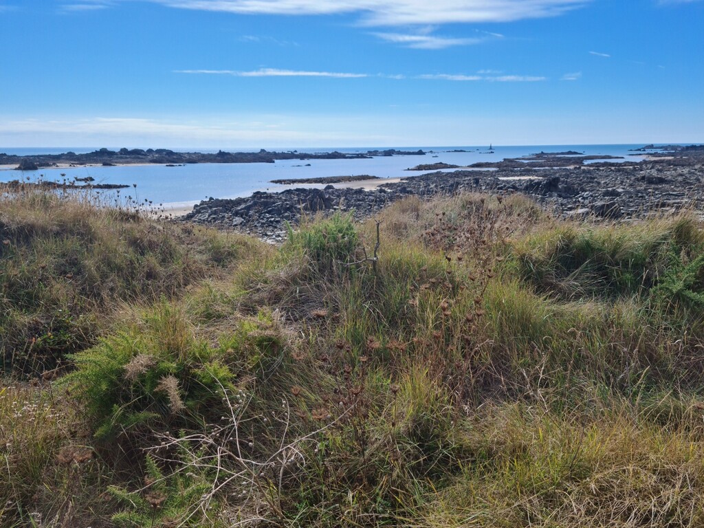
The island also has the third largest tidal ranges in the world, with over 12m on Spring Tides. In fact, Jersey doubles its area between high and low water spring tides!
On the south-east coast, the tide can recede up to two miles. This FKT can only be undertaken on a low tide as the way points will only be reached on a receding/low tide.
This FKT is an ‘off trail’ point-to-point challenge, navigating through the vast intertidal area to each way point and on to the finishing point. Ultimate success will be completing the route by beating the clock and before the tide comes in.
There are very few places in the world where the geography makes this possible and this makes the route unique amongst FKT’s and therefore is a worthy addition.
The landscape is beautiful and resembles a moonscape teaming with wildlife and sea life. Please review the drone footage and photos of the historic landmarks and unique landscapes (below)
Route
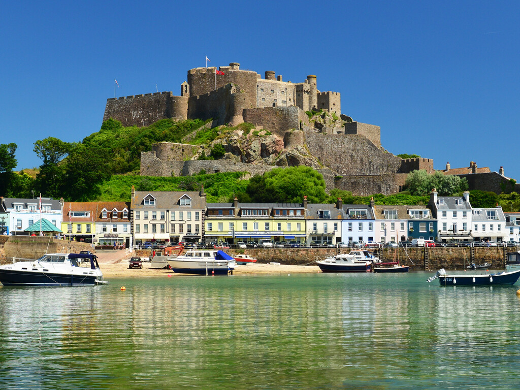
The route starts in the coastal harbour village of Gorey at the foot of the iconic Mont Orgueil Castle.
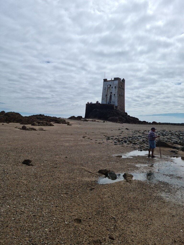
Starting at the entrance of the Dolphin public house and heading directly down the Gorey slipway and on to the beach, you will then make your way to Seymour Tower, located some 2 kilometres out from the coast. This is the first Way Point. A photo must be taken on the gun battery at the base of the tower.
Seymour Tower was built around 1782 and stands on a rocky outcrop off the south-east tip of Jersey's National Park in an internationally recognised RAMSAR wetlands site.
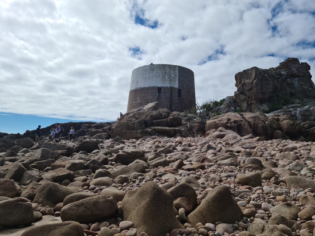
You will then make your way from Seymour Tower to the next way point; Icho Tower.
Icho Tower again located 2 kilometres offshore, is a squat, round tower, much more akin to the Martello towers and was constructed in 1811.
After reaching Icho Tower, take a photo as evidence and continue heading around the coast to La Motte. This is the next way point.
La Motte is a tidal island, and listed archaeological site, also known as Green Island, located approximately 200 metres (660 ft) from the beach and rises to 17 metres (56 ft) above sea level. The island has a grassy surface and is predominantly clay surrounded by rocks.
Ascend to the top of the Island and take a photo as evidence.
Now continue around the coast to Harve de Pas where you will have to leave the beach after you have passed the swimming pool and continue on land and around to St Helier Harbour and on to the next and penultimate way point; Elizabeth Castle.
Elizabeth Castle is built on a rocky islet in St Aubin’s Bay and construction started in the 16th century near the time when Sir Walter Raleigh was Governor of Jersey.
Make your way to the castle’s gates via the causeway and take a photo at the main entrance gate.
Now continue along the beach to the final way point; St Aubin’s Fort.
St Aubin’s Fort was built on a tidal island in the 1540’s and features a tower keep that is surrounded by granite walls and ramparts. During the German occupation of the Channel Islands, the German forces added bunkers and other features to the fort.
Make you way from the beach along the causeway and up the slipway to the Fort, where you will take a photo looking back in the direction of the causeway and towards land. This will be provided as evidence that the causeway is still accessible before the tide has risen and cut access off.
Now finally make your way back down and along the causeway and up the slip to the entrance of the Royal Channel Islands Yacht Club. This is the finishing point!
Summary of Route:
- Dolphin public house, Gorey (start)
- Seymour Tower
- Icho Tower
- La Motte / Green Island
- Elizabeth Castle
- St Aubin’s Fort
- Royal Channel Islands Yacht Club (finish)
Route distance is circa 17 miles.
Drone footage of intertidal area used with permission from Chris Brookes photography and with credit to Explore Jersey
Disclaimer: Participants attempt this activity at their own risk. Please check the tides before attempting this activity.
Comments
Seconding the Jersey Intertidal Challenge - 21 April 2023
When I saw that there was an FKT route for Jersey and that it visited some of my favourite places, I knew that I would have to run it. Not to challenge the FKT, just for the experience. Previously I hadn't even considered that it was possible to link these locations on a single tide.
Next was the question of when to do it. Obviously it needed to be on a low spring tide. I don't mind a bit of cold while running so my first choice was February, unfortunately an issue at work stopped that. In March, atrocious weather stopped play, you would not want to be out there in fog and relying on a phone to get you back to safety. Things came together for April and at just before 1pm on a sunny spring afternoon, I found myself outside the Dolphin and wondering what lay ahead.
When planning, I had looked at what the FKT route called for and decided to make best use of the tides and straightline as much as possible. The first stretch to Seymour Tower was a little compromised as the tide was still dropping. Remainin well off-shore for Seymour to Icho Tower and just afterwards involved some thigh deep gullies at about 10 degrees Celsius. It was around here that I also managed to step on some sort of flat fish. Heading back to shore still on a dropping tide I saw the only other person since leaving Gorey, a low-water fisherman, gaff in hand.
Nearing La Hocq, with the tricky navigation out of the way, the running also became much easier, no more deep water and fewer sand ridges. A quick stop off at Green Island for the first time in many a year and onwards to La Collette for the only paved section of the route to get around St Helier Harbour.
Soon enough Elizabeth Castle was ticked off and the end was almost in sight. I approached St Aubin's Fort from the seaward side which involved a short scramble up the rocks but shortened the route slightly, every little helps. From here, is was a quick return to shore again to the finish line.
I surprised myself with a respectable time of 2:42, helped in a big way by perfect conditions and my choice of route which saved two and a half miles, still 20 minutes off the current FKT route. I reckon that there is another even shorter option for next time. I also could have set off a good thirty minutes later and avoided the wading sections as at the end I had plenty of time to return from St Aubin's Fort. Hindsight eh.
Good luck to those that follow and be sure of where and when you are going, it can get dangerous out there.