The Mighty U
This has been a major challenge to mountain adventurers since it was first created by Evan Welsh back in June of 2012. It takes two major southern California challenges, the San Bernardino 9 Peaks Traverse (an FKT route on its own) and then connects with the joining Yucaipa Ridge Traverse which is mostly off trail and has multiple peaks of its own. Kinda like the WURL but a bit more mellow.
This has been done in a few ways since its inception adding neighboring peaks with different finishing points, but this FKT version is following the original route set by Evan Welsh as he did it in unsupported fashion in a time of 18 hours and 21 minutes. The start/finish is set between The San Bernardino Peak trail in Angelus Oaks and the Bear Paw Reserve (permits available) where the dirt road meets the pavement. In between those two points, the main objective is to summit 18 peaks (9 on each ridge) as listed below.
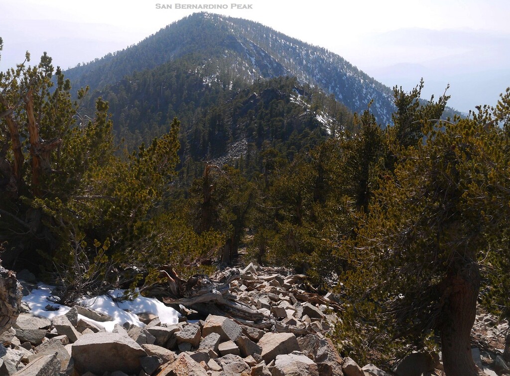
San Bernardino Peak (10,649), East San Bernardino Peak (10,691), Anderson Peak (10,840), Shields Peak (10,699)
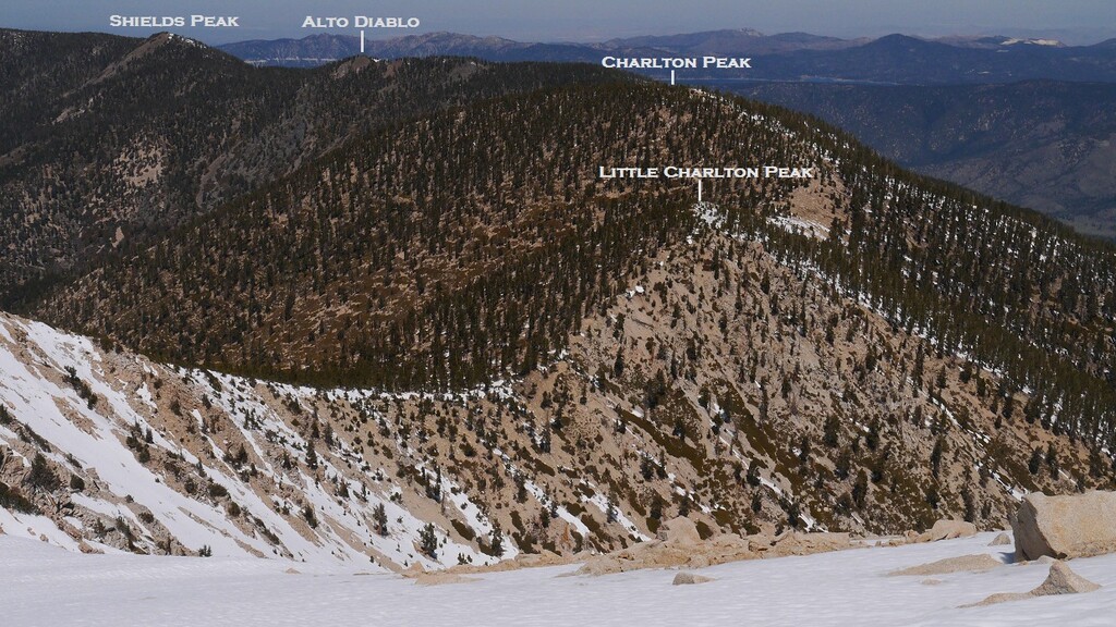
Alto Diablo Peak (10,563), Charlton Peak (10,797), Little Charlton Peak (10,656), Jepson Peak (11,207), San Gorgonio Mountain (11,499)
Galena Peak (9,314), Cuchillo Peak (8,875), Wanat Peak (9,058), Little San Gorgonio Mountain (9,137)
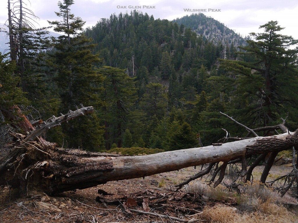
Wilshire Mountain (8,832), Wilshire Peak (8,868), Oak Glen Peak (8,350), Cedar Peak (8,287), Birch Mountain (7,825)
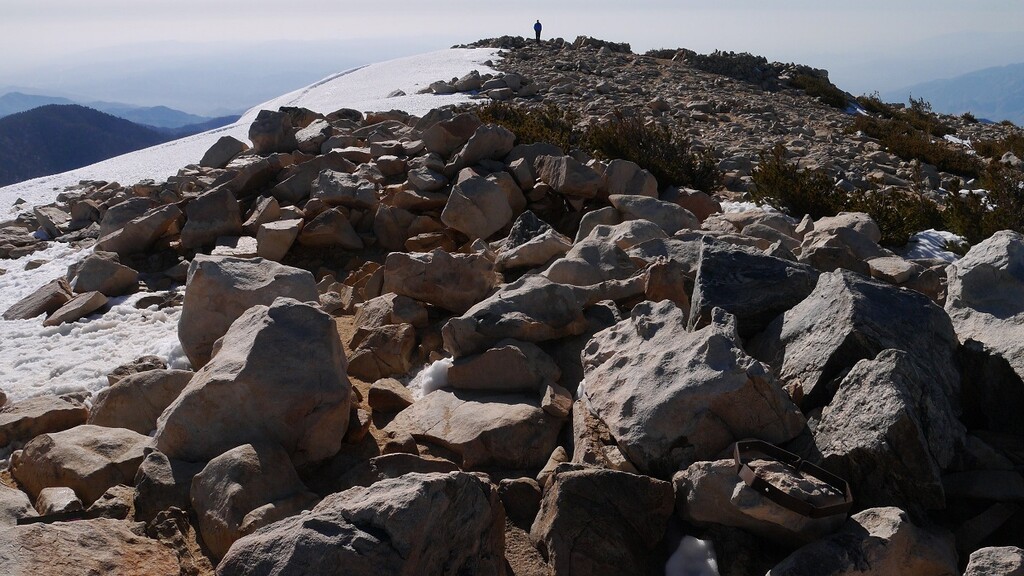
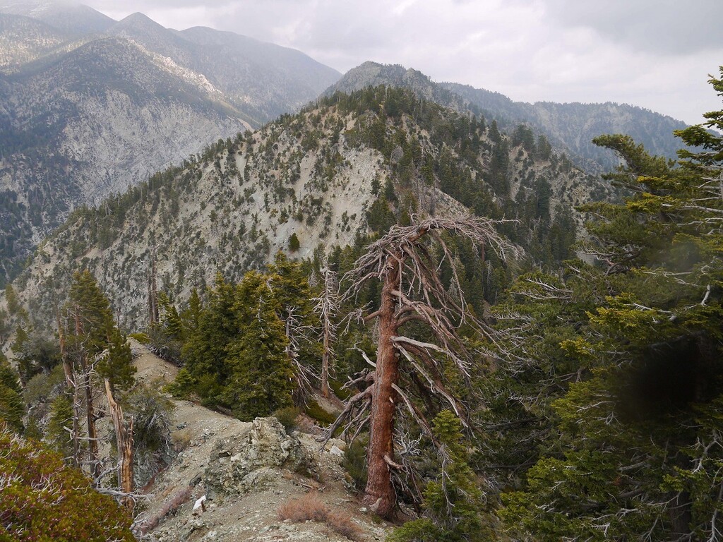
There are many ways to approach a few of the peaks on the San Bernardino ridge portion but none are technical. However, there are sections of the first few peaks on the Yucaipa Ridge between 3rd and 4th class with gnarly exposure depending on your route choices. Choss galore! Also, although most of the peaks are pretty easy to locate the high point, Wilshire Mountain is a little harder because the high point is wide but there is a large boulder in the vicinity, so if you found that, good enough. There is a burn scar across the Yucaipa Ridge that’s growing back which can make things tricky moving quickly with loose things under shin-high brush as well. There are bears and mountain lions out there so keep your eyes peeled because you’re far from help without a helicopter.
A note about water. As with most ridgelines, there are few areas that provide water. If you don't want to carry enough for the whole trip, the closest available water would probably be High Creek located on the Vivian trail about 4 miles below San Gorgonio Mountain. Always check trip report for flow levels.
It's a beautiful route with a lot of changes in the landscape over time! Good luck!