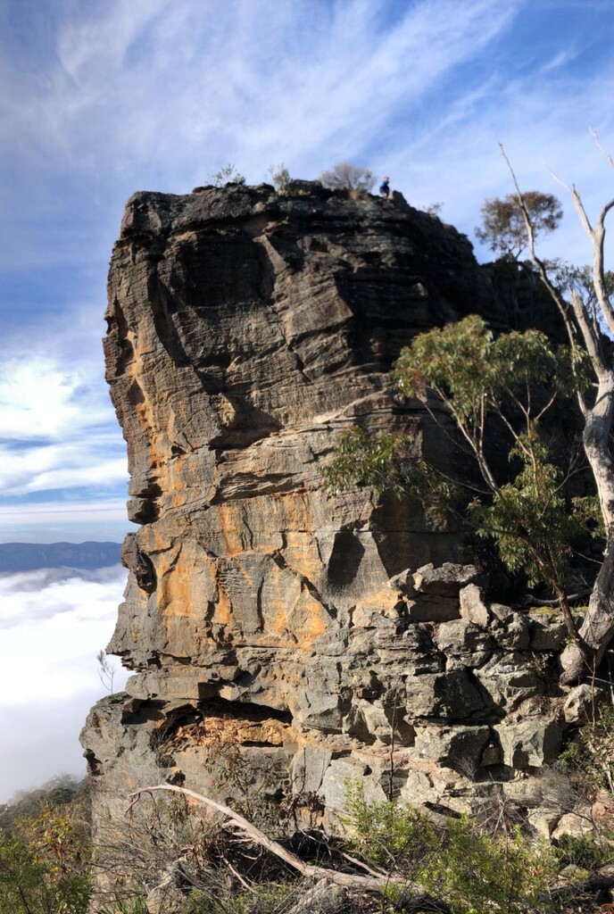
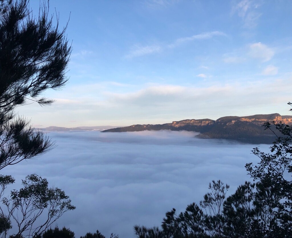
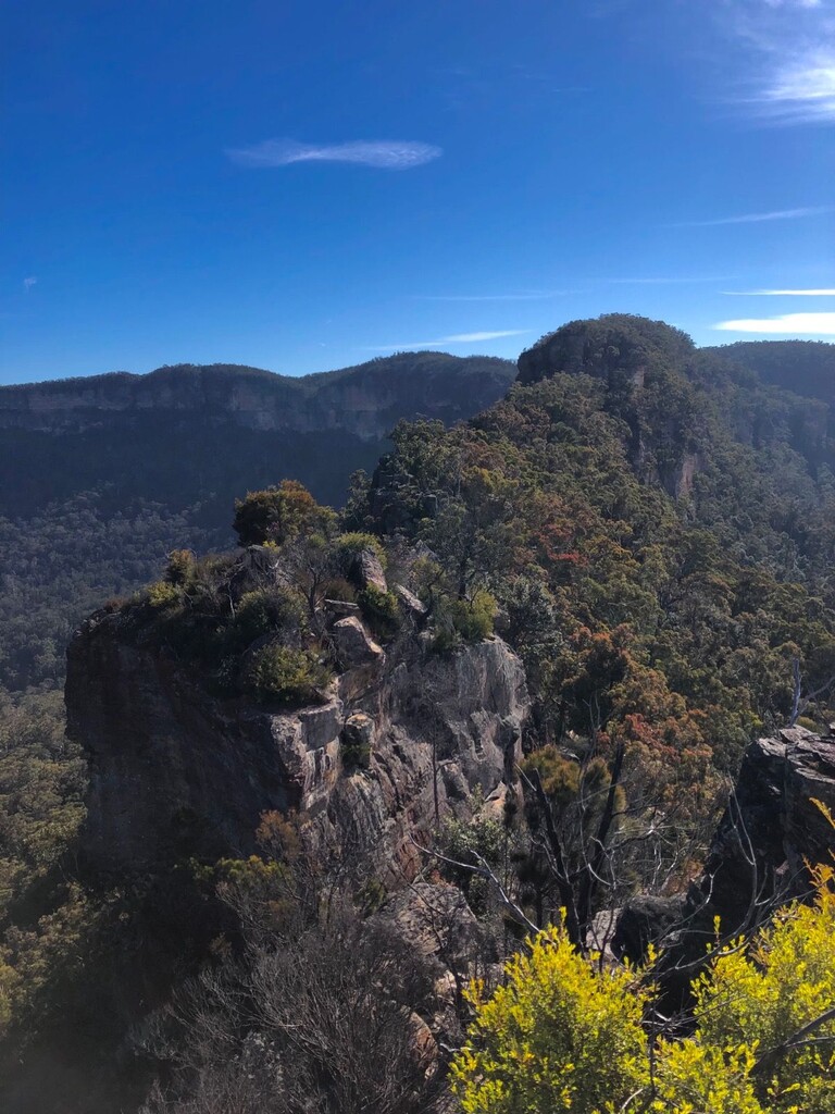
It is possible to traverse Mt Solitary's Southern spine (Korrowall Buttress) all the way over the Northern cliff lines ("Miners Pass") to the Kedumba River. Dropping into the valley and along the spine you get wonderful views of the Kedumba Valley, Lake Burragorang, the Wild Dogs, Narrow Neck and Mount Solitary itself from some rare angles. The round trip from the Kedumba Valley Road gate is about 31km, of which 13km is off-track with serious navigational challenges. You could choose to run counter-clockwise, but the navigation will be more difficult. You can save time by using the Goat Track as a shortcut.
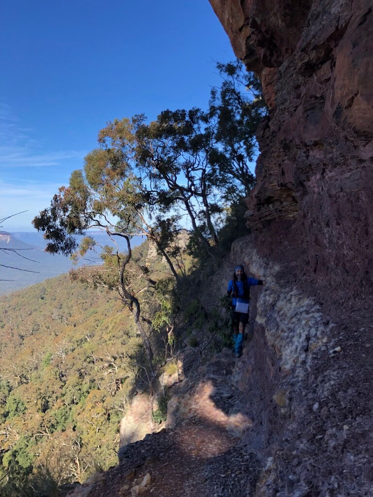
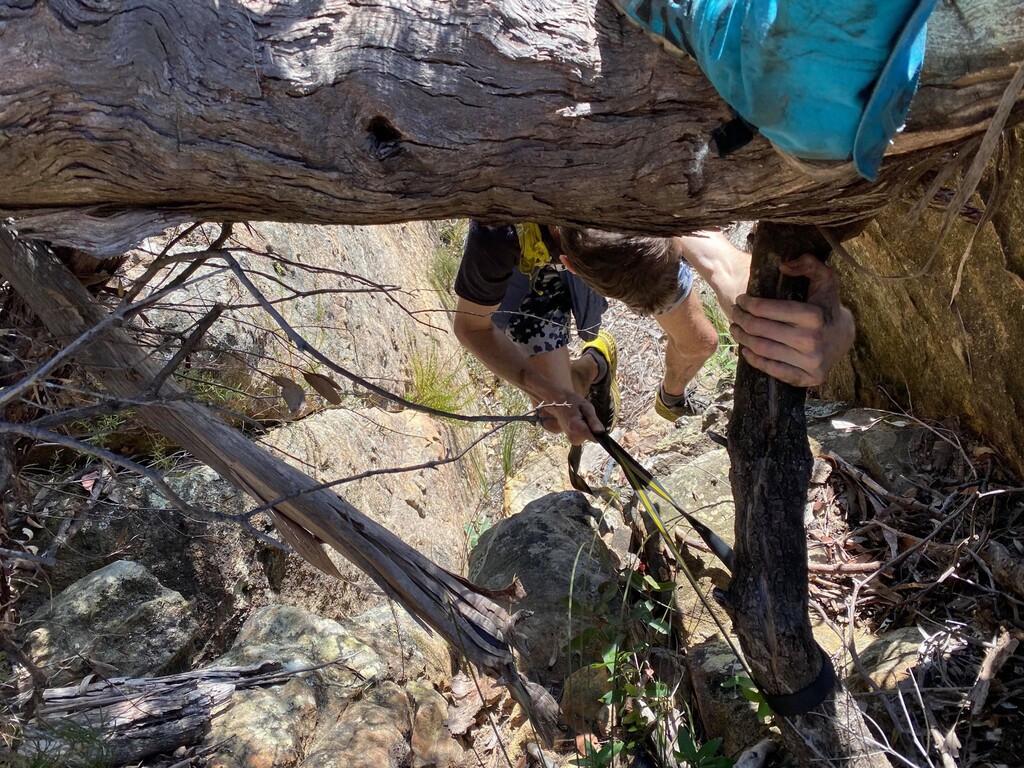
It is considered a three-day bushwalk, and it requires research, comfort with exposure, scrambling skills and good judgement. Read every blog post you can find. The challenges begin as soon as you reach Rucksack Point, the bottom of the knife-edge. At a few stages you will find yourself on a thin stack of boulders with cliffs on either side and no obvious way to proceed. After you have wrapped around Point Repulse on a thin ledge and scrambled up onto Solitary, it is easy off-track hiking to the Miners Pass. Depending on foot traffic and storm/fire damage, it can be hard to discern your way down the scrambles and through the cliffs. It would be wise to rehearse the Miners Pass and the Goat Track once in advance.
Recommended: as well as your usual supplies, bring a 10m tape-sling or rope, a PLB, head-torch, extra layers, extra food, water filter/purifying tablets and ideally a competent companion.