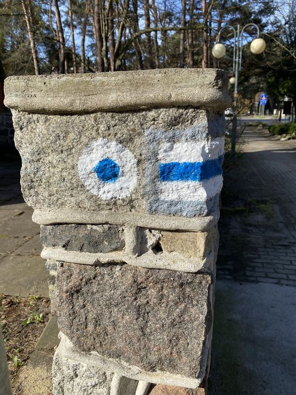
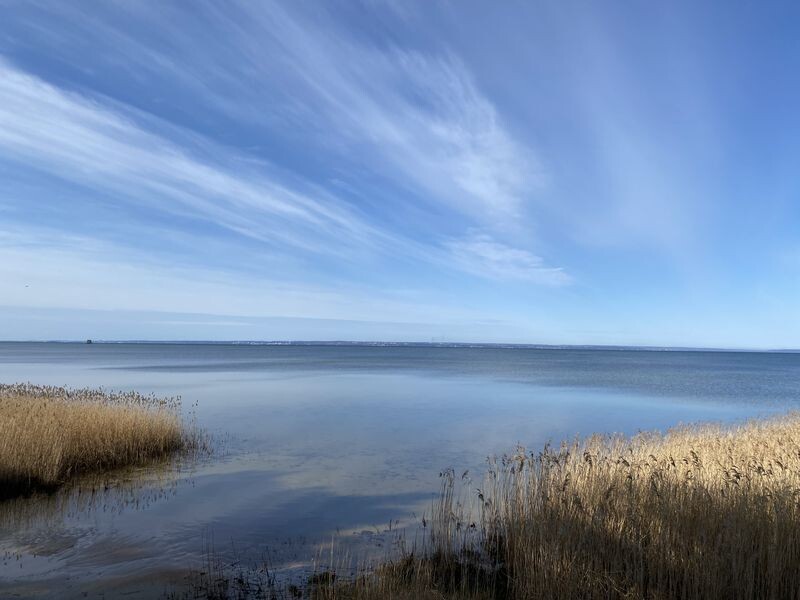
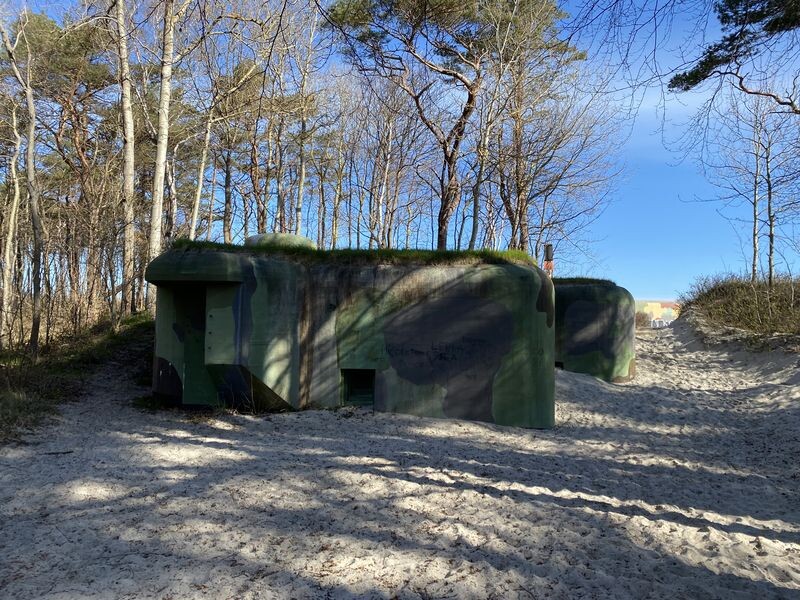
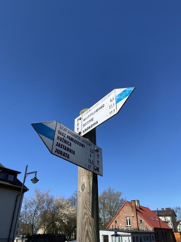
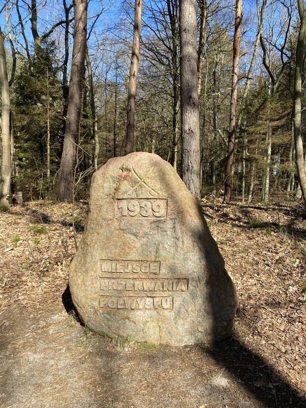
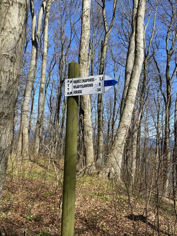
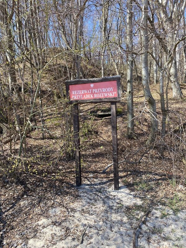
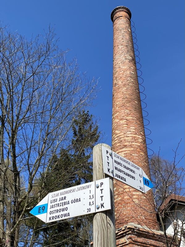
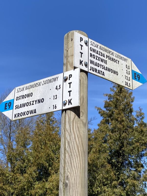
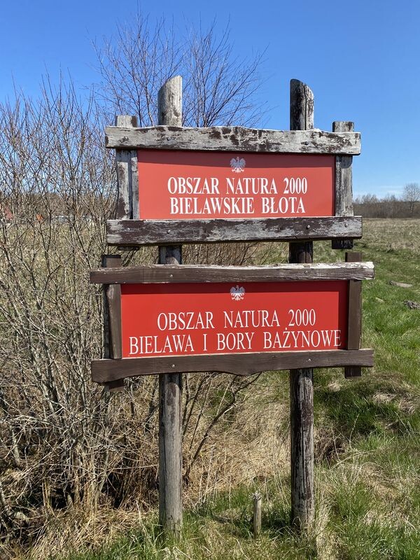
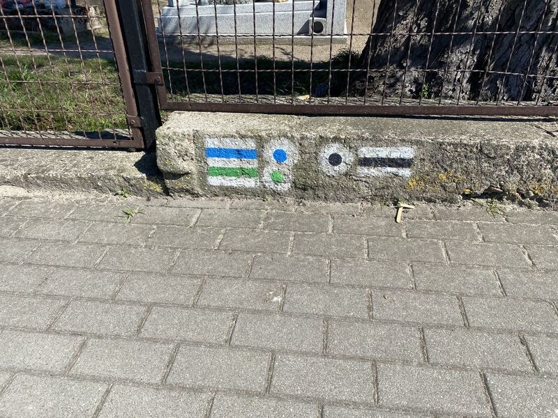
Nadmorski Szlak Zatokowy (Niebieski) - The Coastal Bay Trail (Blue) runs along the northern part of the Kashubian Coast in the land part, and also largely along the Hel Peninsula. The trail begins (or ends) in Krokowa and ends (or begins) in Jurata. The total length of the trail is about 55 km. The trail runs along the shore of the Baltic Sea (Zatoka Gdańska, Zatoka Pucka) and also along the beach from the side of the open Baltic Sea. However, for the most part it runs along beautiful forest paths and roads. It was designed in such a way as to show most of the interesting places of the Hel Peninsula and Kashubia in the vicinity of Władysławowo and Jastrzębia Góra. It was marked out in 1975 along a route similar in outline to the present one, marked with blue as the color most associated with the sea, then fragments of the trail were changed several times, mainly for nature protection reasons. The start in Jurata at the train station (you can easily see the appropriate blue marking) then goes towards the Gulf of Gdańsk and Jastarnia. Along the way, we can admire many fortifications from the Second World War. After Jastarnia, we follow the forest trail towards Kuźnica and Chałupy. We come across a stone commemorating the breach of the peninsula by the Germans in 1939 and we will run along the beach for the first time. On the Hel Peninsula, the trail runs along forest paths and sometimes along a seaside cliff (in the vicinity of Chałupy). The next stage is the forest road leading from Chałupy to Władysławowo. We run between the dunes and the railroad tracks in a magnificent pine forest. In Władysławowo, the route runs near the fishing port, Dom Rybaka, then Aleja Gwiazd promenade and finally Cetniewo (Central Sports Center). From Władysławowo we get to Chłapowo to run back to the beaches along the beautiful valley Chłapowska Dolina. Later, heading towards Rozewie, we will admire (and finally climb) the cliff in Rozewie to run by the Lighthouse in Rozewie. In Jastrzębia Góra, the valley so-called "Lisi Jare" we will run down to the beach once again. Then, after a minutes, running along the forest path, we will reach the center of Jastrzębia Góra from where we will go further south (southwest) to the town of Ostrowo and then Karwienskie Błota. Here the route connects with the R10 route, which is popular with cyclists. The trail enters the Bielawskie Błota, covered with meadows, forests and moors. From there, we take the forest road to Sławoszyno, and after a while we cross the national road and reach Krokowa, where we end the trail at the bus station. Markings clearly visible on the fence of the cemetery opposite the bus station. The Trail in Krokowa connects with two other trails (the green one in Puszcza Darżlubska and the black Grot Mechowskie) traversing Kępa Pucka, while in Władysławowo with the yellow Swarzewski trail. In the section from Krokowa to Władysławowo, it is a part of the International Walking Trail E9. There are many places on the trail where we can supply our backpacks with water or something to eat without deviating. The trail is very well marked (only in Władysławowo and the vicinity of Chłapowo you should be careful because you can lose new markings and gently reflect the old trail route).
Main points on the trail:
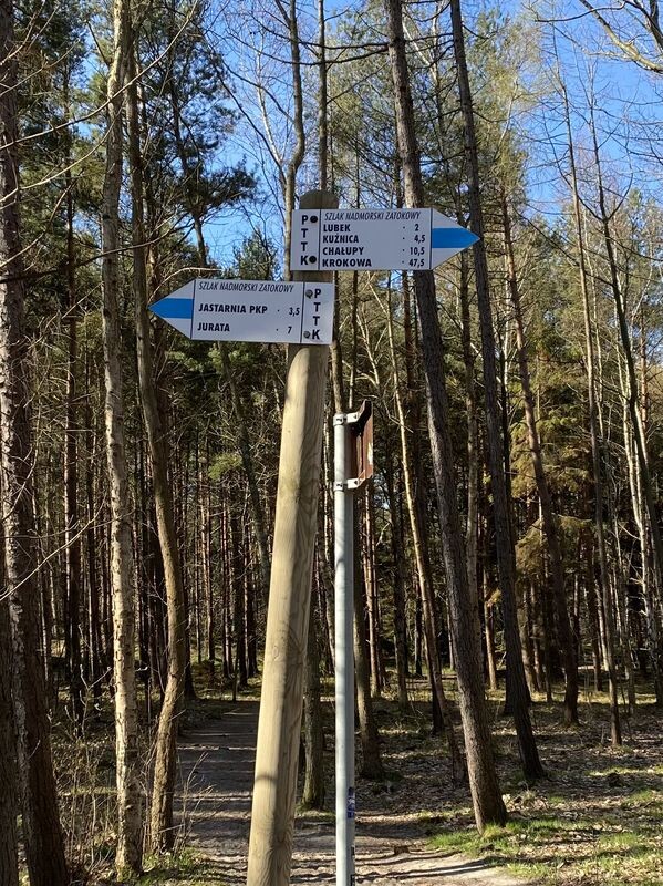
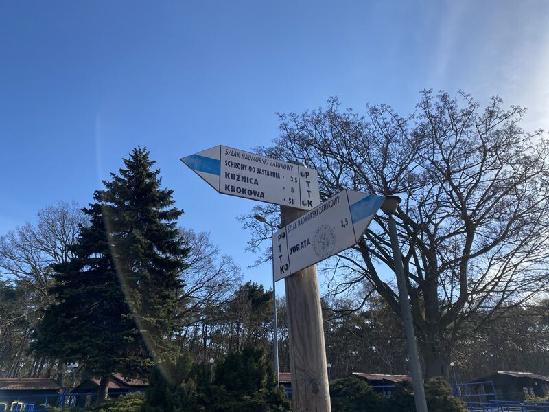
- JURATA, przystanek kolejowy 0 km
- JURATA, Raciborska, dojście do Kossakówki 0,2 km
- BÓR, ul. Leśna 2,9 km
- JASTARNIA, stacja kolejowa 3,5 km
- Mierzeja Helska, stara droga helska 7,2 km
- Mierzeja Helska, Lubek 8,7 km
- KUŹNICA, Syberia 9,9 km
- KUŹNICA, stacja kolejowa 11,2 km
- Mierzeja Helska, Ortus 13,7 km
- Mierzeja Helska, głaz pamiątkowy 14,7 km
- CHAŁUPY, tory, ul. Bosmańska 17,1 km
- WŁADYSŁAWOWO, Wielka Wieś 24,4 km
- WŁADYSŁAWOWO, stacja kolejowa 25,7 km
- HALLEROWO, ul. Morska 26,1 km
- CETNIEWO, Aleja Gwiazd Sportu 26,4 km
- CETNIEWO, COS OPO 27 km
- Parów Granicznik 27,7 km
- CHŁAPOWO, szosa Władysławowo - Karwia 28,8 km
- CHŁAPOWO, ul. Jantarowa 30,1 km
- plaża, Wąwóz Chłapowski 31,2 km
- Parów Łącznik (wylot) 31,9 km
- Góra Jastrzębia, 68 m npm, plaża 32,4 km
- ROZEWIE, Parów Łebski (wylot) 33,5 km
- ROZEWIE, latarnia 34,6 km
- LISI JAR, ul. Rozewska 35,5 km
- JASNE WYBRZEŻE, plaża 36,4 km
- JASTRZĘBIA GÓRA, Rybacka Droga 37,6 km
- JASTRZĘBIA GÓRA, Gwiazda Północy 37,8 km
- JASTRZĘBIA GÓRA, ul.Rozewska 38,2 km
- Czarna (Woda) - kanał Karnel 39,5 km
- OSTROWO Pustki 41,2 km
- OSTROWO, ul. Plażowa 42,9 km
- OSTROWO, leśnictwo 43,9 km
- Kępa Ostrowska, kulminacja 45,4 km
- KARWIEŃSKI DWÓR, szosa 46,4 km
- Bielawskie Błota, zakręt 49,4 km
- SŁAWOSZYNO, dawny zakład torfowy 50 km
- SŁAWOSZYNO, szosa do Karwi 51 km
- szosa Puck - Choczewo 52,9 km
- MINKOWICE, szosa do Parszczyc 53,4 km
- KROKOWA, PKS 5,2 km