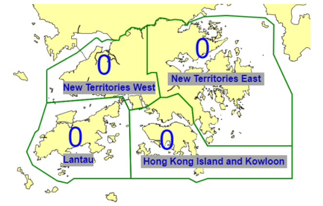
Hong Kong SAR China has a total area of 1,108 sq km (428 sq mi), of which 3.16% is water. Referring to the above map, Hong Kong is administratively divided broadly into 4 parts: New Territories East, New Territories West, Hong Kong Island and Kowloon, and Lantau Island. New Territories East and West comprises an area of 952 sq km (368 sq mi), and I refer to them as "New Territories".
The starting and ending points are at the roundabout between Mei Ching Road and Container Port Road South, which is on the southern dividing line between East and West New Territories on the above map. The route runs along the outermost periphery of New Territorties.
The route is fixed with minor deviation allowed, and runners have to follow route parameters. Since the goal is to reach from the start back to the start, minor deviation is allowed as road block and repairs varies day to day. Clockwise the whole or part, and anticlockwise the whole or part, are allowed.
No transportation is allowed throughout. The route is pretty straightforward running. Run a few hours for scores of miles, carrying one bottle of nutrition drink. Take time to rest, refuel food and drinks from convenience store, then restart the exploration. For payments, convenience stores and public transport accept Stored Value cards (Octopus). Running solo is no problem as Hong Kong is one of the safest city in the world.