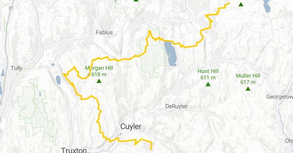
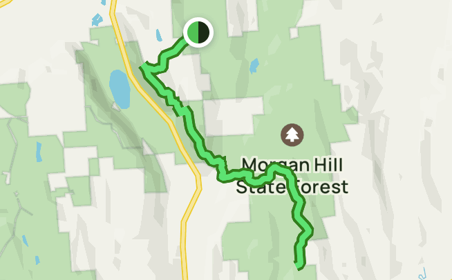
Location
New York,
US
Distance
14.48 mi
Vertical Gain
3,287 ft
Description
GPS Track
Onondaga Trail.gpx47.5 KB
Onondaga_Trail-long.gpx590.79 KB
FKTs
Male
Female
| Laura Kline | 2h 52m 41s | ||||
| Kelly MacDonald | 3h 22m 17s |
Male
| Kyle Metzler | 8h 9m 9s | ||||
| Stephen Messur, Nick Mirizio | 13h 28m 42s |
Images
Comments
Carson Albanese's attempt does not appear to go all the way to the turnaround point at Chickadee Hollow Road. The turnaround appears to be almost half a mile early.
Also, the trail has been re-routed somewhat, as Brian Bellucci's track shows. The gpx for this route should be updated. I ran this route today (much slower) and was careful to follow the current trail markings, and it looks like this: https://caltopo.com/m/0A2F
Yes you are correct, I just noticed this myself. Trail ends at junction at Chickadee Hollow Road. Either way great work! Look forward to going back soon!
This is just a section of the Onondaga Trail, right?
This is the Onondaga Trail. It’s just a section of the Finger Lakes Trail.
Yes—the full Onondaga Trail (which is a branch of the Finger Lakes Trail) is about 38 miles one way, as seen on the interactive map at https://fingerlakestrail.org/plan-hikes-finger-lakes-trail/interactive-…
Just went out today and set a decent time! 2:35:40. Unsupported (I think I may have put in self supported by accident). We will see when it gets confirmed. Tough little route! Excited to see the time go down more and more!
Someone appears to have set a time of 2:11:38. https://www.strava.com/activities/3968833810