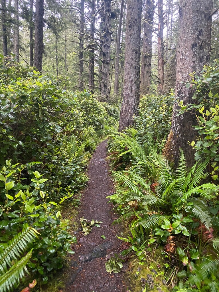
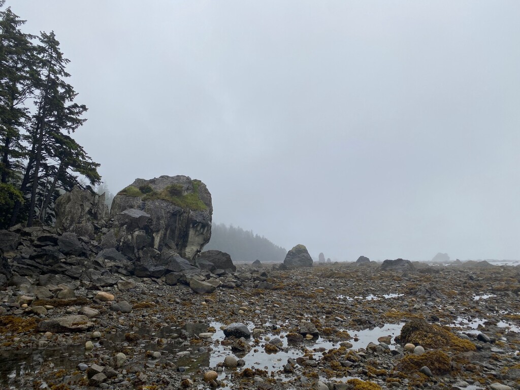
The Ozette Triangle Trail begins at the Ozette Ranger Station in the Olympic National Park, at Lake Ozette. Make sure to obtain a permit at the Ranger Station. The trail starts out in a beautiful old growth forest with western redcedar, licorice ferns, western sword fern, salal, and other evergreen plants. Starting at the Ranger Station, you cross the Ozette River on an arched bridge before you reach a trail junction at 0.25 miles. Stay to the right on the Cape Alava Trail for a counter clockwise route. You will later return on the Sand Point Trail to the left to complete the loop. Large parts of the trail are on an elevated path made up from beautiful boardwalk planks from cedar wood. The planks can get slippery and parts that are not covered with planks can get quite muddy. You will pass through a meadow called Ahlstrom’s Prairie at 2.25 miles and continue your journey towards the beach. At around 3.3 miles you will descent onto the beach and reach Cape Alava. Keep left and hug the shoreline to travel southward. This stretch of the loop can be extremely rocky and covered in large amounts of kelp. Make sure to time your run with a low tide to make the passage possible. You will pass ancient petroglyphs at Wedding Rocks carved by ancestors of the Makah tribe using various tools, including rocks and bone. (While in the area, stop by the Makah museum in Neah Bay to learn about the history of the tribe and the Ozette Archeological site.) At about 6 miles, you will arrive at Sand Rock. Make sure to summit the rock as it is a great lookout for the entire shoreline. Then, retract your steps for about 0.25 miles until you reach a large disk at a tree that indicates the start of the Sand Rock Trail. Sand Rock Trail is also partially lined with boardwalks and brings you back to the Ozette Ranger Station.
This amazing route offers lots of variety with boardwalks, dirt and gravel, and also has a technical section covering a rocky shoreline. This route is located upon the ancestral lands of the Makah and Quileute peoples, who lived on and cared for these lands for thousands of years.
https://www.alltrails.com/trail/us/washington/ozette-triangle-trail
https://www.wta.org/go-hiking/hikes/lake-ozette
https://www.nps.gov/olym/planyourvisit/ozette-loop.htm