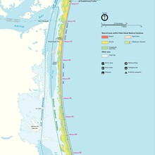
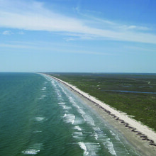
Padre Island National Seashore (PINS), encompassing 130,434 acres, is the longest remaining undeveloped stretch of barrier island in the world, and offers a wide variety of flora, fauna, and recreation. The park itself is about 70 miles long, but the actual coastline of the park is 65.5 miles of mostly runnable sand.
According to UltraRunningHistory.com, PINS is also the home of what may have been the first ultramarathon in the world, held in 1953.
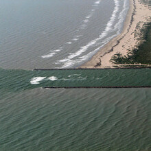
This FKT encompasses PINS' 65.5 miles of coastline. The beginning of this FKT starts at the beginning of the PINS' coastline, which is at the vehicle barrier at 27°29'30.1"N 97°16'00.3"W, and the end of the FKT is at the Port Mansfield Channel. If you start the attempt at the vehicle barrier where Park Road 22 ends, then you skipped the first ~5.5 miles. There are mile markers every 5 miles, but these start at mile ~5.5. The SS Nicaragua Shipwreck is around mile marker 50, or 10 miles from the end.
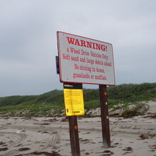
The vast majority of the beach is only accessibly by 4X4 or foot. High tides, sargassum beds, tall dunes and soft sand will prevent most vehicles from driving the entire 65.5 mile stretch of coastline.
This route is completely remote, and the only access to the route is from the north end. There are no buildings or fresh water to speak of, and no way to exit the route upon completion, except by coming back the way you came. A one-way attempt would require a support vehicle to provide water along the way and bring you back when complete. An out-and-back unsupported attempt would be nearly impossible, as one would have to carry enough water to last 131 hot, exposed miles.
Comments
I plan on attempting this route starting tomorrow afternoon. I will be starting on the south end, near the jetties, and my brother will be supporting me in his truck along the way. Driving conditions on the beach will dictate if this actually happens or not.