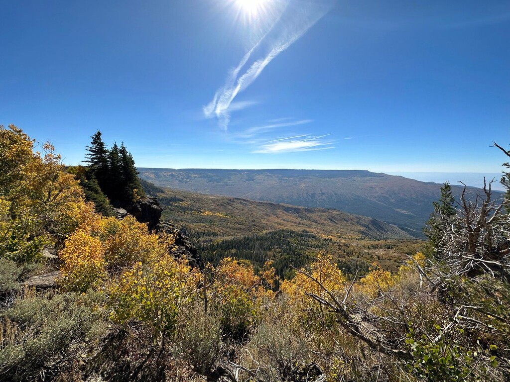
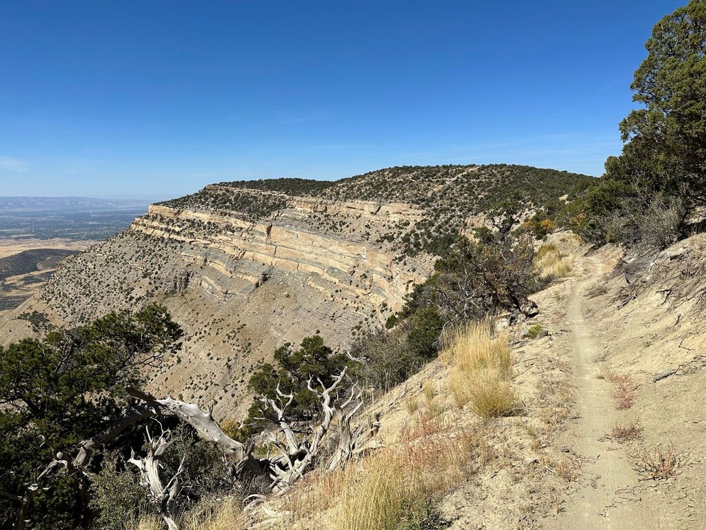
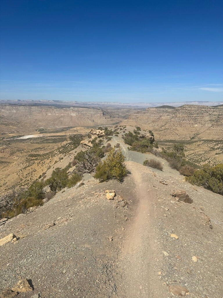
The route totals ~34 miles with 1500 feet of climbing and 7500 feet of descending, but is built with enough ups and downs and tight sections that little of that downhill comes very easily. Built as a 'downhill' mountain bike trail, it makes for a very interesting run from 10,700 feet down to 4,700 feet. Entirely singletrack or desert 'wash' until the final 2 miles on road into town. Aside from a few short sections, the entire trail feels very fluid for a running trail (much more cross country single track than true 'downhill trail'). The trail itself stops at US-6 but is marked through to the junction of North River Road (becomes 3rd Street) and Main Street in downtown Palisade. You run ~11 miles of alpine atop the Grand Mesa, then ~11 miles of high desert full of color in late September, and then a final ~12 miles of proper hot desert running into town. Note: the 'safe' running season for this route is fairly short, having finally run it. The last available water is at mile 16.4, and the trail is hotter and more technical the lower you go from there. Further, shuttle service ends in early October ahead of the route itself closing for the season for elk in November.
Palisade Cycle (formerly Rapid Creek) runs shuttles throughout the season for a reasonable price, they were happy to shuttle me even as a runner, and the bikes (10 others I started with) were amused by it. No congestion issues ever, bikes take off fast from the top but are happy to step aside at the obstacles runners can move through more easily.
Full route info is available here: https://www.copmoba.org/palisade-plunge
___________________________________________________________
The climb variation is the climb from the Colorado River to the top of the Grand Mesa, ascending over 9,000 feet over the course of 31 miles. It's a completely different beast from the standard route descending to the river, with three times the climbing. Of note, this route starts at the Palisade Plunge trailhead - not the bike shop in town.
Comments
The cool way to do this outstanding route is round trip from the bottom. May 2022: https://www.strava.com/activities/7155064260