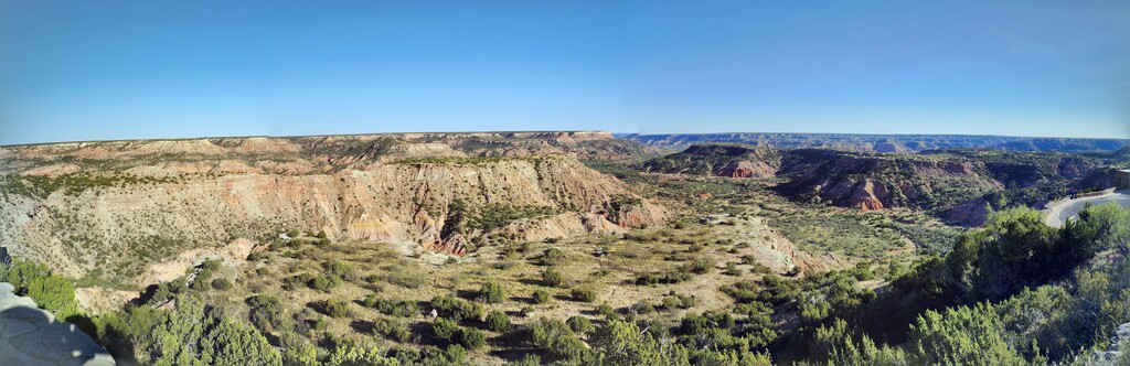
The idea for this route was born out of R2R2R in the Grand Canyon. Palo Duro Canyon is the 2nd largest canyon in the United States needed a good FKT and this is fitting as it not only goes R2R2R but throws in the famous Lighthouse rock formation as well, giving the runner a tour of the canyon like no other.
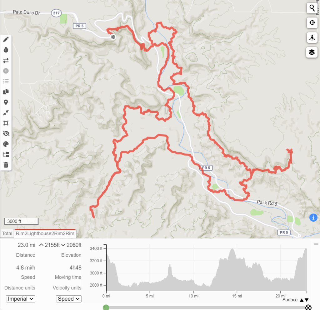
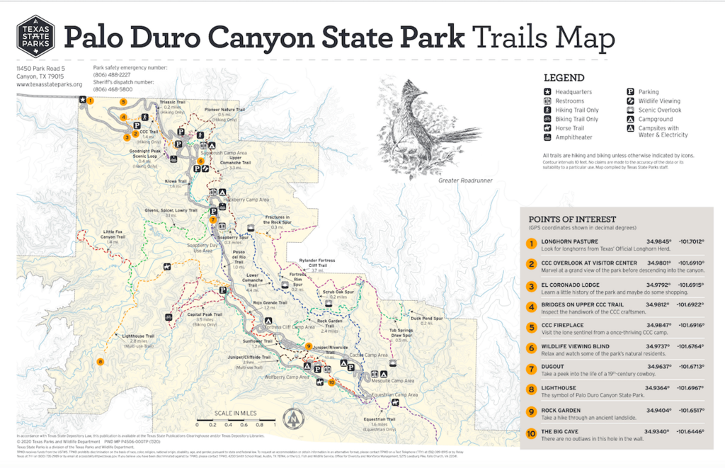
- Starting at the Visitor Center overlook, begin at the metal plaque and run down the CCC Trail to the parking lot below. About 1.5 miles.
- Cross the parking lot and road, then turn right on Kiowa Trail. Follow that until it dead ends into the road. About 1.6 miles.
- Cross the road and go onto Givens-Spicer-Lowry Trail (GSL). Run that until it dead ends in 3.1 miles into the Lighthouse Trail.
- Turn right on the Lighthouse Trail and follow it until you reach the picnic table. Go beyond the picnic table and follow that trail to the top of the Lighthouse. The goal here is to get onto the formation's saddle and take a picture touching the far structure. This is important as it adds significant time and difficulty. About 1.2 miles.
- Turn around and run the entire Lighthouse Trail to the parking lot. There is supposed to be water in that parking lot but it's often turned off for some reason. You can stash water here if it's off and still call it unsupported as otherwise some might have an advantage if they get lucky with the water situation. About 2.9 miles.
- Run Rojo Grande, which begins behind the water fountain and trail map. Run until it dead ends into a road and the Sunflower Trail. Turn right on Sunflower. About 1.2 miles.
- Run about .25 miles on Sunflower Trail until you see a parking lot on your left. There are a few options of how to get to this parking lot from Sunflower so pick whichever you like. Cross the road to Rock Garden Trail. About .25 miles.
- Run Rock Garden all the way to the canyon rim and take a picture with the 2.5 mile marker for Rock Garden Trail. About 2.5 miles.
- Turn around and run back down Rock Garden Trail until you reach Lower Comanche Trail. About 1.4 miles.
- Turn right on Lower Comanche Trail and follow it until it becomes Upper Comanche Trail. About 2.2 miles.
- Continue onto Upper Comanche Trail and run it until it ends in the parking lot by Mack Dick Pavilion. This is the same parking lot where Kiowa Trail begins. About 3.3 miles.
- Run across the parking lot, the road, and the original parking lot that was crossed to begin the day. Continue up the CCC Trail until you reach the metal sign at the overlook. About 1.5 miles.
- Celebrate!
This run flows well despite the many directions. It's the most straightforward way to run R2LH2R2R possible, which was the goal. Additionally, it keeps the runner from crossing back and forth across the canyon repeatedly as well as keeps the runner on different trails as much as possible. This is a fantastic way to see all that Palo Duro Canyon has to offer.
Please stay on trail. On CCC and especially Rock Garden you are able to cut off significant distance by cutting switchbacks. That's against park rules and is tearing up the trails in places. Please don't do this as we need to keep the park's trails open and in good shape!
Final note and word of warning: The GPX is shorting the route by a lot of elevation gain. My watch measured 3,383 ft of gain on this route and considering a lot of the route is full of small ups and downs it is likely considerably more than my watch read during my run.

Comments
This looks fun. A visit to Palo Duro has been on my bucket list for a few years now; I'll have to try this route when I visit in a few weeks.
I love PDC, this route is fantastic and definitely wanna give it a shot!