The attraction of this route is to immerse yourself in the history of Norfolk county in the UK, away from the tourists and visitors of the (admittedly beautiful) Norfolk. It's also an opportunity for quiet contemplation.
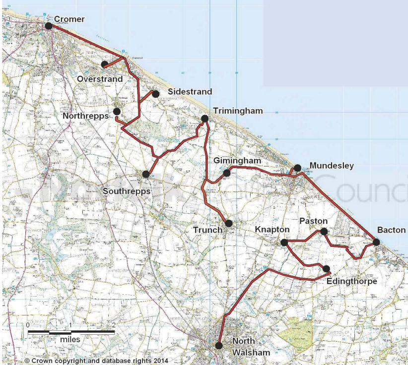
"Paston Way is a meandering 22 miles between Cromer (the pier) and North Walsham, discovering the area’s beautiful medieval churches.To visit all 14 of the fine churches on the Paston Way, the trail will cover 29.5 miles.
Each church has its own hidden history and one was even moved brick by brick from a cliff top to save it from the sea.
View overview map of Paston Way – PDF download (1mb) (snip attached) or view Paston Way on interactive map.
In travelling church to church, the trail ambles down quiet lanes, through picturesque towns and villages, across vast arable fields, disused railway lines and quiet grazing pastures with views of the North Sea. There may be seals on the stretches of beach walk too.
The Paston Way takes its name from the Paston family who during the Medieval and Tudor periods were the dominant and wealthy landowners in the area through which much of the trail passes. The Paston family in turn had taken their name from the small village of Paston on the north east Norfolk coast. They also wrote the famous Paston Letters."
https://www.norfolk.gov.uk/out-and-about-in-norfolk/norfolk-trails/long-distance-trails/paston-way/about-paston-way-and-points-of-interest