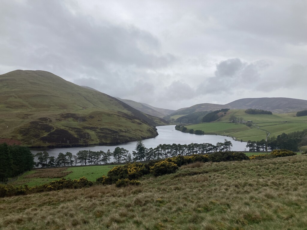
The Pentland way is a 20 mile (31.6km) route along the full length of the Pentlands. It has been classified by the "Long Distance Walkers Association" as a long distance way and includes over 1150m of elevation. The route embraces all that make the Pentland Hills such a special place - beautiful reservoirs, steep hillsides, historic villages and majestic wildlife.
The idea of this route first came about in 2012 by "Friends of the Pentlands" Charity founder, John Stirling. It was later waymarked with special signage and officially came into existence in 2015.
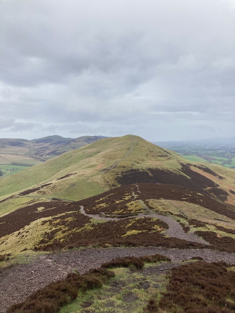
The route passes through the villages of Dunsyre, West Linton and Carlops before ascending over the summits of Cap Law, West Kip, East Kip, Scald Law, Carnethy Hill and Turnhouse Hill. It then briefly drops down to Glencorse Reservoir before ascending the final hill, Allermuir Hill, and then finally dropping down to village of Swanston to finish.
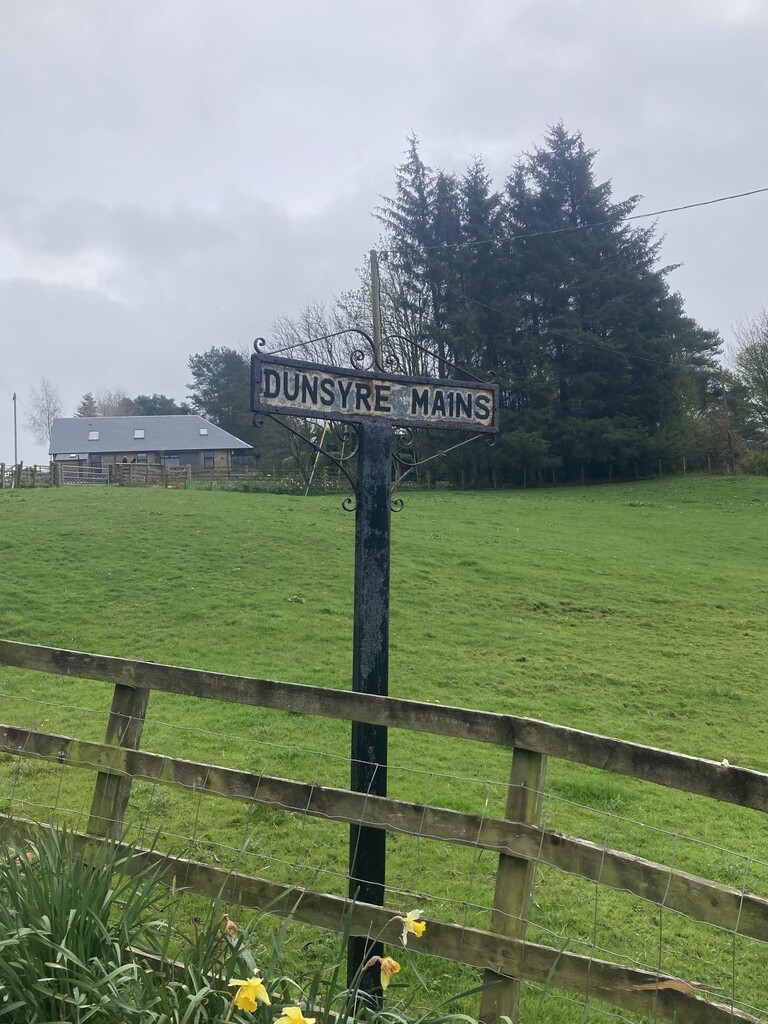
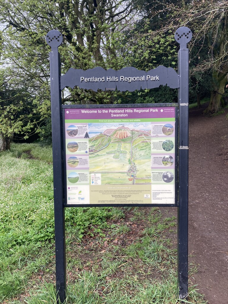
Start in Dunsyre next to the old "Dunsyre Mains" sign and finish in Swanston's "Pentland Hills" carpark next to the Pentland Hills information board. Follow the waymarked route throughout. There are numerous paths that run parallel to one another on the ascents and descents of the 6 hills between Cap Law and Turnhouse Hill (both Cap Law and Turnhouse Hill included). None of these hills have an obvious main route, so any path may be used provided you pass through the summit cairn on each hill.
For more information, please visit the "Friends of the Pentlands" webpage: https://pentlandfriends.org.uk/the-pentland-way/