Route: Rincon Peak

Submitted by brimichelle_runner on Wed, 11/06/2024 - 08:37am
Location
Arizona, US
Distance
14.77 mi
Vertical Gain
4,167 ft
Description

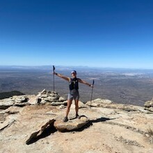
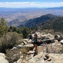
Rincon Peak is the second highest peak in the Rincon Mountains at 8,482ft elevation. Though slightly lower than Mica Mountain, it is the most prominent peak in the Rincons. Both Rincon Peak and Mica Mountain lie within Saguaro National Park. Though there are a few different ways to reach Rincon Peak, the most direct route is via the Miller Canyon Trail, which takes you approximately 4 miles to the Rincon Peak Trail. The total route is approximately 14.7 miles with over 4,000 feet of elevation gain. The final half mile of the ascent is particularly challenging, boasting 700ft elevation gain and a 24.6% average grade.

GPS Track
Images