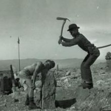
A version of the old "Cook-Zumwalt Route" (which Cook and Zumwalt did in 24 hours in 1932), as been outlined by backpacker.com. Here's the description:
This trip starts with a bang: a 4.4-mile, 2,874-foot climb from Bear Lake trailhead (1) to 12,324-foot Flattop Mountain (2). Head northwest on Tonahutu Creek Trail 3.5 miles across Bighorn Flats; end just below treeline at Renegade campsite (3). The next day, stroll downhill 4.5 miles to Big Meadows and camp in .75 to 1.5 miles at South Meadows or Paintbrush campsites. From here, it's less than two hours to the village of Grand Lake. Follow Summerland Park and West Portal Roads for 1.5 miles to East Inlet trailhead (4).
Walk up the East Inlet drainage 6.6 miles to Lake Verna (5) for the best campsite in the valley. Take a rest day and explore the emerald-grass shores of Fifth Lake, below aptly named Isolation Peak (13,118 feet). To reach Boulder-Grand Pass (6), follow an unmaintained trail east, past Spirit Lake, to the north side of Fourth Lake. Bushwhack steeply to the east-northeast to the 12,061-foot pass. Descend the east side, skirting a permanent snowfield alongside a steep gully on the left (north). Continue to the designated campsite just east of the patrol cabin (7) beside Thunder Lake. On day six, climb northeast through open forest to the Lion Lake Trail. After a .5-mile side trip to explore the wildflowers around the Lion Lakes and Trio Falls, follow game trails east from Lion Lake No. 1 (8), climbing about 500 vertical feet to North Ridge, just west of Mt. Orton. Contour down the far side to the north and camp at the upper end of the Hunters Creek (9) cross-country zone.
Next morning, climb to the cirque below Longs Peak's south face. Keplingers Couloir (10) rises steeply for 1,600 feet to the Notch, between Longs and Mt. Meeker. A few simple hand-and-foot moves are required to pass obstacles; keep right when in doubt until you reach the base of the Palisades cliffs (11). Expect snow in this chute until late June.
Traverse left across exposed slabs to the Keyhole Route; follow red-and-yellow blazes to the cleaved summit of Longs Peak (14,259 ft.) (12). Finish an exhausting day with a 10-mile, 4,800-foot descent of the Keyhole Route, North Longs Peak Trail, and Glacier Gorge Trail (13) to close this 43-mile loop.
Mark Oveson did a 48.6 mile version which is shown in our overview map. Oveson's time was 17h48m (6/16/2012).


Comments
I realized after submitting my FKT that it would have been nice if I added pictures of the route so that it gives people an idea of what this beautiful loop looks like.
You can do a "virtual" tour of this gorgeous route here.
I have named each photo filename with the following template : MM-XX-Desc.jpg with MM meaning Mile Marker, XX being the actual number of miles the photo was taken from the start (assuming the historical CCW direction) and 'Desc' being a short description of the location.
Note : I took those photos when I scouted the route in 5 different outings over the last 2 years, hence the time of the day, weather and therefore lighting can be different from one photo to the other.
Frederic
Bravo on that time and start/finishing at the Boulderfield. This really is the the best loop in the Front Range...