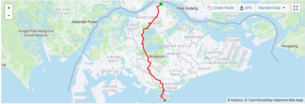
Route: Singapore North - South Crossing (Singapore)

Submitted by TGreeneSG on Tue, 11/17/2020 - 09:34pm
Location
Singapore
Distance
35.35 km
Vertical Gain
340 m
Description

Singapore’s most northerly point accessable by foot, SAF Yacht Club, to the southerly most point of Sentosa accessible. The route follows mainly the Park Connector Network trails in Singapore, passing through Sembawang, Mandai Trails, Bukit Timah Nature Reserve, The Green Corridor and then out on to the main roads at Dunearn Road, Sixth Avenue, Alexandra, Red Hill, Lower Delta and across the bride onto Sentosa Island. Park to finish. A surprisingly accessible route with hills and jungle for most.

GPS Track
Images