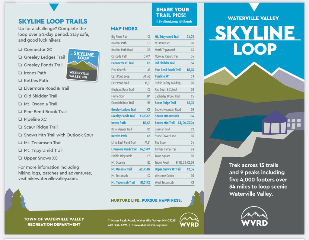
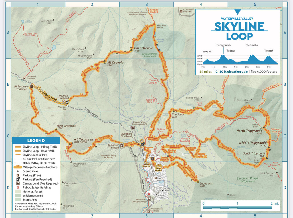
Route: Skyline Loop - Waterville Valley (NH)

Submitted by pjweezy on Thu, 07/07/2022 - 03:44pm
Location
New Hampshire, US
Distance
32.26 mi
Vertical Gain
10,633 ft
Description

EPIC LOOP AROUND WATERVILLE VALLEY - 9 peaks (5 4K footers) 15 trails and just under 11K in elevation gain.  

 Started/finished at Livermore trailhead off west branch road in Waterville. I decided to go clockwise and hit Mt Tecumseh then Osceola - up the tri pyramids (down south slide) and finished off with the Snows Mt Summit. Total Elapsed time was 9hr 13min and 58 Seconds with just under 11K feet in elevation gain! Perhaps this is the fastest know time for this route?

 I did this unsupported with a quick stop at my car after about 16.5 miles in to refuel (short out and back from greely pond trail head.  Added on .6 miles but necessary. I also had a filter on my bottle to refill in the rivers. 

This loop is similar to the famous pemi loop but in waterville valley NH. 

https://www.hikewatervillevalley.com/skyline-loop


Images