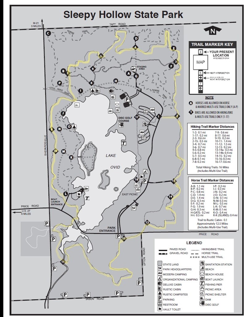
Route: Sleepy Hollow Trail (MI)

Location
Michigan, US
Distance
11.2 mi
Vertical Gain
797 ft
Description


Sleepy Hollow State Park contains over 2,600 acres including a river winding its way through the woods, fields and trails. Lake Ovid nestled in the middle of it all was developed by damming the Little Maple River and covers 410-acres. The park offers a year-round opportunity for recreation with 181 modern campsites.

The trails throughout the park take you through prairie grasses, hardwood forest and stands of pine trees. This route follows the main running and biking loop, beginning and ending at trail marker 1 where the trail meets State Park Drive. The trail is rated "intermediate" due to uneven and hilly terrain. While some of the trails allow horseback riding and dog sledding, this route does not. 

- Submitted by Zach Crim

GPS Track
Images