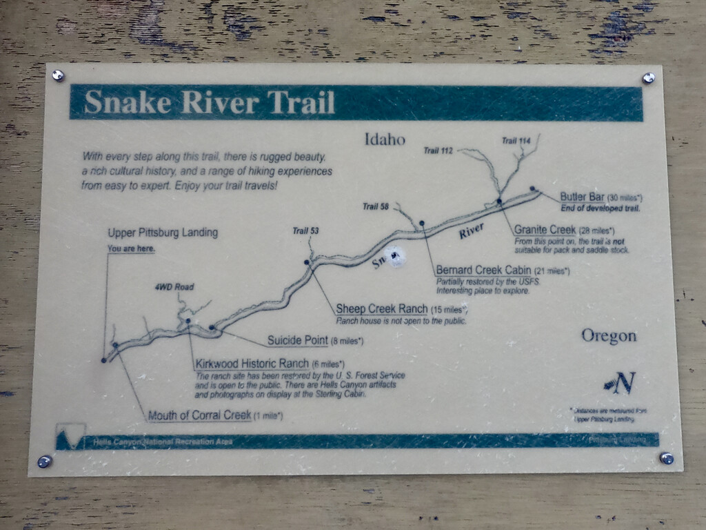
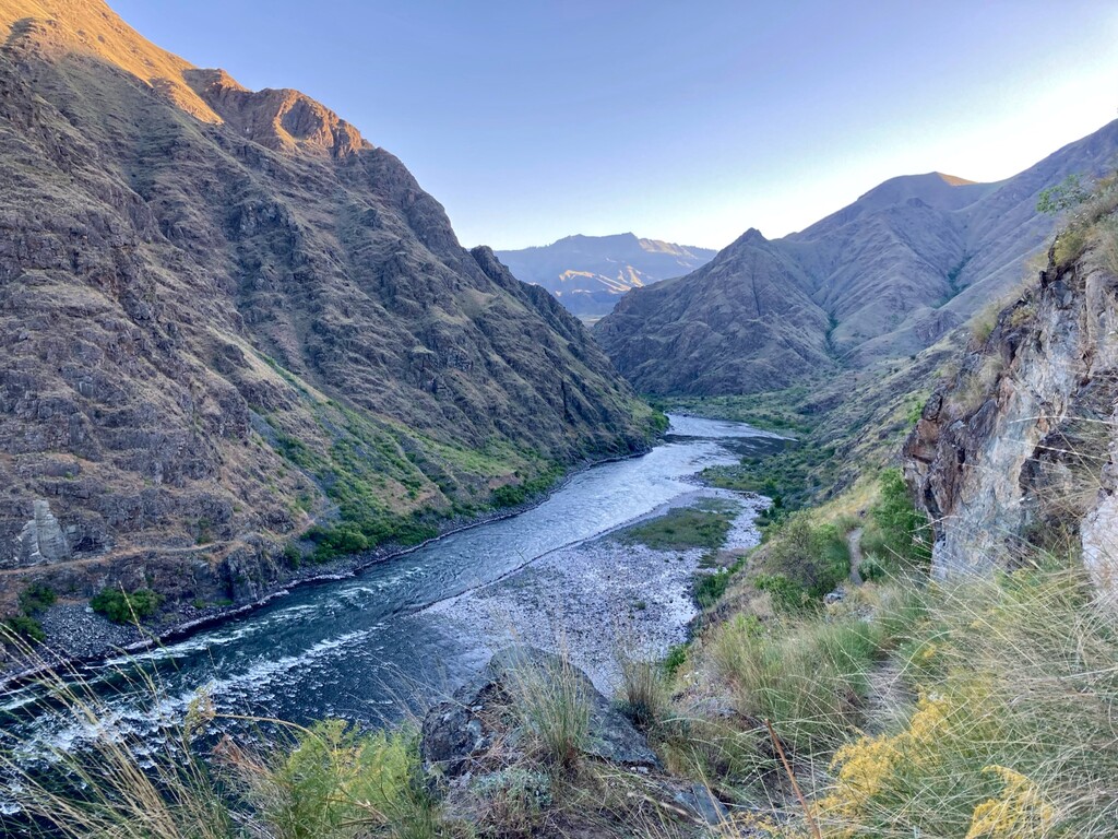
"The Snake River National Recreation Trail (#102) winds its way along the Idaho side of the Wild and Scenic Snake River deep in the Hells Canyon National Recreation Area." [Source: https://www.nrtdatabase.org/trailDetail.php?recordID=248]. The Snake River was named for the Snake tribe of the Shoshoni Indians. "The Snake River National Recreation Trail (#102) winds it way along the Idaho side of the Wild and Scenic Snake River deep in the Hells Canyon National Recreation Area. Beginning at the Snake River Trailhead near Pittsburg Landing, the trail goes across rocky slopes, under cliffs and along grassy canyons eventually ending at Brush Creek. This trail provides access to side trails that enter Hells Canyon Wilderness [Source: https://www.fs.usda.gov/recarea/wallowa-whitman/recarea/?recid=51661].
According to the trailhead sign (see photo) and this USFS page, the trail officially starts at the Upper Pittsburg Landing trailhead (a.k.a. the Snake River Trailhead, 45.622389,-116.464175), and not as commonly assumed at the Lower Pittsburg Landing trailhead (0.4mi down the road from the Snake River Trailhead).
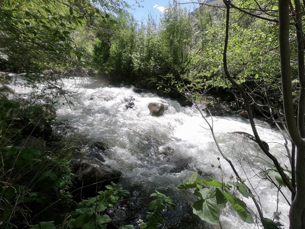
While the trail was originally built to Lamont Springs (Source: https://en.wikipedia.org/wiki/Hells_Canyon_National_Recreation_Area#Snake_River_National_Recreation_Trail), the trailhead sign indicates the end to be at Butler Bar (mile 30). However, recent reports (e.g., https://www.oregonhikers.org/forum/viewtopic.php?f=8&t=29628), many other online sources, and our own exploration (May 16, 2021) determined that the trail does not continue beyond Granite Creek (mile 28) and has probably been abandoned for decades. The Granite Creek bridge has also been washed out for many years. As the attached photo shows (May 16, 2021), Granite Creek can be raging and may be impassable. Granite Creek should be considered the current and official end of the trail. What's beyond is not a trail and not maintained. The NRT database also confirms this: "connects Pittsburg Landing to Granite Creek."
According to the trailhead sign, the trail from the Upper Pittsburg Landing trailhead to Granite Creek is 28mi long. It can be done out & back from Pittsburg Landing, or one can book a jet boat ride (e.g., http://snakeriveradventures.com) and be dropped off at Granite Creek.
Expect rattle snakes and lots of poison ivy (see photo).
No permits are required.