Approx distance: 88km
Approx vertical gain: 4900m (other tools relegate the vertical gain, however we will leave it as a surprise).
The Southern ranges, Precipitous Bluff and the south coast route (see below link for south coast) https://parks.tas.gov.au/explore-our-parks/southwest-national-park/south-coast-track
lies entirely within the Southwest National Park, this linear circuit follows a well established route that fully immerses you into the depths and untamed beauty of the southwest wilderness in Tasmania, for a full description of this route it is advised to purchase the book “southwest Tasmania” link here: http://www.john.chapman.name/pub-sw.html
There is also a very comprehensive blog in this link that describes the whole route: https://www.tastrekker.com.au/2021/05/southern-ranges-third-time-lucky.html?m=1
The track starts from from near Lune River, (located 70km/2hrs south of Hobart) follow the Huon highway (A6) till the Hastings caves rd (C636) turnoff, follow this rd to Lune river then turn right into South Lune Road, after 4kms turn left at Junction and then turn left on limestone quarry rd where you will find the carpark and a walkers registration booth. To get to the end point from Lune river, you will follow south cape rd (C636) to cockle creek (21km) this is where you will leave the second vehicle and is the southernmost point you can drive in Tasmania.
Link to cockle creek info below: https://parks.tas.gov.au/explore-our-parks/southwest-national-park/cockle-creek
(It is advised to take two vehicles as there is 20km of gravel rd between start and finish, or alternatively have someone drop off and pick up at the other end).
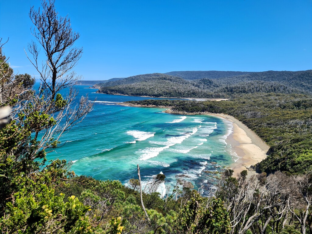
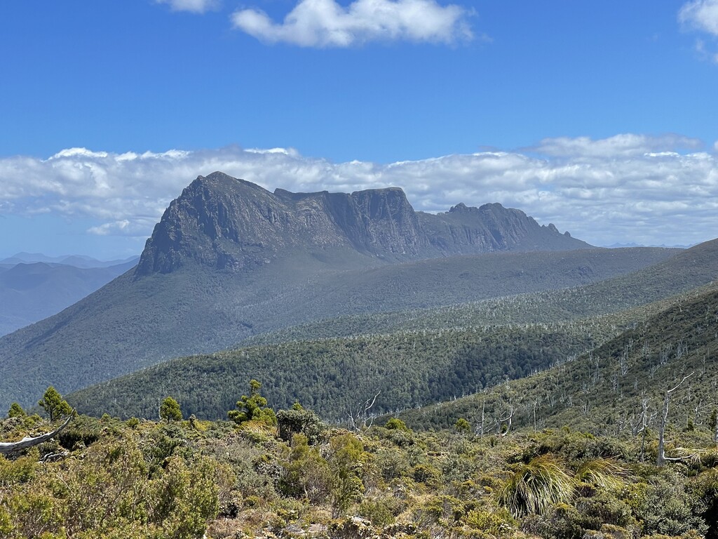
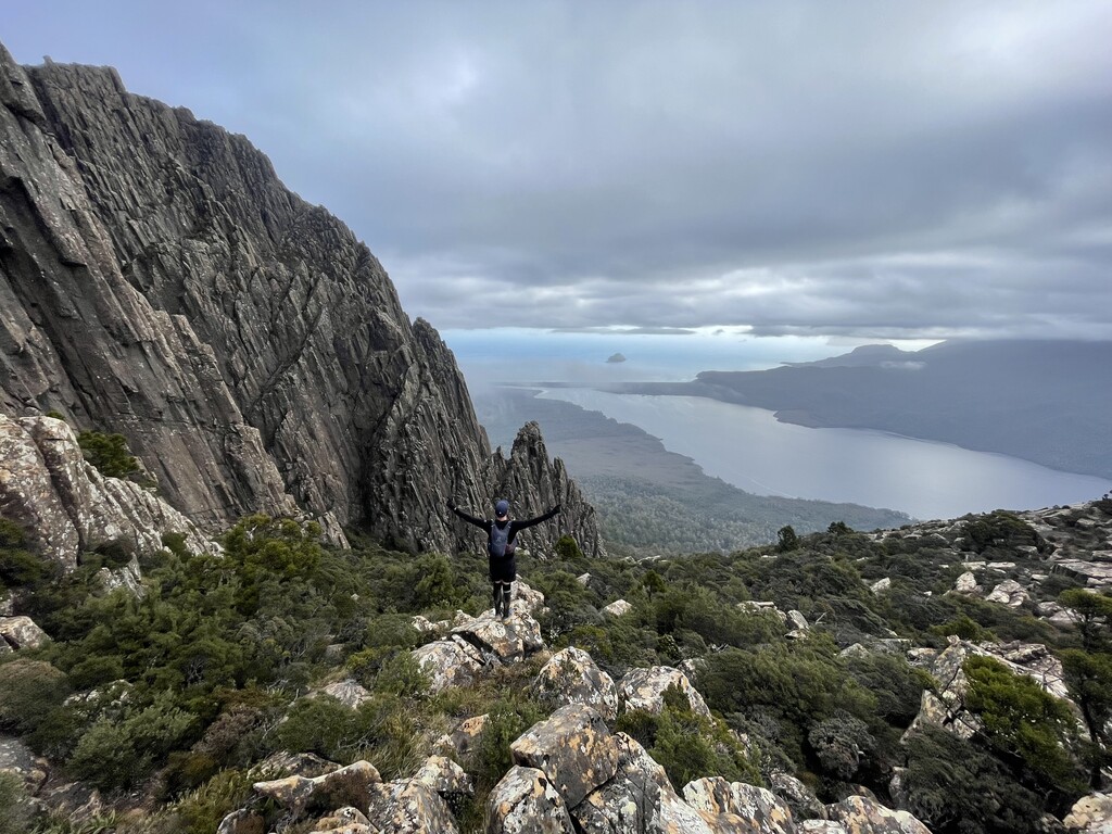
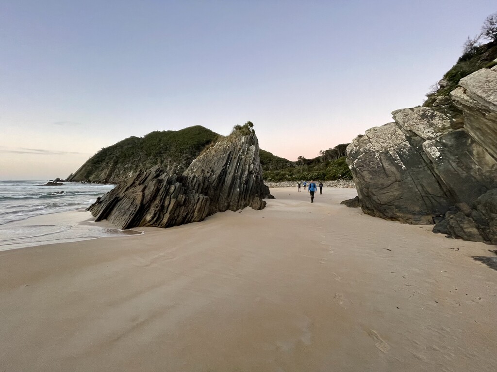
The track starts at the registration booth on limestone quarry rd and is well marked from mystery creek and along moonlight ridge through to pigsty ponds and out to Pindars Peak (we didn’t go to the summit). From Pindars peak out to Precipitous bluff the track is rough and muddy but fairly easily followed (the gpx will be handy here) there is good information on this part of the track in this blog The Southern Ranges revisited (thegreatambler.com) After the summit of precipitous bluff is taken (the only summit taken on this entire route) The Track then descends down to new river river lagoon, the track here becomes poorly marked once you leave the dole rite cliffs of precipitous bluff, the track is well taped and good navigation skills are required here, stay with the tape! (the gpx will give only minimal assistance in this area) once you reach the waters edge there is a 7km wade along the edge of new river lagoon to prion beach, from here the track is well marked as you are now on the south coast track! This ends at Cockle Creek which is 20km south of the start point (We left one vehicle at the end point and drove the other car back to the start of track)
This track is completely remote and full of all types of adventure for those brave enough to take it on! It is highly recommended that you are comfortable in remote areas and have a high amount of experience before attempting this, you will most certainly be a long way from help should you need it. The route follows the established track and is not an open course.
Most people take about 9 to 10 days to complete the Linear circuit, Walkers and Runners should note that the track surface will be rough, muddy and unmarked over extended sections.
The following link is a good blog of the circuit as undertaken by two walkers in 2016. https://thegreatambler.com/posts/southern-ranges-circuit-via-precipitous-bluff/