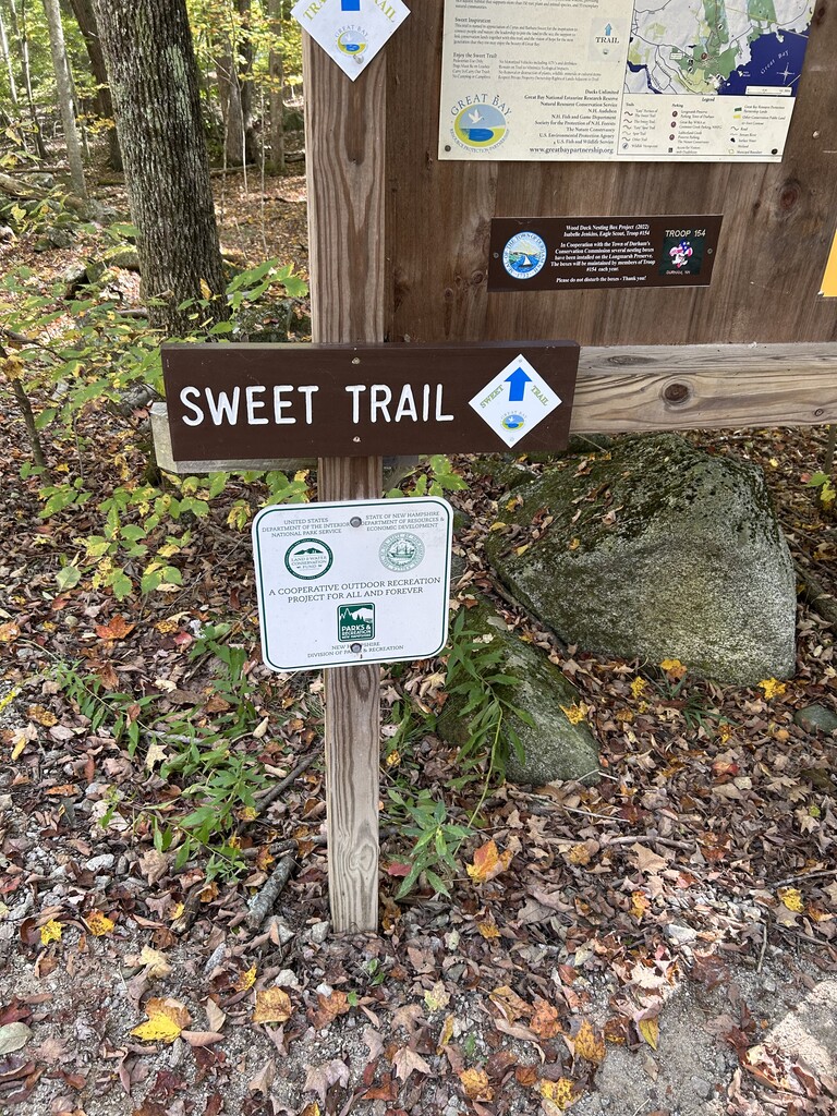
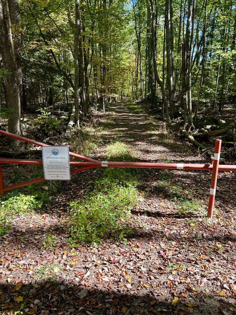
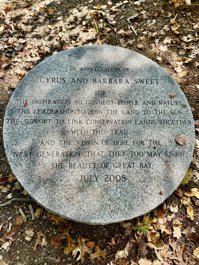
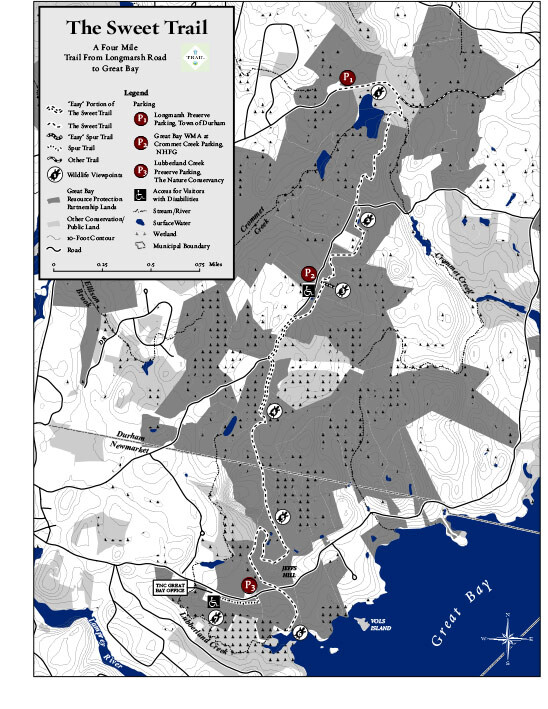
This is the most beautiful trail in the Seacoast of New Hampshire. It follows a network of beaver ponds from Durham, NH, to the shores of the Great Bay estuary. The route is well marked, and it starts and ends at the red gate at the end of Longmarsh Road in Durham (there is a small parking lot there). The turnaround point is the southern terminus of the Sweet Trail at the Great Bay estuary and is marked with a granite tablet honoring Cyrus and Barbara Sweet.
The trail is runnable throughout, but it is surprisingly technical in some areas with granite rocks and tree roots. The Sweet Trail is marked with white tin squares containing a blue arrow and the logo of the Great Bay Resource Protection Partnership.
In 1973, shipping and oil magnate Aristotle Onassis planned to build the world’s largest oil refinery in the area of this trail, with an underwater pipeline out to the offshore Isles of Shoals. Fortunately, in 1974, the plans were defeated by well-organized local residents who understood the value of Durham Point for nature, recreation, and beauty.