Location
New Hampshire,
US
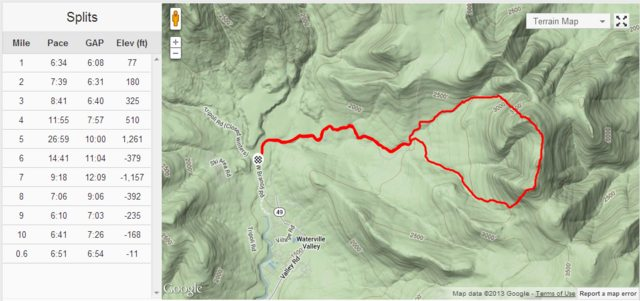
Distance
10.74 mi
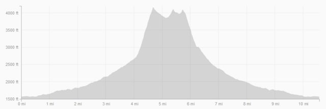
Vertical Gain
2,927 ft
Description
GPS Track
FKTs
Male
Female
| Ben Thompson | 1h 37m 31s | ||||
| Ben Nephew | 1h 44m 9s | ||||
| Ryan Welts | 1h 53m 23s |
| Lexi Jackson | 2h 16m 1s | ||||
| Emily Mazeau | 3h 22m 24s |
| Lindsay Weigel | 2h 21m 23s |
Images
This route on the old FKT site