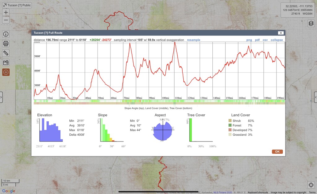
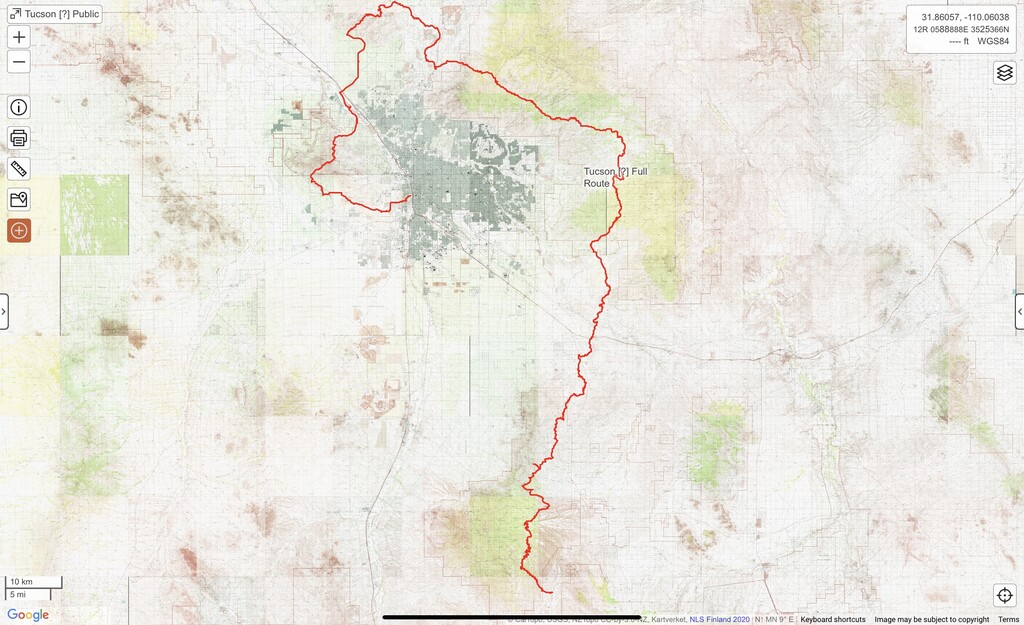
The Tucson [?] links the mountains around Tucson into one question mark shaped track. Questioners traverse the Tucson Mountains, Tortolitas, Catalinas, Rincons and Santa Ritas. Staying between 2100’ and 6250’ this route is perfect late fall to early spring. At almost 200 miles with nearly 30k feet of gain this route is perfect for a speed attempt but also makes a nice week outing. Questioners are almost never more than 1.5 hours from Tucson which simplifies shuttles and enables other runners to join for part of the journey.
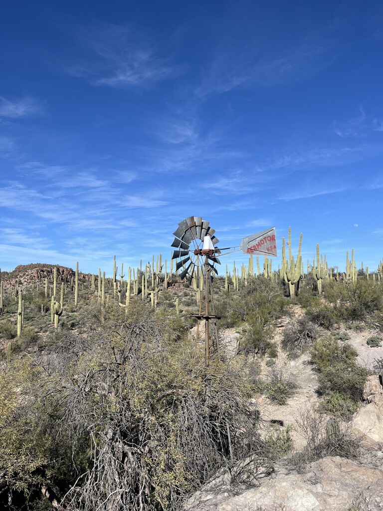
Starting from the Mercado District Questioners first ascend “A” mountain gaining a view of most of the rest of the route from the top. Dropping over the saddle a small road section leads to the El Groupo Loop eventually reaching the 36th street trailhead. From here a nice tour of Tucson Mountain Park takes place eventually spitting Questioners out at Juan Santa Cruz picnic area. About a quarter mile of running along Kinney road (THIS IS THE MOST DANGEROUS PART OF THE ROUTE) leads to Kings Canyon Trail Head which starts a tour of Saguaro National Park West eventually popping out at Abington trailhead.
A bit of road/ easement/ river path running brings Questioners to the Wild Burro trailhead, starting the Tortolita Mountain traverse. Ascending Wild Burro to Alamo Springs hits the Ridgeline trail, where most excellent views are achieved looking out at the ranges around Pima and Pinal counties. After a nice descent and some rolling jeep roads to Crow Windmill, the Honeybee trail system is accessed, eventually leading to Big Wash trailhead followed by some river path running to Catalina State Park.
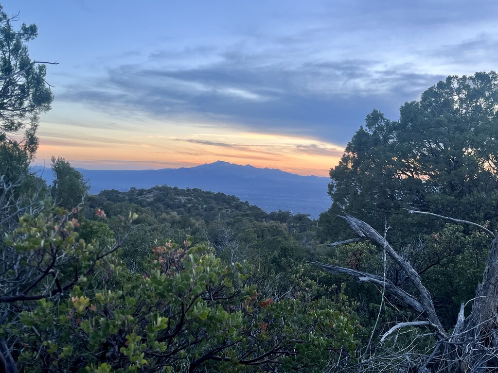
From Catalina State Park the road running ends and the route enters the Santa Catalina mountains in dramatic fashion, ascending through the Pusch Ridge Wilderness Area to Romero Pass. From the pass Questioners (at this point are they Questers?) are greeted with views of the inner basin of the Catalinas to the West and spectacular views of the previous two ranges traversed to the East. Descending on West Fork trail (part of the Arizona Trail) there are opportunities to refill water at creek crossings and Hutches Pools. A climb up Shreve Saddle leads to the Gordon Hirabayashi CG, a great spot for crew access if running supported. Hiker boxes are also located further down the trail at Molino Basin.
From Molino Basin the route follows the Arizona Trail into Redington Pass before hopping off and heading towards Chiva Falls. Rolling jeep roads lead to a ridge where some off trail travel takes Questioners to the Douglas Springs CG in Saguaro National Park East. The track provided keeps the off trail travel above 4500’ - a requirement for off trail travel in Saguaro National Park East. Most of the winter, water can be filtered at Douglas Springs before the climb up to Cow Head Saddle, the high point of the route. A long descent reunites to the Arizona Trail as Questers enter the foothills of the Rincons.
From here the route continues south bound along the Arizona Trail rolling through Colossal Cave Mountain Park, going under I-10, grazing the shoulder of Mount Fagen (many cows also graze here), and just generally staying between 3500’ - 5500’ along the Arizona Trail. The route finishes at Casa Blanca trail head just outside of Patagonia, AZ.
Considerations for longevity of this route
In putting this route together I tried to keep the longevity of it in mind. Unfortunately this meant taking a few more roads and avoiding some off trail connections in areas, particularly in the connection between the Tucson Mountain range and the Tortolitas. While a runner could pick through some State Trust land near Avra Valley Rd and bypass the Twin Peaks Rd portion, since those parcels may have access restrictions in the future, I opted for the road and was pleasantly surprised to find detached paths most of the way to Wild Burro Trail Head. The gpx associated with this route is all taken from actually traveling the route on foot over the course of 5 days in February 2024, the daily tracks were combined with a couple spurs removed where I accessed crew, made a wrong turn, or camped along the way.
Crew access considerations
For those not familiar with the Tucson area, a lot of the trail heads in the Tucson Mountains and Tortolitas are only legally accessible between dawn and dusk, something to keep in mind while planning supported attempts. Redington Rd varies in condition throughout the year, it can be very rough at times.
CalTopo of the route can be found here https://caltopo.com/m/V5RNV if you plan to attempt this route please don’t hesitate to reach out with any questions (pun intended)
Comments
My friend Logan Foll put together a nice video of the first year running this route, explaining some of the planning and giving a sense of where the route goes https://www.youtube.com/watch?v=b-qG47AOtuo enjoy!
So... I have no idea how this will go, but wouldn't be an adventure otherwise! Planning to try it this week (supported), starting Wednesday morning