Veluwezoom FKT routes
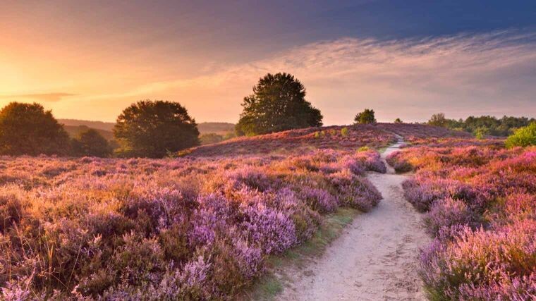
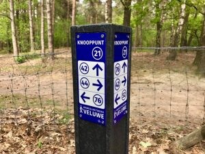
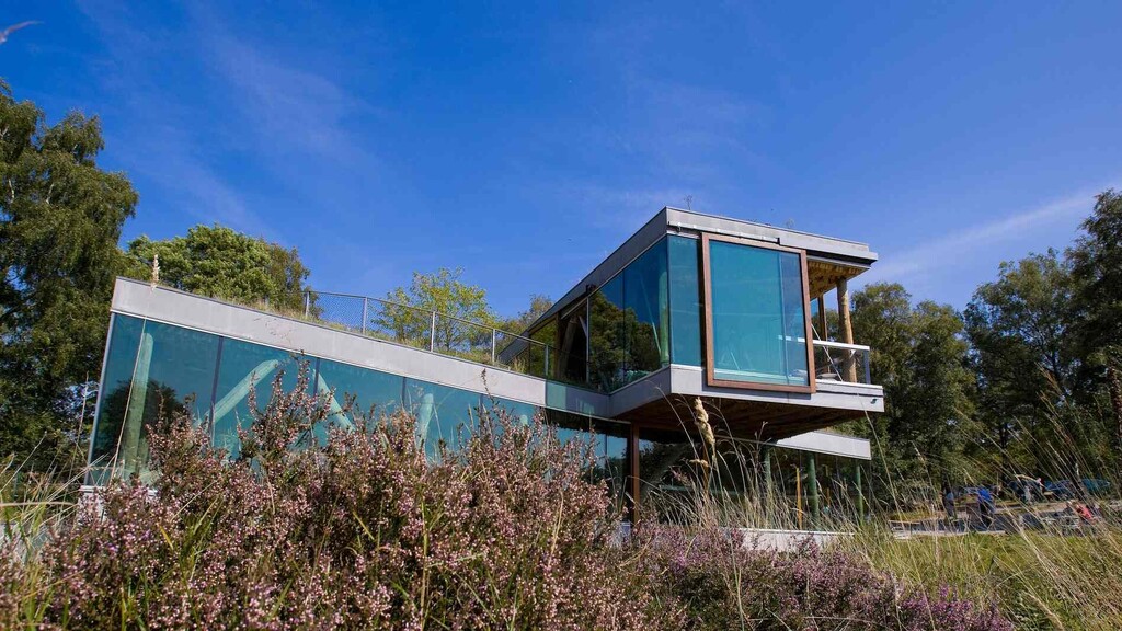
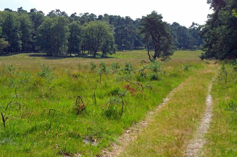
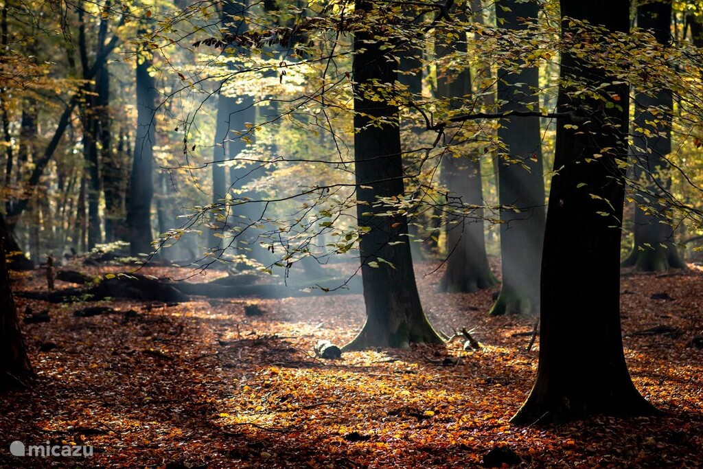
The Veluwezoom is a wonderful and varied National Park outside Arnhem in the Netherlands. It is also a well visited area all year round. There are deep forests, green pastures, open bush, heather and grass land, and the landscape is steeped with ridges, valleys, and peaks formed by the melting glaciers after the last ice age. The park landscape rises above the flat Rhine and Maas valley and offers many wonderful views. In the south-center of the of the park is an open very hilly area called Posbank that is highly popular due to the many peaks with views, and beauty with the changing season. Here you can find freely roaming horses and a flock of sheep in the summer period. The park and the forests to either side are crisscrossed with foot paths, there are several MTB routes and fast downhill valleys, there are horse-riding trails, paved cycling paths and a few paved roads. The park has a few marked paths mostly for shorter hikes and the some longer MTB routes. One 15 km (7 peaks) trail has been accepted as FKT route. Like so many other places in The Netherlands the area is instead marked with numbers at the junctions (knooppunten; KPs) of the paths so you can plan your route by going from KP to KP. The many signs will also point in the direction of other junctions.
This area is probably the most diverse in terms of beauty, technical trails, and opportunity to have significant elevation in The Netherlands. As such it deserves some really challenging FKT routes apart from the 15k route. Inspired by the ExtraTrail system of the Ardennes two more routes was designed following 1½ years of reconnaissance running on the area. The red route is 31k with 700 m of elevation and the longer black route is 46k with 950 m of elevation. The black route is an extension of the red. There are several options to choose from in terms of start/goal since the routes passes several parking options for cars and bikes. The descriptions starts/ends at the parking by the Houtplaats restaurant, which also can be reached by foot from the train station in Rheden.
Common
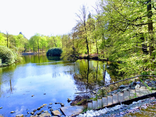
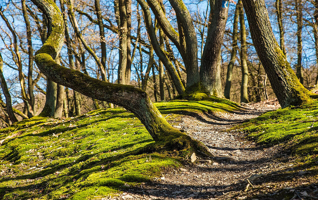
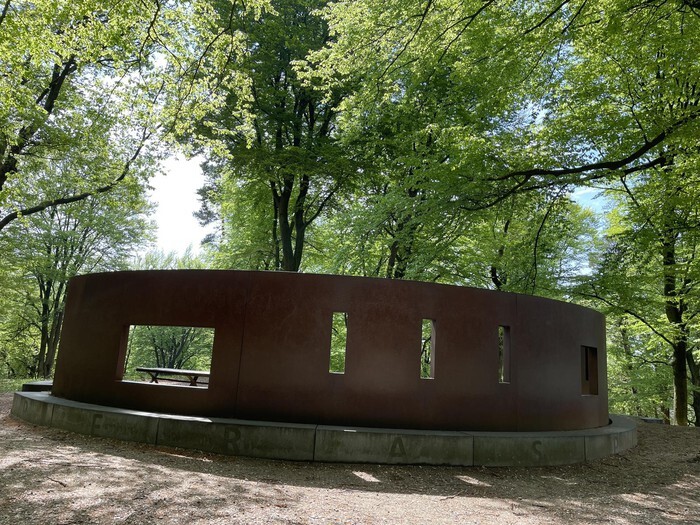
The route starts by crossing the road and heading first west then zigzagging south and west between and across open fields. It then enters a wooded area at the start of an East-West going ridge. The route descents on the south side and follows the ridge below only to make a sharp right turn and ascent up the ridge, after two left turns it again then descent toward a paved road/biking path. Make a right here and follow the path shortly and then ascents eastward to the continuation of the ridge, however the route then turns north onto a side ridge that points toward the Posbank. This trail goes up and down and then passes over the first peak, Dassenberg, and continues toward a crossing with the biking path and several trails (KP 34). Here the route makes a hard left turn and goes SW below the ridge. The trail crosses a parallel SW-NE biking path and becomes a wider dirt road to make a new left turn and follow a gorge up to the EW ridge again and now turn right and pass through a gate (KP 71) into a park area next to Velp/Rozendaal. After passing a gorge to the left the route slides left and descents to the south of the ridge and follows below until the end of the trail, where the route makes a right turn and ascents to the ridge again. Here it makes a left turn to follow the ridge and goes over the Ossenberg peak and continues to a wider sandy trail (KP 07) where is makes a new left and again descents to the south of the ridge. At the bottom, exiting the forest area, the route makes a super sharp right turn and ascents into the woods and then goes parallel to the open fields below. At the end of this area slide right to another trail (KP 30) that goes around the next peak. It ascents to the west side and here make a sharp right and ascent the last bit up to Keienberg peak. Here there is a monument for resting and inspiration (Natuurmonumenten). Make a left and head down the peak to the north. At the bottom of the descent (KP 02), you continue slightly and then make a right turn and follow a fine single trail over another little ridge mostly northbound. As you descent again you approach a nice lake (KP 59) which you pass to the left (W side). Cross over the small streams that run to the lake and continue N with the stream/valley to the left and another ridge to the right that also goes toward the Posbank. The route slides up to a parallel trail a little above the valley trail, pass through the gate and continue, then make a sharp right (KP 15) and ascent up the ridge. Make a left still going upward until you hit a trail that traverse the ridge. Make another left and head down to the valley-trail again. The route goes up and down the ridge as you go north toward the Posbank and provides a lot of elevation. Toward the end you pass a parking lot and then ascent passed Zijpenberg and arrive at the SW of the Posbank. You cross a paved biking path and enter the open area of Posbank. The route makes a right and start a descent to the bottom valley of the Posbank, then cross and ascent to the north of the Posbank, makes sure to go toward KP 01 passing by KP 70. At this junction/viewpoint you have the best views in many directions and at the café close by you can fill water bottles at a public tab. There is a parking lot and possibility for an alternative start/end. The route continues on the north ridge of the Posbank and then turns right (KP 54) and make a descent toward the SE corner of the Posbank. You pass several viewing points on the way. Toward the end of the descent first slide left and then make a right turn at a junction. As you exit the Posbank make a left and ascent the next ridge (east bound) with the Posbank area to your left. Make another left and follow the ridge until another junction where there are MTB trails, make a sharp right and descent on the east side of the ridge into the forest area next to Rheden and De Steg. At the bottom of the descent make a sharp right and pass a mudhole to your left and exit a gate onto another paved biking path. Take a left and follow the paved path shortly then make a right and ascent onto the next ridge. Here you find a long-distance MTB trail (blue makings), make a right and follow this as it winds through the forest. It goes south and east and passes another ridge before a descent toward Parkweg. Make the left turn at a red/brown summer cottage then slide right leaving the MTB trail, pass a black painted garage and slide left (at KP 81) and make another ascent onto another ridge mostly north bound. This trail ends in a junction (KP 74), turn right and continue upward now sharing the path with the 15k route. The routes pass over the peak at Lappendeken and crosses the parking lot (another option for start/end) at a place with grass fields. Cross the road still on the 15k path onto a red paved biking path, however, shortly after the route slides right (at KP 75) and you pass through a gate into and grass field. Sometimes this field has highlanders, a hallmark of the Veluwezoom. Cross the field and exit through a gate (east bound) then entering another forest area Middachter that connects to an old hunting forest (Hof te Dieren). There are many paths crossing each other but stay on a straight course that slowly turns NE, it merges with a wider gravel road that makes a right and then a left turn. In the left turn take the second of two single trails to your right. At the end of this trail make a left and descent passed a small water/mud hole and ascent to a new forest/gravel road and continue NW. At the next cross section make a right and shortly after a left onto a wide path toward the Prins Willemsberg. At the top there is a circle of benches, and many paths intersects here. Continue straight over the hill and descent NW and follow the road as it turns W and shortly after slide right onto a single trail toward KP 65. At KP 65 you have an open area with fields and a pancake café (De Carolinahoeve) in the middle. Turn right with the fields to your left and forest to your right. After a while the path slides next to a biking path now again shared with the 15k route. As the biking path turns right cross over and continue north. Pass through a gate and at the junction with the next biking path make a sharp left turn leaving the 15k route and head west. Continue straight at the next intersection now running toward KP 09. This is a nice very little used trail with good opportunity to see dear or other wildlife. The trail turns south and winds up and down ridges. It ends a junction with a larger trail, make a right still heading toward KP 09. This trail merges with a wider gravel road also shared with MTB bikers. Stay on this until KP 09. Here make a left and follow a smaller trail that soon turns right and goes parallel to the wider road south. At the end the trail again merges with the gravel road (lined with big trees) and turns east, follow this until you again hit the 15k route, turn right and head down a single trail south bound. At the end you hit a biking path, make a left and shortly follow this only to make a right and cross through to a junction with a paved road still following the 15k signs. Cross the road and leave the biking path to a single trail to your left, keep left at the next junction and turn right when the trail hits a wider trail going toward KP 11. The first KP 11 sign is at a crossing of 5 paths, take the second to you right pass the second KP 11 sign and pas by Rouwenberg peak, now the 15k route turns left. Continue straight at KP 05 and cross the bridge going over the biking path from before. Head straight, now going back toward the Posbank and KP 93. You arrive at the Posbank in the NE corner by an octagonal café. Follow the path to the parking, then go through the gate to your left and follow the path back toward PK 54 and KP 01 from before.
Black route specific
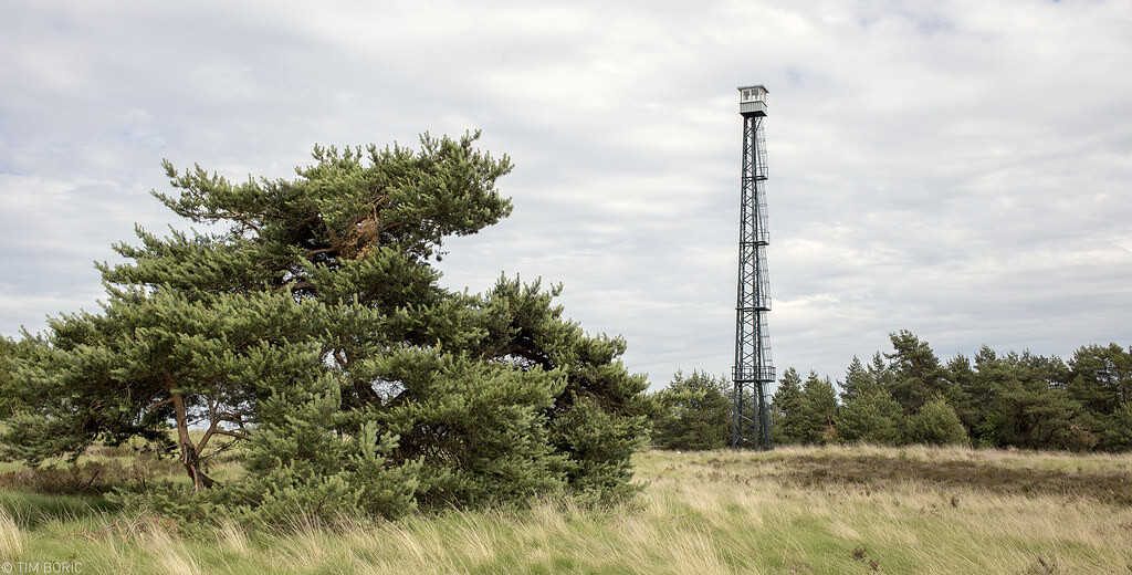
Pas by KP 54 and head to KP 01 viewing point. Now is another opportunity to fill water and/or get supplies from the café. Head back down the same trail you made the ascent before, passing KP 70 and going all the way to the junction in the Posbank valley. Now make a sharp right toward the west of the Posbank, stay on the harder trail to the left, the sandy softer is for the animals. This trail makes a steep ascent to the west side of the Posbank. As you exit the gate also close to Zijpenberg make a right and slide next to the road. Cross the road and find a small trail into the forest, you then hit a wider sandy riding trail. Turn right and follow this as it slowly turns left and exit the forest. Slide right onto a narrow single trail that crosses a biking path and goes into an open landscape called Rozendaalische Veld with nice views and sandy patches to the right. This trail is heading west and is popular with dog walkers. As you cross over a wider trail and a biking path the route heads up a sandy hill, here you can find a nice single trail heading NE. This trail merges with another trail and heads toward the tall fire tower (brandtoren) to the north. Pass by the tower to the junction with the biking path and several other trails. Still heading north use the wide gravel MTB road next to the paved biking path. After a little while the route heads east (KP 57), follow this through a gate into a big open grass land where highlanders roam freely (the area is very big so you rarely see them). The trail heads mostly NE over a hill and onto a wider gravel road (KP 02). Make a left and head north and pas by the highlander monument that is placed here. At the next junction make a right and follow this trail E turning NE then turning N. You exit the area through a gate and follow a dirt road with a farm to the left. At the next junction (KP 32) make a right and follow a gravel path next to a biking path. After a while you arrive at a parking lot at Elsberg. Shift to the left side of the road to a trail/horse riding path and follow this SE. At a junction where the road turns south and the biking path goes east, pass the gate and make a right following the riding path. There is an MTB trail to your right. Follow the riding path south as it continues alongside the road and the MTB trail. Further south the MTB trail shift over the riding trail so you have the MTB to your left and the road to your right. A little further ahead it shifts back again so both MTB and road is to your right. After a while the riding trail turns SE away from the road and MTB trail and heads toward another parking lot by the Posbank. You now have another road to you right and also a biking path. Take the trail as close to the biking path as possible (KP 62). The trail is winding its way south toward the Posbank café now from the north side. The biking path turns left (east) so it crosses the trail. Turn left onto the biking path then right to the café and KP 01. Again, you have chance to fill water or purchase energy if required. Continue over the road to KP 01 make a left and follow the trail once again on the north rim of the Posbank back toward PK 54. At KP 54 make a right turn and head down the same descent through the Posbank as the first time, again slide left and make a right toward the SE corner. As you exit this time go straight and head up the ridge going SE. At the ridge turn right and follow this trail south bound. Exit the forest through a gate and follow the gravel-turning paved road down to Schietbergsweg. Make a right and shortly after you arrive back at the starting point by the parking lot.
Links:
https://www.natuurmonumenten.nl/natuurgebieden/nationaal-park-veluwezoom
https://www.visitarnhem.com/veluwezoom
Related routes:
Veluwezoom red route - https://fastestknowntime.com/route/veluwezoom-red-route
Zevenheuvelenroute Veluwezoom (NL) - https://fastestknowntime.com/route/zevenheuvelenroute-veluwezoom-netherlands
FKTs
| Jorrit Wensink | 4h 34m 19s | ||||
| Torben Østerlund | 5h 59m 59s |