Route: Wandle Trail (United Kingdom)

Submitted by David Bone on Thu, 06/11/2020 - 03:27am
Location
United Kingdom
Distance
12.5 mi
Vertical Gain
200 ft
Description

The river Wandle itself is a tributary of the Thames to the south west of London, consisting of 15 miles of rich chalk stream habitat in good condition, which in its industrial heyday, was the ‘hardest working river in London’, with over 90 mills along it’s banks throughout time. The river rises in two sources Waddon and Carshalton.

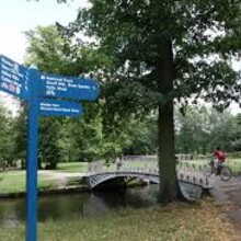
The Trail mostly follows the Wandle River, and runs for about 12.5 miles (20km) from East Croydon Station to the Thames Path in Wandsworth near Wandsworth Town train station. The main starting points is Wandle Park, Croydon (12 mile walk). In places the trail is narrow and uneven

The Trail map shows a running route and highlights the fascinating places with artwork created especially for the route, cafes, restaurants and attractions such as Merton Abbey Mills, Deen City Farm and Wandsworth Museum.

https://wandlevalleypark.co.uk/map/

Submitter: David Bone

GPS Track
Images

Comments

User Picture
Profile picture for user escoacorrere

I'm going for this FKT attempt today. Wonderful route. 

I did the out & back / unsupported on Boxing Day (elapsed time 2:53). It was muddy in parts but otherwise an easy one, and a great route to discover this part of London.

User Picture
Profile picture for user Antonio Palmarini

Can it be done from the end (Wandsworth, which is where I live) to the starting point (wandle park)?