The Watzmann is a mountain in the Bavarian Alps south of the village of Berchtesgaden. It is the third highest mountain in Germany, and the highest mountain located entirely on German territory.
The traverse of Watzmann is a very famous tour, normally done in two days but also possible in less than four hours.
https://fastestknowntime.com/route/watzmann-traverse-germany
Another famous route in this area is the circumnavigation of Watzmann, which is not as difficult as the traverse and offers a lot of beautiful views while running through unique landscapes.
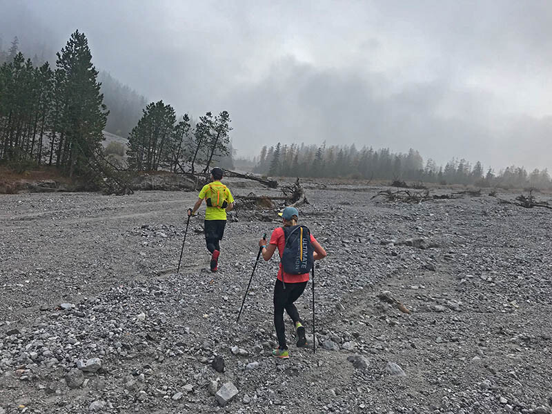
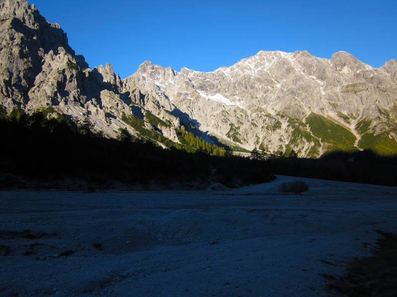
Starting at the parking lot „Wimbachbrücke“ near the village of Ramsau the run leads you through the unique Wimbach-Valley.
Follow the famous trail passing Wimbach castle (after 4km) and Wimbach hut (after another 4km). The area is unique and was formed over millions of years.
After this continuous climb, covering around 700m, you reach the heart of the valley, surrounded by sharp mountains direct behind Mt. Watzmann.
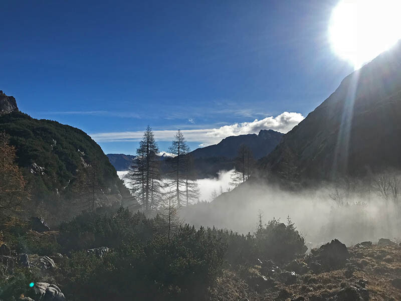
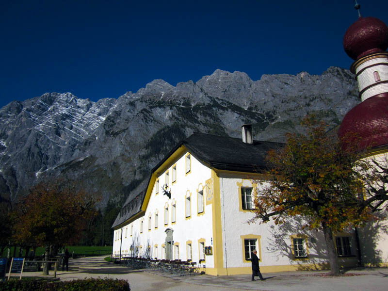
Now the climb up to „Trischübel“ starts, a famous waypoint in the national park. After this climb, you start the long descend down to the famous pilgrimage church of St. Bartholomä at King’s Lake. On this downhill, you will pass a technical spot where you have to use the fixed ropes. It’s not that difficult but you have to be careful, especially when it’s wet. The rest of the downhill is pure trail running on awesome trails through breathtaking landscapes.
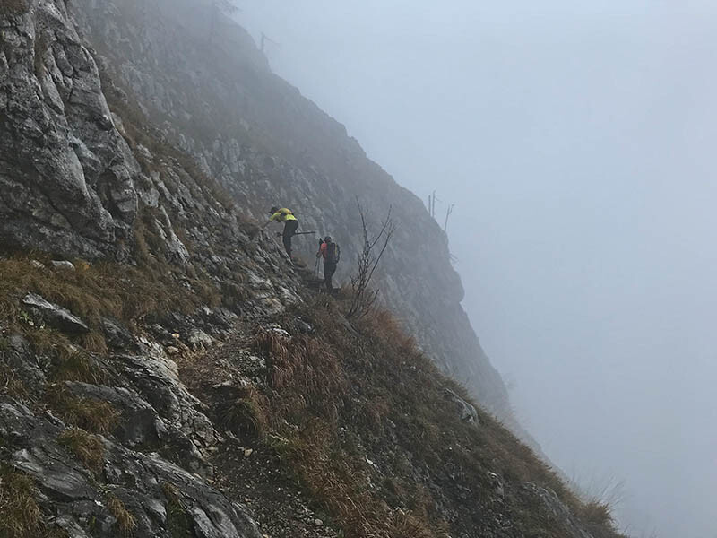
After passing the tourist hotspot St. Bartholomä the next climb via Rinnkendlsteig ist waiting.
As described in another report (https://fastestknowntime.com/route/konigssee-umrundung-germany):
The Rinnkendlsteig is steep as hell and normally the sun is burning during the whole climb where you can rest in the shadows only at the beginning of the climb and at the end. You need a lot of liquids because during the next 800m of vertical climbing there is no water at all. The Rinnkendlsteig is the most difficult part of the route with small trails and breathtaking deep views down to the lake. Be careful if it’s wet or the weather is turning bad. You can get in serious trouble if you underestimate this part.
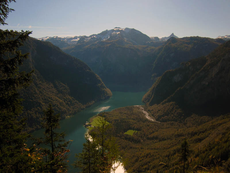
At the end of the climb, you should visit the awesome viewpoint of Archenkanzel with an amazing view down to the lake.
Follow the trail to Kühroint. At Kühroint turn left to follow a trail through the woods which starts the final downhill to the parking lot. Crossing the service road and stay on the trail for a few more minutes before the service road is the only way to get back to the start. Try to enjoy the last 5.5k on the service road as much as possible. Speed up to get the FKT or calm down to review the last hours where you covered around 30k and a total climb with more than 2000m.
-submitted by Steve Auch