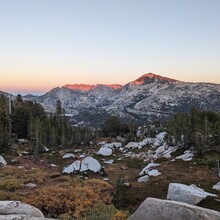
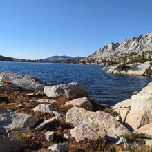
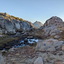
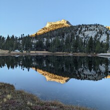
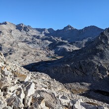
The Yosemite High Route is another High Route created by Andrew Skurka (refer to https://andrewskurka.com/adventures/yosemite-high-route/ for details). It officially starts in the Yosemite backcountry - the "northern terminus" is Grace Meadow, in the far northern section of the park (on the PCT), at gps coordinates of approximately 38.14846, -119.61116, where a creek from the east joins Falls Creek. This is where the FKT begins. You must access this point by foot, and that time is not included in the FKT.
The route then follows these waypoints:
CR-00 N terminus of Core Route at Grace Mdw
CR-01 Keyes Pk Pass
CR-02 Tilden Crk at 9,320' below Mary Lk
CR-03 Tower Pk Pass
CR-04 Stubblefield Cyn
CR-05 Shelf Pass
CR-06 Cross crk in bottom of Thompson Cyn
CR-07 Willow Pass
CR-08 Join/leave Buckeye Pass Tr
CR-09 Jct: Buckeye Pass Tr & Rock Island Pass Tr
CR-10 Leave/join Rock Island Pass Tr
CR-11 Rock Island Lk Pass
CR-12 Suicide Ridge
CR-13 Low spot in Slide Cyn at Piute Crk
CR-14 Join/leave Burro Pass Tr
CR-15 Burro Pass
CR-16 Matterhorn Pass
CR-17 Pool at head of Spiller Crk, jct SHR
CR-18 Stanton Pass
CR-19 Soldier Lk, outlet
CR-20 Join/leave Summit Lk Tr, jct SHR
CR-21 Leave/join Summit Lk Tr
CR-22 W edge of 9640-ft mdw on McCabe Crk
CR-23 Don't Be A Smart Pass
CR-24 Roosevelt Lk, inlet
CR-25 Low spot btw Roosevelt Lk & Young Lks
CR-26 Young Lks, outlet of lowest lk
CR-27 Jct: Young Lks Tr & Dog Lk Tr
CR-28 Jct: Side tr to Dog Lk
CR-29 Tuolumne Mdws Wilderness Center
CR-59 Tuolumne Mdws Wilderness Center
CR-58 Jct w/PCT, S side of Dana Fork bridge
CR-57 Join/leave tr at ford of Dana Fork
CR-56 Leave/join Mono/Parker Pass Tr
CR-55 Jct: Spiller Lk Tr & Mono/Parker Pass Tr
CR-54 End of Spillway Lk Tr
CR-53 Helen Lk, outlet
CR-52 Kuna Crest Saddle (Class 2)
CR-51 Kuna Crk
CR-50 Leave/join JMT/PCT near Lyell Fork
CR-49 Join/leave JMT/PCT below Donohue Pass
CR-48 Maclure Lk, outlet
CR-47 Russell Pass
CR-46 Low spot btw Sluggo & Russell Passes
CR-45 Sluggo Pass
CR-44 Lk 10217, outlet
CR-43 Foerster Ridge Pass
CR-42 Harriet Lk, outlet
CR-41 Leave/join Isberg Pass Tr
CR-40 Jct: Red Pk Pass Tr & Isberg Pass Tr
CR-39 Triple Pk Fork, ford
CR-38 Merced Pk Fork, ford
CR-37 Join/leave Red Pk Pass Tr
CR-36 Tarns at 10,400 - ESE of Gray Pk
CR-35 Adair Lk, outlet
CR-34 Lemon Pass
CR-33 Outlet of lk at 10,420' E of Mt Clark
CR-32 Quartzite Pk
CR-31 Clark Cyn at 7,700'
CR-30 S terminus of Core Route at Merced River
The FKT ends at "CR-30," the southern terminus, which is in the backcountry at approximately 37.73740, -119.44910, and time recorded on the FKT site stops here. It does not include getting back to a trailhead.
As with other high routes (Sierra High Route, Wind River High Route, etc.), most of the "core route" is off-trail (about 70% in this case) and there is no defined route or course, except when the route overlaps with a trail (about 30% of the time while on the "core route"). The FKT site will not publish detailed gpx tracks of the route, however detailed gpx tracks must be submitted for verification that the waypoints listed here are included in the chosen route.

